
The view from Lamberts Lookout
Lunch was a gourmet pie for both of us. There was little initial discourse because we were so hungry. We’d started out around 10.15 to do a listed 5.2 kms walk. How hard could that be with only 281 metres in height variation? We’d both done bits of the trail before, just not the way we were doing a full loop today.
It was now 3.10, as in the p.m.; how had we so badly underestimated the time factor? Four and a half hours, average just over one kilometre per hour, what had happened?
Since we were both into photography, that got the initial blame but, for me, in truth, the trail was so time consuming because of the variation in surface. Revisiting the internet site we’d used for guidance showed that they claimed to have taken 2 hours 20 minutes with 281 metres gained; they were young and even they complained about the roughness of the trail. They also hadn’t attained 70 years, not even when you combined their ages, something we couldn’t claim.
Later checking of another site said to allow 3 ½ hours, with a 473 metre height variation, which better reflected our experience. Just goes to show not to believe even the most visited site on the internet. Yet another site listed the distance as 6.2 kms.
It’s all downhill from here
The crux is that Porters Pass, Colliers Causeway and the Overcliff Track are not part of the NPWS area of Blackheath. I’d like to say it’s council cared for, but that would be so erroneous. It may be under the council’s control but, other than some signage, they obviously don’t have it on their priority list. They probably figure that there’s little benefit for locals, thus the trail is in appalling condition in parts, unaided by the heavy rains in recent years. Rutted, rocky and decidedly uneven, it demands constant footfall attention.

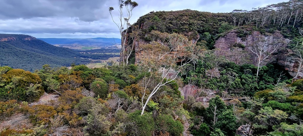
Panorama of the cliff you have to walk below
Yet this walk is one of the most scenic and has more variety than any other I can think of in the whole Blue Mountains. Many internet sites rate it THE top walk. There’s waterfalls, giant cliffs, panoramic views, canyons, ragged rocky outcrops covered in colourful lichen and a variety of flora and fauna. It’s also a mecca for rock climbers, whose grunts and efforts echo eerily across canyon walls. They’re so prolific they even have pitons permanently fastened on many of the rock faces.
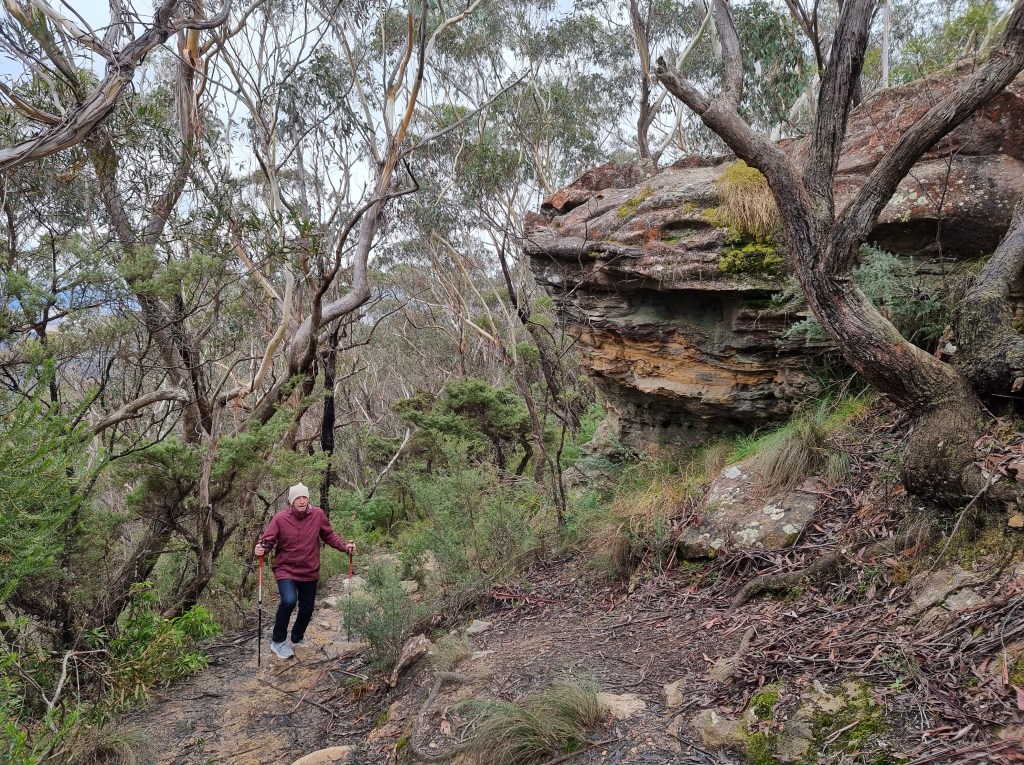
In the beginning at Porters Pass
We’d started out from Burton Road, where there’s no real carpark, just a couple of spots at the end of the street. Me and Mr. C, whose name is also Ian Smith but I’ve chosen to identify him by his middle initial. We’d met a few years previously on a misty drizzly day on the eastern side of the Blue Mountains. We’d fortuitously bumped into each other on the trail, the only two people out that day and we’d met; what were the odds we both had the same name?
Since then we’d done a couple of walks together and kept in touch via the internet. We’d explored new territory, nearly been landed on by some base jumpers and had seen a trio of waterfalls at their best.

Mr. C showing the way at Porters Pass
Today was windy, chilly and overcast, the latter making it better for photography; with even light making for less contrast. Initially there’s not much to see, but you soon come to Lamberts Lookout. Here I appreciated the fact I’d brought both a jumper and a parka, not to mention a beanie, as we gazed out beyond a nearby sandstone cliff across to Kanimbla Valley and got blasted by the wind. It’s just a warm-up, pardon the pun.
Next it’s all downhill, winding your way to the base of the massive cliff face on uneven steps and turning left onto Colliers Causeway, constructed in 1916 on top of a talus slope and named after Henry Justice Collier – a Blackheath store owner, one of the first trustees of the Blackheath Reserves and Mayor of the Blackheath Council (1922-23).
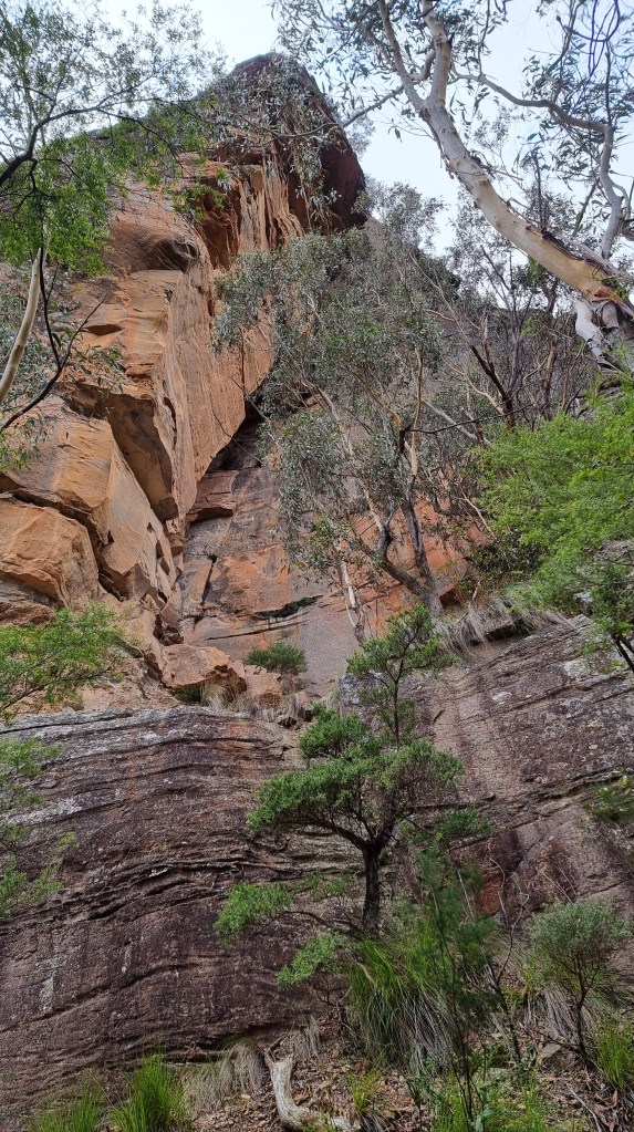
The cliff is oppressive as it towers over you
I was so glad I’d purchased my first ever walking poles only the day before; they proved to be more beneficial than I could have dared hoped for. Continually falling behind due to photographic opportunities, I needed them to hasten the chase.
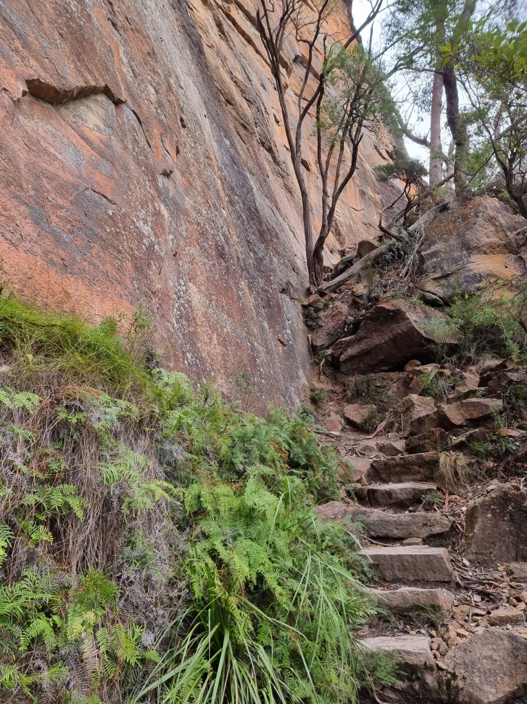
It’s not an easy track
The dominance of the cliffs cannot be understated; places where massive slabs have sheared off can be clearly seen as you gaze skywards. The trail along Colliers Causeway undulates continually, the footing isn’t always secure but we’re making progress and the scenery is breathtaking.
Slippery by name, slippery by nature
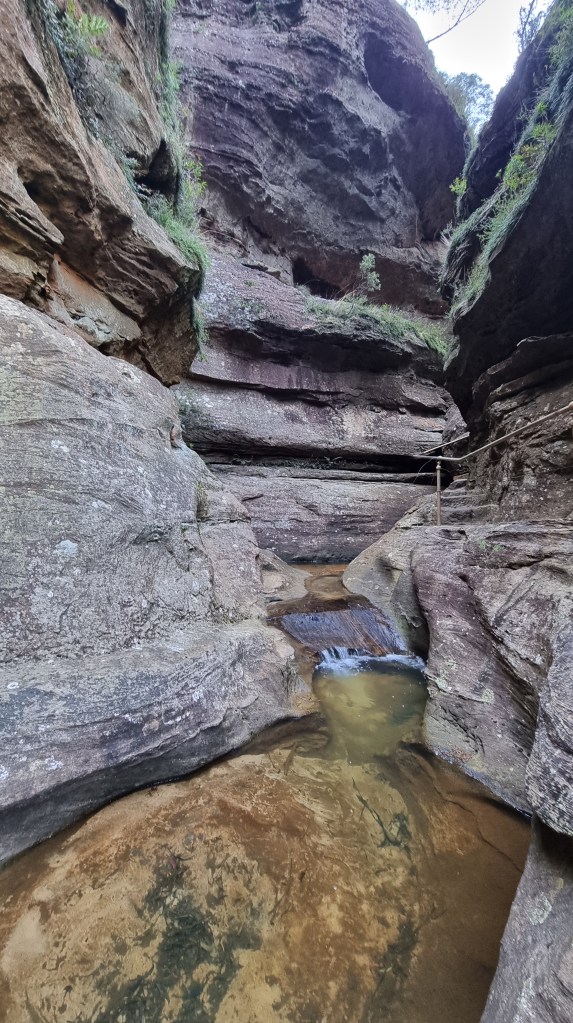
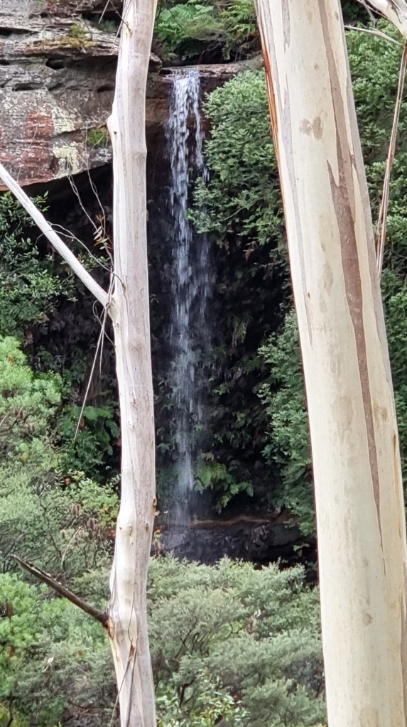
The next variation in scenery, after about a kilometre (seems further), is Slippery Slide Falls. You can hear it before you get there and I know I don’t need to worry about catching up to Mr. C because waterfalls, or streaky photos of same, are his dream time and he’ll blow lots of time getting the right image.

There’s a track there somewhere
One of the most dramatic bits of walking in the whole Blue Mountains, you have to rock hop a stream, find a way through large moss-covered boulders and then mercifully grab a hand rail to launch yourself upwards on the narrowest of staircases cut into the rock face with the slimy brown cascade beside you. Those with vertiginous problems need not apply!
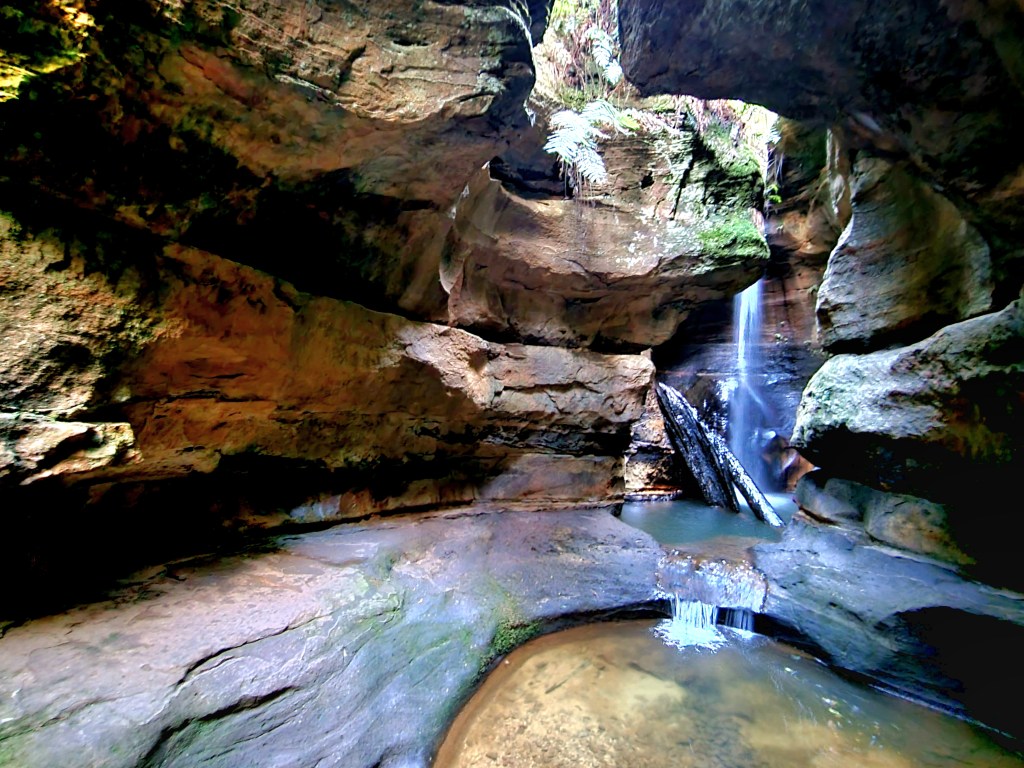
The Canyon aka The Grotto
Up you go to an intersection where a short diversion takes you into a small canyon, aptly titled The Grotto, featuring a low overhang with a picturesque waterfall and pool, a favourite for locals in summer. Then it’s back on trail and heading upwards to Centennial Glen, replete with old growth eucalypts standing tall, memorable overhangs with lush fern clusters, a walk behind a couple of waterfalls and the echoing sound of those climbers/abseilers.
Centennial Glen
It’s all a bit surreal but then, after another sharp climb, you’re suddenly on top of the plateau and everything changes. You’ve reached Fort Rock, welcome to banksia land, low scrub and 360 degree panoramas. Up here the trail is not as well trod and you occasionally query if you’re heading in the right direction, except there is no other way to go.

Mr. C checking on how to get out while I shoot from Fort Rock
Reaching a clump of weather battered exposed white gums is a sign you’re getting close to the end, which is good, because Mr. C’s strength is not in going uphill these days. We meet a man walking his pet greyhound whose name is Jamie. Over the next quarter of an hour he walks with us, invites us for coffee (politely declined) and, after pointing out his house, almost obscured by the forest, tells us to “Drop around anytime”. I reflect that these are the kind of people you meet bushwalking; chatty, friendly and willing to share.

Into the gum trees
Finally we’re at the final intersection and it’s just five minutes back to the car or, more importantly, less than ten minutes to a gourmet pie, which is where we came in.

What a beautiful hike! Such beautiful landscapes.
LikeLike