The now famous Waterfall Way between Bellingen and Armidale is rightly becoming a “must-do” for Aussie travellers. There’s a tendency however to do the most famous three or four and overlook the rest, not to mention other attractions. A well-produced new brochure has hopefully gone some of the way to rectify that and make for a more complete experience.
It even includes the other attractions less visited, particularly Cathedral Rocks, a granite massif that rises to 1,563 metres and its nearby cousin, Round Mountain, at 1579 metres, is claimed to be the highest point north of the Snowy Mountains. Sadly, all you can do is walk around it because it has a large air safety installations up there.
There’s an eight kilometre drive in off the main road on dirt that is sometimes maintained better than others. On this occasion I lucked out as the pathway to Barokee rest stop was in quite good order. A few granite outcrops along the way start the adrenalin flowing because you know if they are interesting, just how good is the main display.
It’s school holidays and Covid all rolled into one. What that means is that, while Sydney is excluded, the rest of the state can still visit so there’s a smattering of tourists there. Indeed, more than I’ve ever seen previously but still only about 10 vehicles can be viewed.
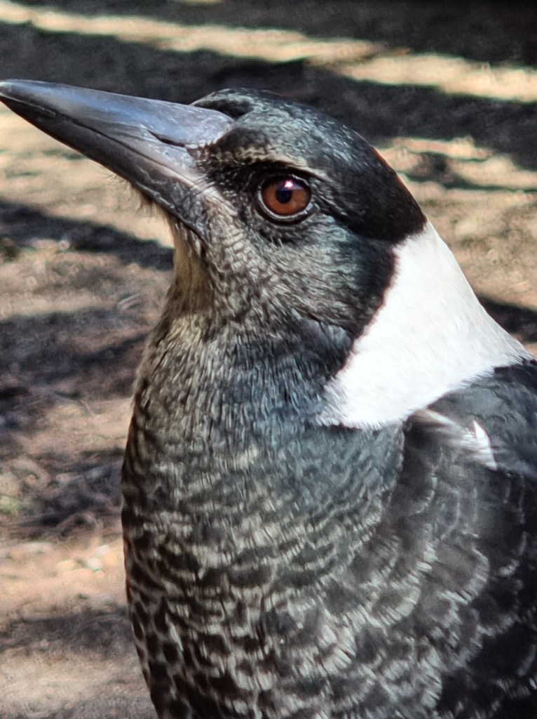
The basic campground sits beside a swamp that isn’t quite humming at the moment because it’s the middle of winter so a lot of wildlife is in absentia. Of course, that excludes the ubiquitous magpies who decide to join me for a pre-walk cheese cracker fest.
Though it’s late in the morning the chill of the night remains as the first steps are taken on the 6.2 km loop trail and side excursion. It’s an undulating path that is rated 3 mostly but adventurers are here for the 500 metre loop that takes you to the top. It’s rated 5.

En route I add a few hundred metres doing my usual off piste photography. There’s a bubbly streamlet beside the trail that feeds the swamp. The flow, though small, is much more than I’ve seen it previously and is audible here and there.
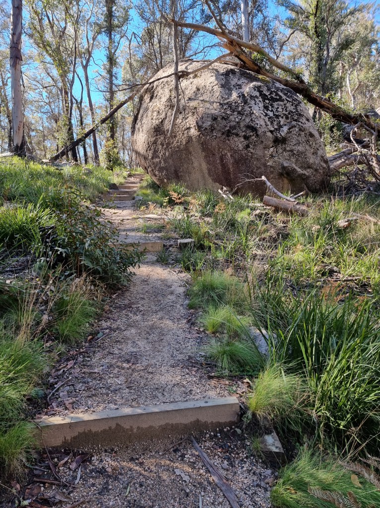
The climb starts in earnest after about a kilometre with regular fixed wooden steps to be taken. Massive bags can be seen at the side of the route with replacement steps. They appear to have been dropped by chopper like the concrete ones I’ve seen at the Grand Canyon in the Blue Mountains. I feel good inside knowing that there’s some money being spent on national parks.
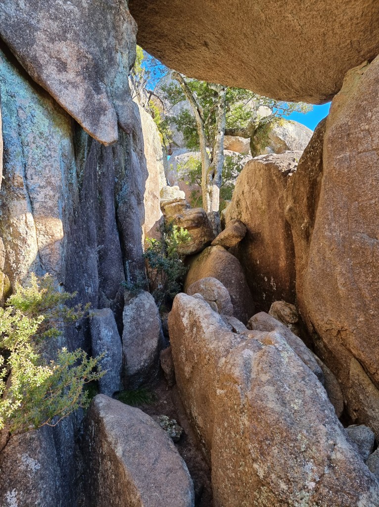
The turn off is reached and rocks now have to be climbed. If you think anything was hard before, you’re bound to suffer on one of the hardest trails in Australian bushwalking, just be thankful it’s less than a kilometre.

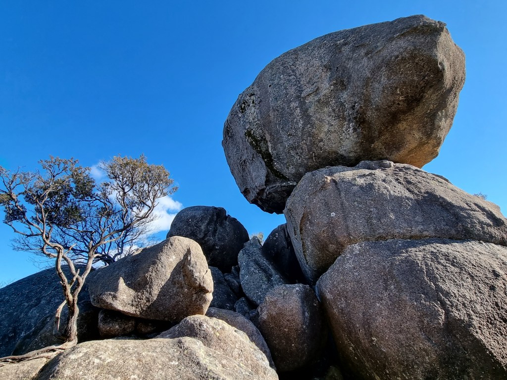
100 metre rock walls tower over you and, at times, the trail is tricky to follow as you scramble left and right up uneven natural stairs. Thank goodness for the occasional arrow. Eventually you get to the seriously hard part and take the path of least resistance. Ducking under massive boulders through a couple of ragged tunnels, ever upwards until you come out onto the final clamber up the last 50 metres, at times holding the heavy safety chain, at others jumping to the next boulder before clawing your way to the top. Fortunately, it’s not wet and the granite is grippy which gives one a little confidence going upwards but it’s not a place for the faint hearted.
There’s a small natural crown on top where you get your picture taken and I’m fortunate to have someone handy to snap me. In the background there’s Round Mountain and its distinctive dome, elsewhere there’s the vast New England and two or three other large outcrops of granite boulders.

It’s hard not to tarry awhile and admire the drama of the formations, the vast panorama and reflect on where you’ve just come from. The more effort, the more satisfaction. It’s a noted place for sunrises and sunsets but, in the middle of winter? I’m not that keen anymore.

Bum slides are the go on the way down until you reach the ragged steps and it’s here that I miss the main trail, hard to follow except for the occasional arrow. By the time I intersect with the main path I’ve gone 100 metres further than I needed and have to regain that height. It’s still a climb after that to get around the northerly part of the formation, something my legs don’t need.
There are scars here from the bushfires; fresh growth flourishing from blackened bark and healthy grasses on the forest floor. I once read about a forest in Canada that had been totally devastated by a similar event but they had monitors in place. Amazingly, within two years there was more wildlife there than they’d ever previously recorded. I hope that happens here.

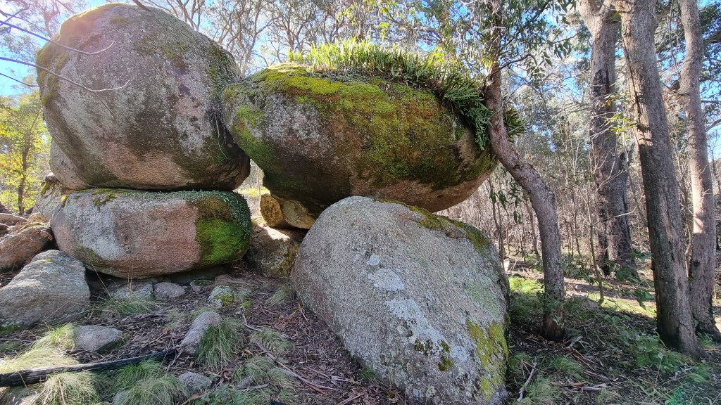
Around the eastern side there’s another huge outcrop, it’s just not as tall as the main one though it covers an area just as large. It’s now pleasant as it’s a gentle downhill route most of the way on the coarse sandy track and back through the swamp again. For the adventurous, this is a must-do in New England.


Perhaps the inclusion of a map in your blog would help, took me a while to work out where “Waterfall way” and “Cathedral Rock” are
LikeLike