I’d corresponded with someone on the internet about the Burr Trail. He said to make an effort to do it. So, as I sat in the hotel room in Torrey, knowing I’d already gone past the turnoff yesterday, a decision was made to go back. The skies were still overcast, blue skies notably in absentia most of the trip.
I’d been speaking to a guy who worked at the motel I was staying at. His words, “I’ve been here for 24 years and haven’t even scratched the surface yet.” He’d also added about my intended route, a loop on Burr and back on Notom Road, “It’s just about all tarred now anyway” and “It should be open now”; referring to the weather, post the precipitation.
Thus encouraged, I stepped out into the brisk morning air looking across at the snow-splattered mountains and started the car, noting all the literature lying around on the passenger’s seat that hadn’t been tidied up. Mmm, must get around to that.

As the byway climbed over Hogback again I wondered if it would be the last time I’d see snow for a while. At Boulder, a nondescript community where people cling to life, I turned east onto the famed Burr Trail, named after a man who was born while crossing the Atlantic in the 19th century.
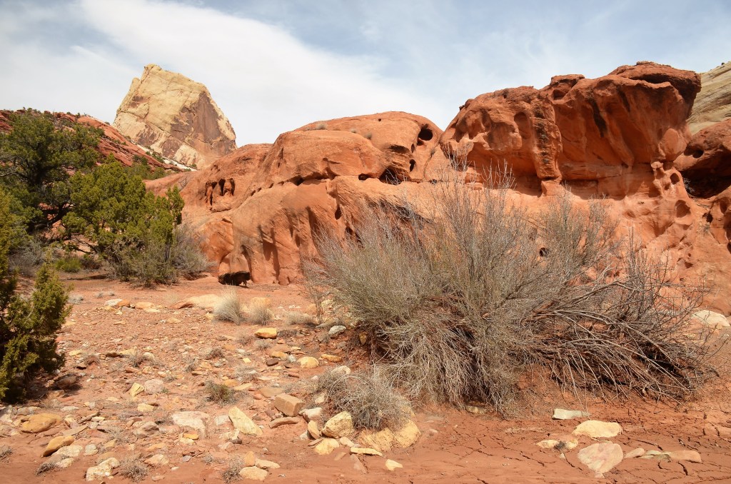
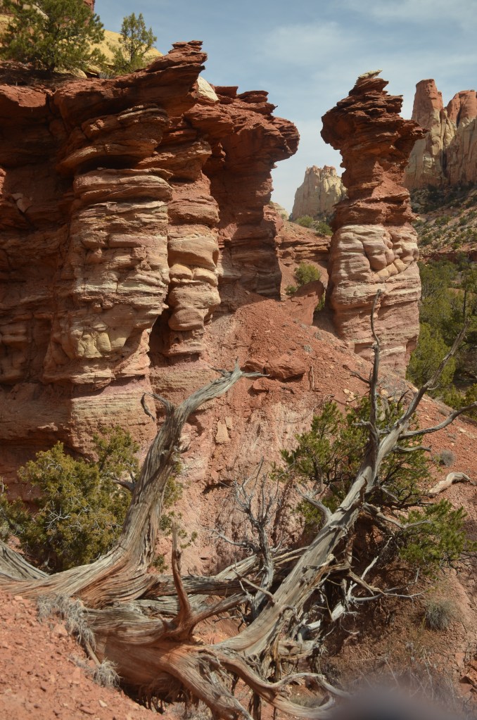
Initially there are large hills of bare slickrock called Durffey Mesa, which is, in fact, petrified sand dunes, and then you descend past the picturesque Deer Creek, a permanent waterway popular with the hiking fraternity where there’s a cautionary sign with a scorpion and skeletal hand that says, “Desert Canyons Don’t Care, your life and safety depend on you”. Mmm, then you traverse the Gulch. It’s along here that I noticed what might be a canyon on the left, so I pulled up and wandered over for a picture, noting tufts of snow still intact beneath shady nooks.


Imagine my shock when I looked down the steep walls and saw the road down there. Welcome to what’s known as the Grand Staircase-Escalante National Monument! If you’re a little confused, there are national parks (mostly with sealed roads and entry fees); state parks (mostly similar to national parks) and then there’s the monuments, run by the bureau of land management where, unless there’s a pre-existing road, it’s left just as it is, a primitive area. All part of Grand Staircase.
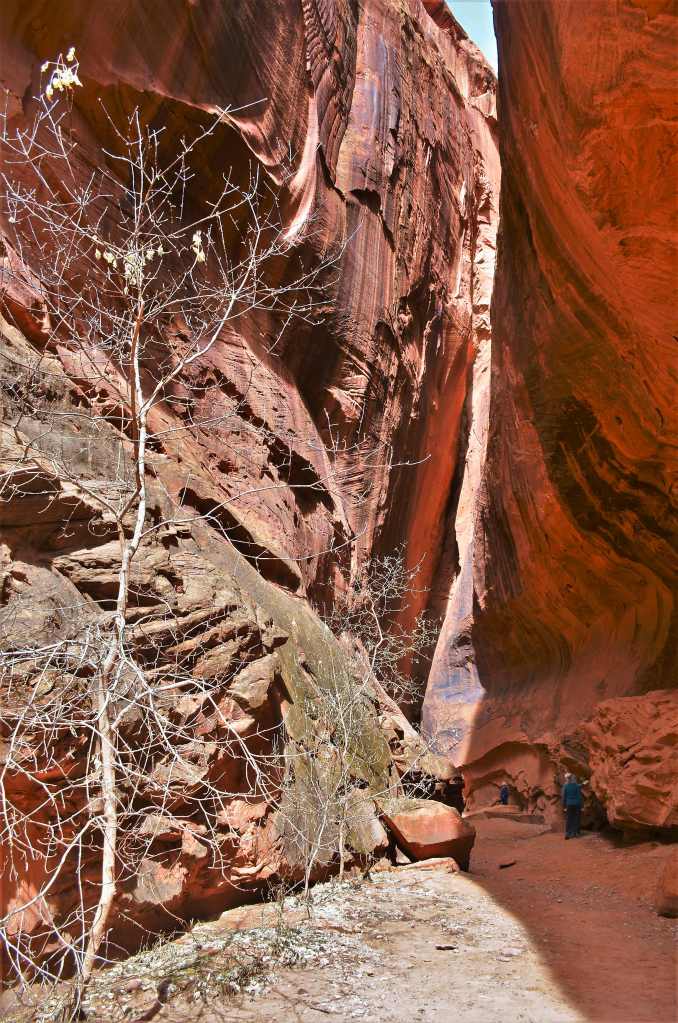
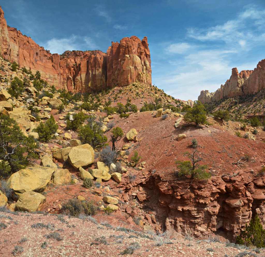
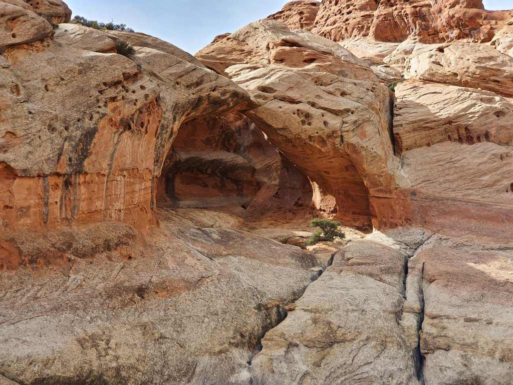
About a kilometre further on, the tar took the plunge and soon you’re driving through Long Canyon with massive walls of rusty coloured Windgate sandstone all around. At one stage there’s a neat short slot canyon on the left, about 10 metres wide and just over 200 metres long, with straight sheer walls either side and a jaw dropping dead end where, from on high, water drips. It’s called Singing Canyon and is a stop most tourists make.
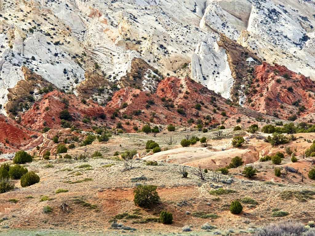
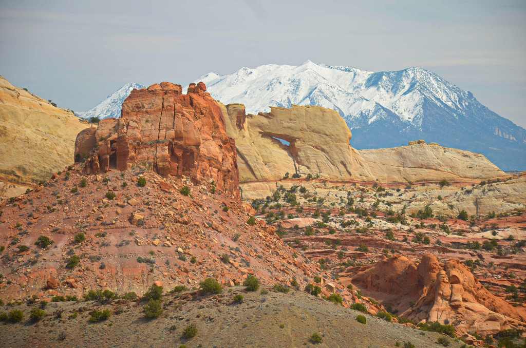
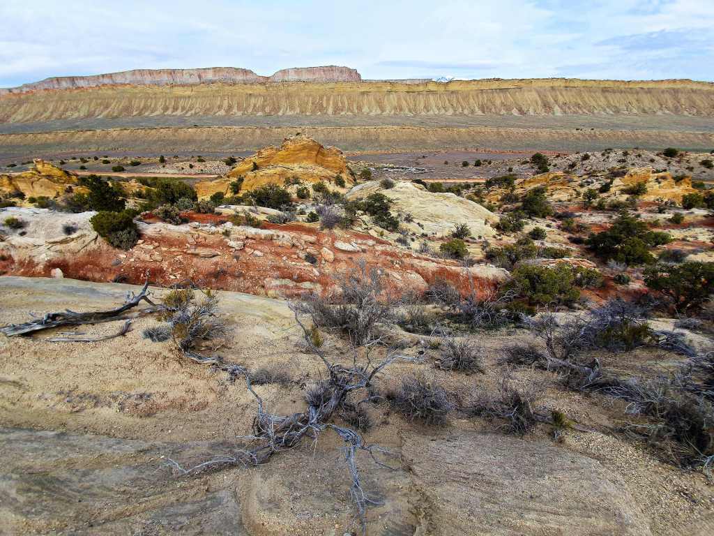
Though the road slightly ascends after that, the cliffs actually get higher until the next shock. The road abruptly breaks out of a side exit and Long Canyon ends immediately at a saddle of the Circle Cliffs with far reaching views to the Capitol Reef and then, way in the distance, the snow-capped Henry Mountains. Below on your right are the colourful Chinle Hills and it’s hard to grasp all the geology that’s going on around you.

The sealed road plunges onto a relatively flat section for a few miles that reminded me of Outback Australia with vegetation only 2-3 metres high at best and several spots where there was barely ground cover. Then, you roll over the edge of the Waterpocket Fold just where the road becomes dirt and there’s another memorable viewpoint at the edge of the Capitol Reef National Park boundary. Capitol Reef National Park….why is called this? Well, the answer takes us back to the early settlers of the area. Settlers thought the white Navajo domes looked like the capitol building in Washington DC while others thought the long wrinkle in the rock layers looked like an oceanic barrier reef. Oceanic reefs make it difficult to travel, as did the Waterpocket Fold, hence the name “Capitol Reef”.

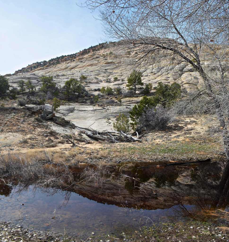
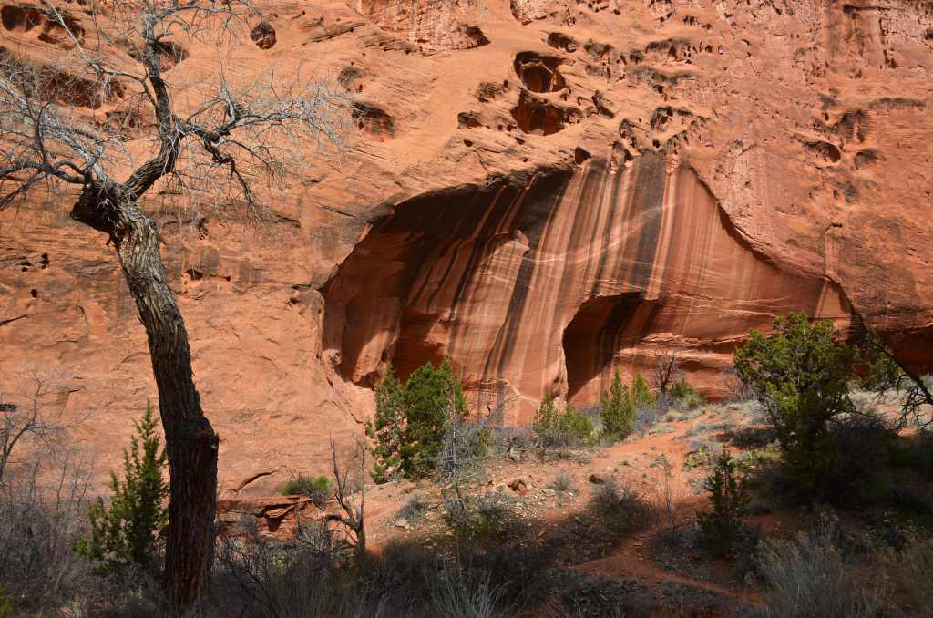
Now the road scenically descends another 1,000 ft over the next few miles to Muley Creek where there’s a noted hike to Upper Muley Creek. In another weird naming event it was determined that the canyon was so narrow a mule would have to bend to get through.
I felt I had to make an effort sometime today so I got my cameras out and set off. The trail follows the creek bed exclusively; it’s also the route 4WD vehicles take to get to a trailhead in the middle of the canyon, winding along through varied hues of rock and variety of shapes, including arches, two of which I viewed before deciding to turn back around the halfway mark, the shortcomings of my legs becoming clearly evident. All the way up I’d hoped a 4WD might give me a lift, but none came by. Now, on the way back, three passed me going up the canyon.

Again here you couldn’t help but notice the varying colours of the sediments, how fragile some are and how cemented others. Then, back in the car and just a couple of kms down the road, the road suddenly almost disappeared down some electrifying switchbacks. Oh shit, I have to drive down there? In places, you couldn’t see the road ahead, because it curled back under itself. It descends 800’ at an average 12 degrees. At least you were wide awake by the time you reached the bottom.
The junction with Notom-Bullfrog Road was soon after and I was quite looking forward to heading north back towards base, not really knowing what to expect. Bad road, that’s what to expect! In certain sections it was seriously rutted and it took all my years of accumulated driving skills to maintain a relatively straight line. Even then I’m sure I used the sump a couple of times to flatten some of the ridges out. The good side is that they were sandy soft but after each bad section, of about half a dozen, I was glad of respite.
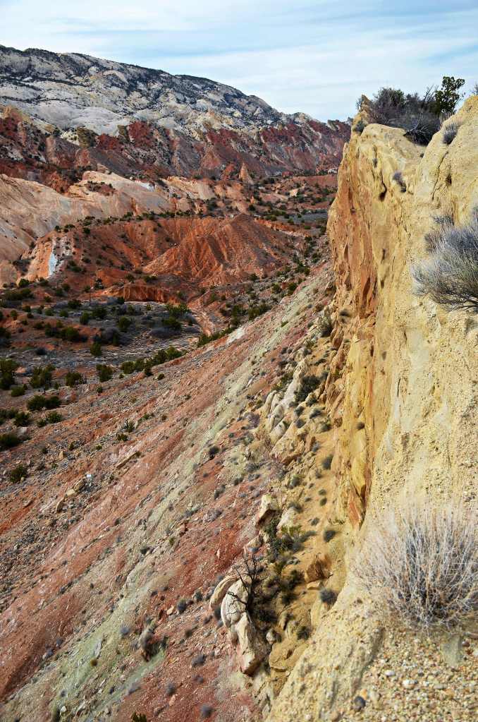
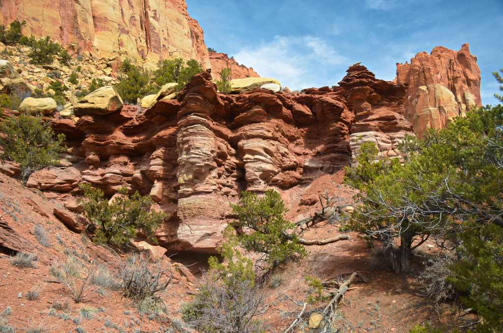
Then there’s the panorama off the road, a massive green tinged Cedar Mesa and the snow-capped Henry Mountains, some over 11,000ft, beyond on one side. It’s all a bit much to grasp in a moment or two but, if you stop and climb the hogback ridge of Dakota Sandstone on the other side, it’s yet another wonder of the state of Utah called the Waterpocket Fold. Sedimentary layers have been compressed into waves whose colour belied the forces of aeons ago and a valley carved by Bitter Spring Creek had exposed them. I’m in a strike valley and, had I continued up Muley Creek earlier, eventually I would have reached an overlook at the top of this range. Still, I clambered up the central ridge three times and was able to see one of nature’s grand wonders.

The paucity of vegetation also helped lay bare the geological forces of times past and I wished that I’d time to spend a couple of hours to wander across to the dried up river bed and explore, but time and energy (plus a decent place to park) were lacking, so I took the easy option and was ultimately relieved when a tarred surface was attained about half an hour later and revived myself thereafter when I reached the motel.
How is it that one half of one state can have all these amazing things all to itself? Yet, I knew, that tomorrow there would be more, whatever direction I chose.
