It was as benign as it gets; the weather that is. Crisp morning with rising fog from the valley below, a sure sign it was going to be a good day.
My attention turned to the maps of Wingham hinterland. There were hills to be sure, some even had the word Mount before them and I always figure if there’s moisture up there, sooner or later there’s a waterfall somewhere below. Indeed, there was, Potoroo was its name.
The generic common name is adapted from the Eora aboriginal name ‘Poto-Roo’ and was the first macropod to be seen alive in Europe. A pair suffered reverse transportation from the new penal settlement of Sydney to London in 1789, where they were put on display (Claridges et al. 2007). This species was also the first of the Potoroidae family to be formally described by John Kerr in 1792…not that you needed to know that.

The road in was 41 kms, though how much was sealed and how much was dirt I knew not. Google did indicate it would take over an hour, so I surmised that gravel would play some part. No matter, I was off, drink and nibbles beside me on the passenger’s seat.
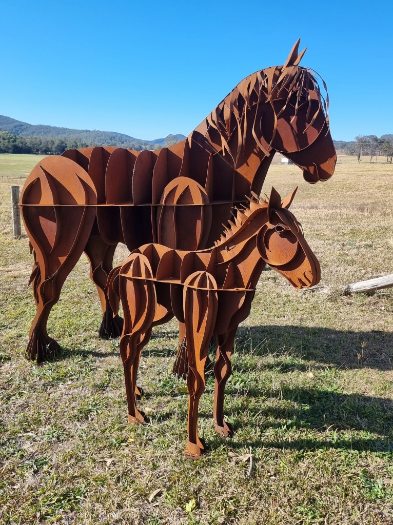
As expected, it was a somewhat circuitous route. Sometimes you wondered why you were pointing the wrong way and then it would change. Past some rickety old fences, a worn out motorbike atop a bus stop roof and an eye catching metal plate sculpture of two horses. Whoever did that was seriously talented.
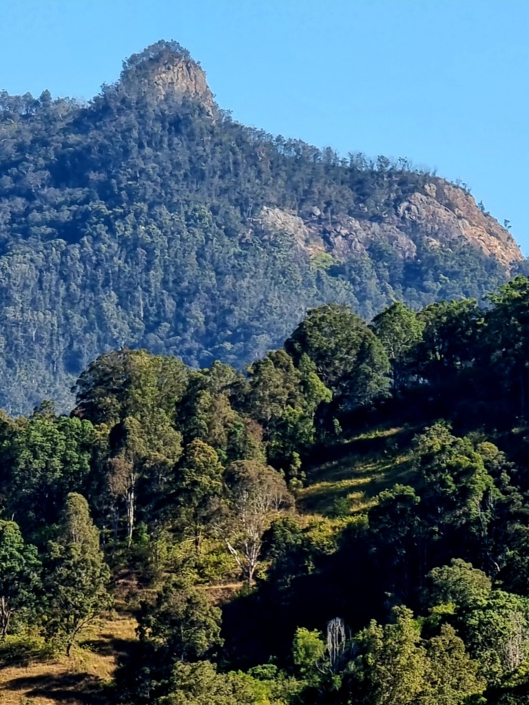
Ahead now a mount with stark rocky outcrop took my attention. Was my destination anywhere near that? Three kilometres later the turn-off and dirt road arrived almost simultaneously. Dingo Tops was where I was headed and also the name of the road. From here it was strictly uphill, winding first through farmland and then breaching the outskirts of the forest before twisting through a wonderland of native trees.
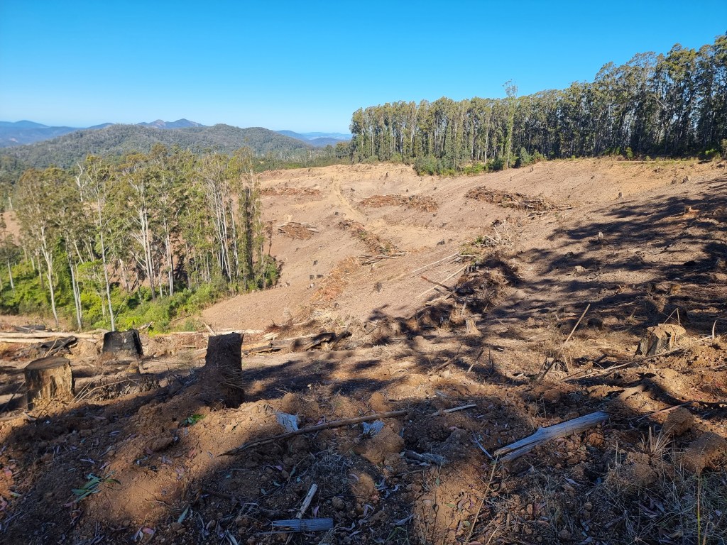
At one point scorched trunks bore testimony to the horror of the bushfires a few years previously. Miraculously they had survived, the crown had been spared on this occasion yet, only two kilometres further on, just when I took the first turn off to the falls, they had been devastated by something they were unprepared for – chainsaws!
Somehow, clear felling seems something of an obscenity to me. All nests, hollows and food sources have disappeared, along with the animals that live there. I realise we need wood and that selective logging is much more costly but, just maybe, we need to pay more.
I tried not to dwell on it too much as the final turnoff to Potoroo Falls was indicated. Only 3kms to go but, it’s strictly downhill and 2WD’s are warned not to go when it’s wet. I can confirm the correctness of that sign. It was so vertical they have more than one erosion hump on the route, but the encircling nature is a treasure. Foot ever ready to brake I cruised steadily in the direction of down.
The arrival is somewhat abrupt. Suddenly, half hidden by leaves, there’s a solid toilet on the right and, a few metres further on, a not-so-huge carpark for four vehicles (or five if you’re all friends).
Though it’s school holidays, only two cars are there. Depending on which sign or website you refer to, it’s 900 metres return or 600 metres one way.
I mean, can you believe, NPWS says the following: “From Potoroo Falls picnic area, follow Potoroo Falls walk around 1km upstream along Little Run Creek” yet, below, they say it’s 900 metres return to the falls.

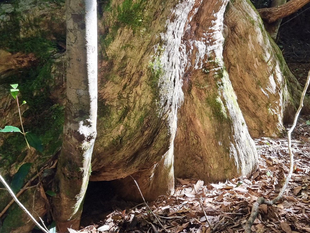
No matter, I’ve got my walking poles and I’m off, initially past the largest recorded watergum, Tristaniopsis laurina, which is nice to know but not overly exciting. I’m waterfall bound and, once upon a time, it involved one minor creek crossing but fallen giants have made sections impassable so now it’s three at least. This is where the poles are indispensable! No wet feet for me.

There’s the usual moss and fungi, those colourful understory occupants that help keep the place alive and the water, unspoiled by humans, is almost invisible it’s so clear. No wonder people want to swim here….except there’s one small problem – it’s very cold! However, I imagine in summertime it would be more bearable but two people give it a go but only get ankle deep before calling it quits.
Which reminds me, I would not recommend this excursion immediately after rain, which is when I usually head for waterfalls. The crossovers with lots of water could be seriously dangerous.
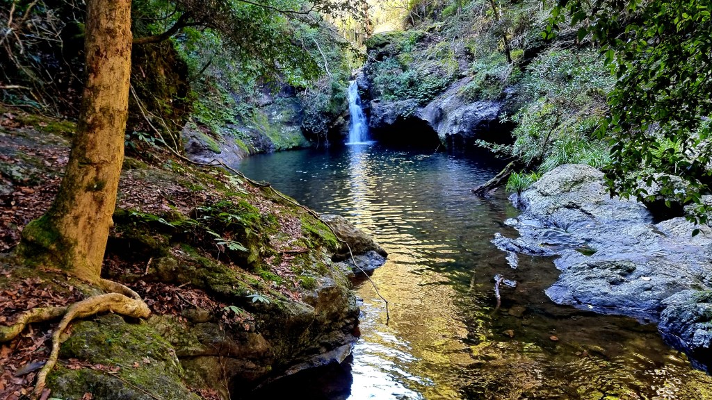
Oh, and the falls themselves? They’re picturesque, as is the whole walk, but you wouldn’t call them spectacular. It’s simply lovely being there, putting your feet up and soaking yourself in the atmosphere, figuratively speaking of course.
Myself and a male parent tried to get to the top of the falls but it was too slippery, too dangerous. Others had died here before, didn’t want to add to the list.

On the return trail you could clearly see where the track used to be and why it was a little rough in places but I couldn’t help but recoil from posts that label it as a 4??? For what it’s worth, in my opinion, it barely rates a 2.
Four is ” Grade 4
Bushwalking experience recommended. Tracks may be long, rough and very steep. Directional signage may be limited.”
The reality is it’s neither steep nor long and, since you’re following the only creek for miles, directions are simple.
On the road home I hoped to see a sign to that mysterious rock mountain but, to this day, I don’t know what it’s called or how to get there. Still, it was one lovely outing.
