COME IN DUFFER

Cummeenduff, now there’s a word.  I was reminded of many of our aboriginal names that bear no relevance to the English language and here the Celtic background still flaunts itself in so many ways but this was a place I’d never heard of.

There was still time in the afternoon for some photography so I begged leave of Lorraine and bolted out the door.  According to the map, the path to the lakes was opposite our entry gate somewhere so I figured I wouldn’t have any trouble finding it.  Mistake.

MacGillycuddy’s Reeks mountain Range

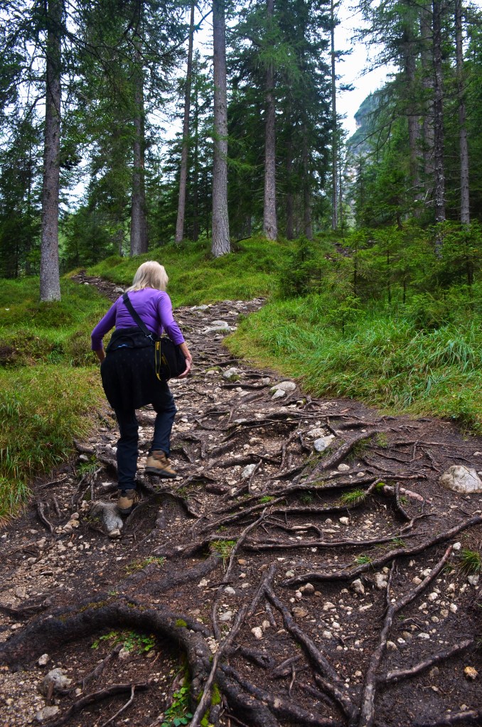
I walked westward along the single lane road and “no entry” did I spy so I did what I always do, jumped a fence.  Second mistake.  The entire paddock I found myself in was a peat bog.  No matter where you put your foot, it squelched.  So I took it easy, working my way down towards a line of trees that had befriended the river.  You couldn’t take your eye off the ground, so potentially slippery was it, and then it happened.  My right foot went out from under me and my dodgy left leg bent totally back as I flopped over on my right side and got the brand new jumper, that Lorraine had bought for me, wet and muddy.

Pain wracked my leg.  I began to wonder just how I was going to get out of this situation but first I had to get up.  If you’re a supple 10 year old it presents no problem but it was like my body was frozen and my leg was trapped beneath it and at least 10 seconds passed before I could roll sideways.  It seemed ages before I could get into a position where I could lever myself upright again. This was achieved slowly and methodically and I found that I could still walk. 

MacGillycuddy’s Reeks

That’s when the adrenalin cut in again and I moved yet again in the direction of the river, knowing that there would not be a second chance, but only made it another 70 metres before it became impassable.  So I turned around in bitter disappointment and struggled warily towards the road once more.

I tried to hide it from Lorraine when I made it back by having a quick shower.  Third mistake.  Unsure of just what to do with the jumper I washed the stained arm gently after I’d done my dirty trousers and socks and hung the lot over the heater before retiring to the dining/lounge room at the far end where Lorraine was.  It was all going swimmingly until……Lorraine went to the bedroom while I sat on the lounge typing on my computer.

I have no idea just how many minutes passed until an irate woman stomped through the door, wrung out the arm of my jumper on the dining room floor before throwing it violently just past my head.  It’s about here that the word “recrimination” comes into play.  The torrent of abuse I suffered thereafter put something of a dampener on the holiday and had not Sheila come to the rescue and calmed Lorraine down a little I don’t know what might have happened.

Neither of us slept well that night; how many hours I lay awake I know not, but they were several in number.  The first time I had to go to the toilet was absolute agony; I should have had crutches so great was the pain in my left leg.  The next couple of times I could manage it but only with gritted teeth.

Sometime during the night (it was around midnight we later learned) the 76 year old party girl came home.  You could hear the solid metal gate clang, her footsteps along the path, the door open, the light clicking on in the hall…..in fact, there’s not a sound that doesn’t echo along the tiled floor.

Breakfast seemed to bring a little relief and the thought that I might actually be able to try again to reach the lakes was inspirational so, with better instructions and ignoring the map, we drove the car to where you turned off for Cummeenduff Glen and found out that you could actually drive to where we wanted to go, albeit slowly.  It was yet another one laner whose only purpose was to service a few homesteads further down the lakes.

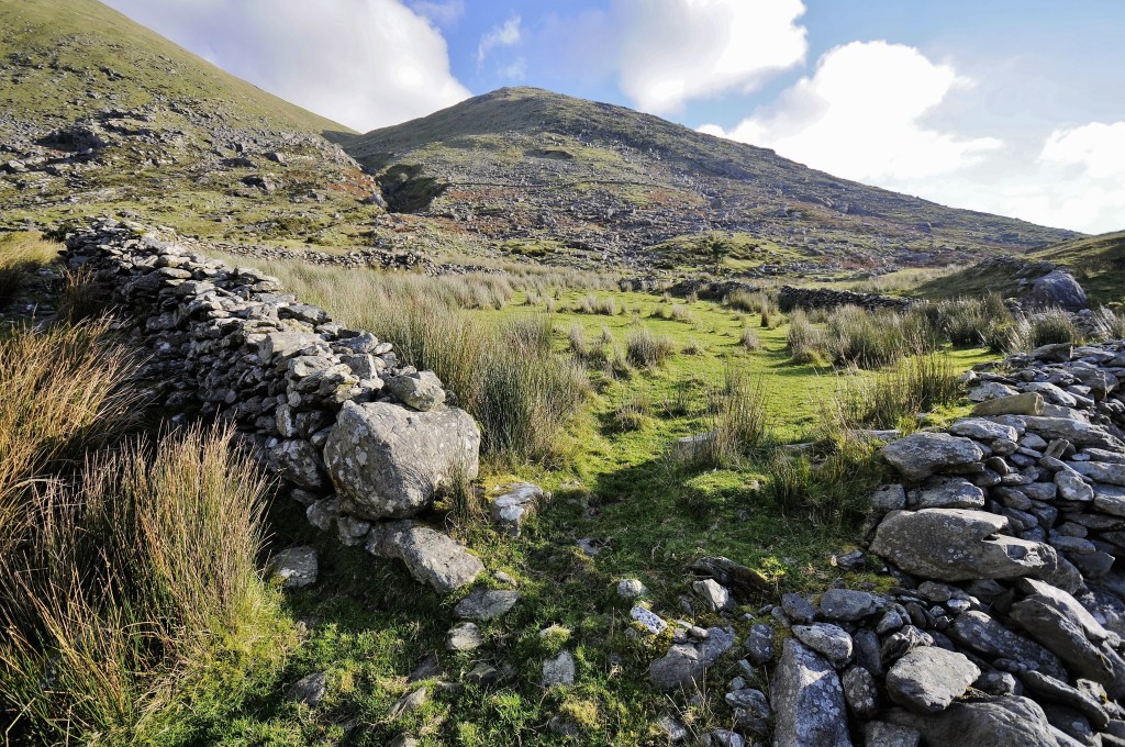
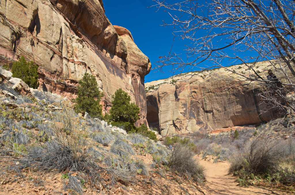
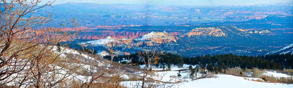
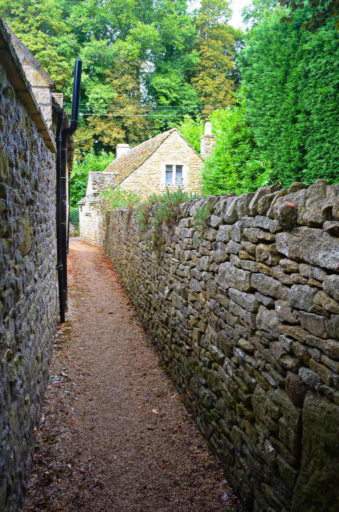
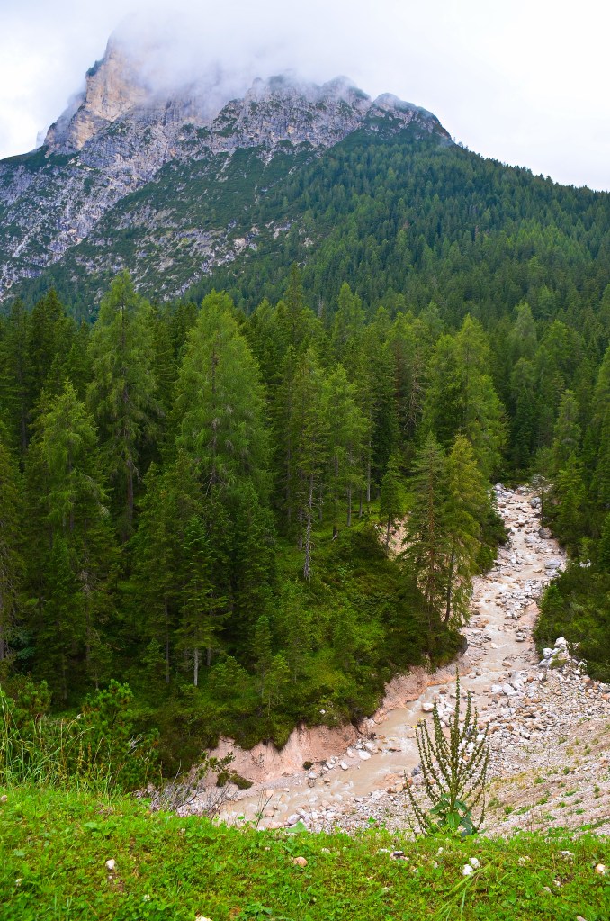
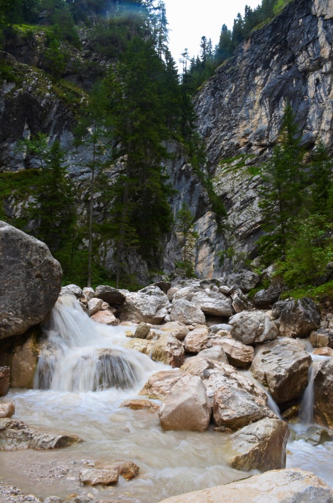
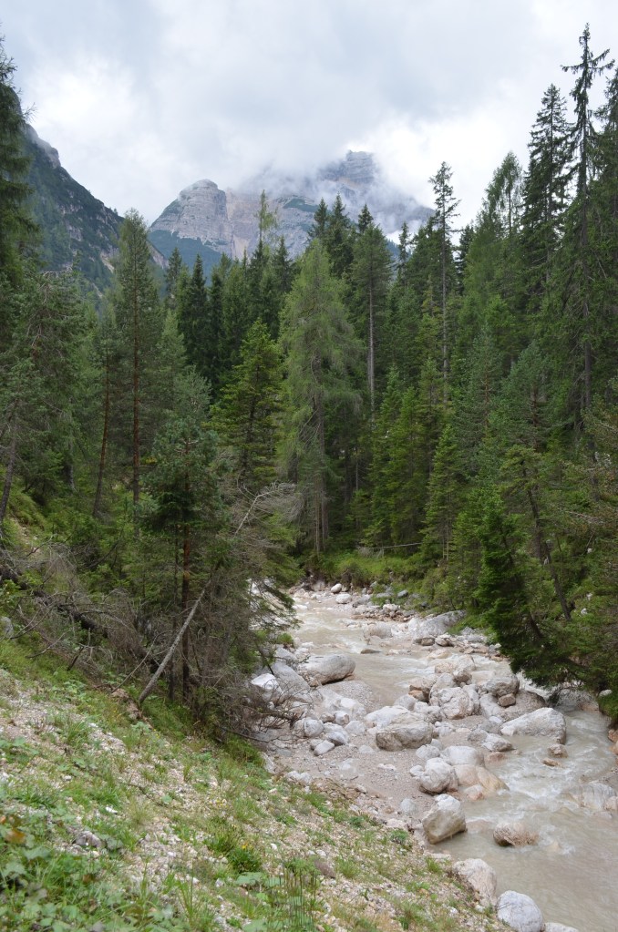
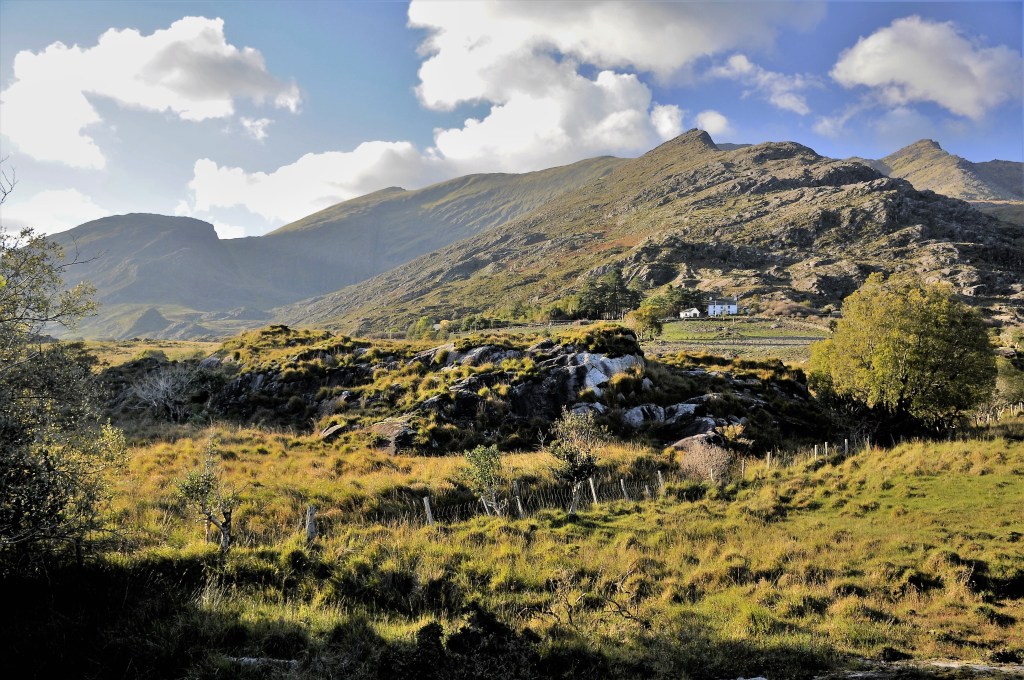
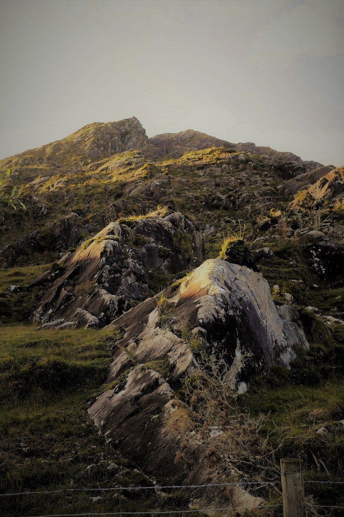
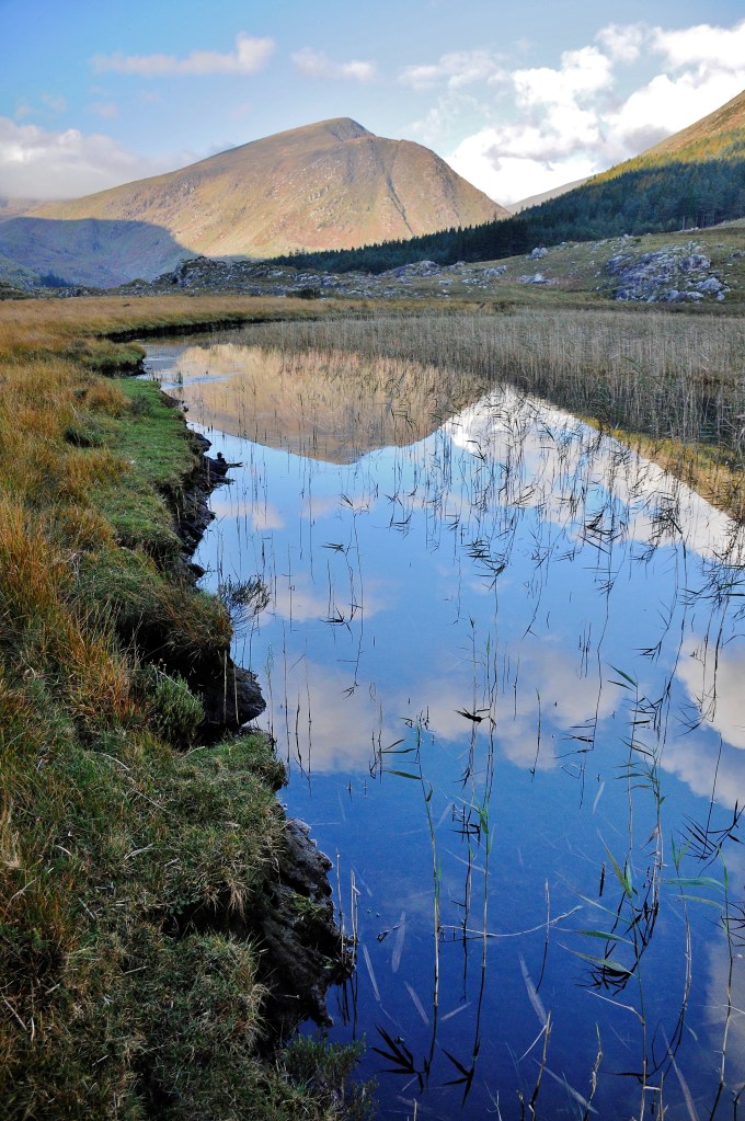
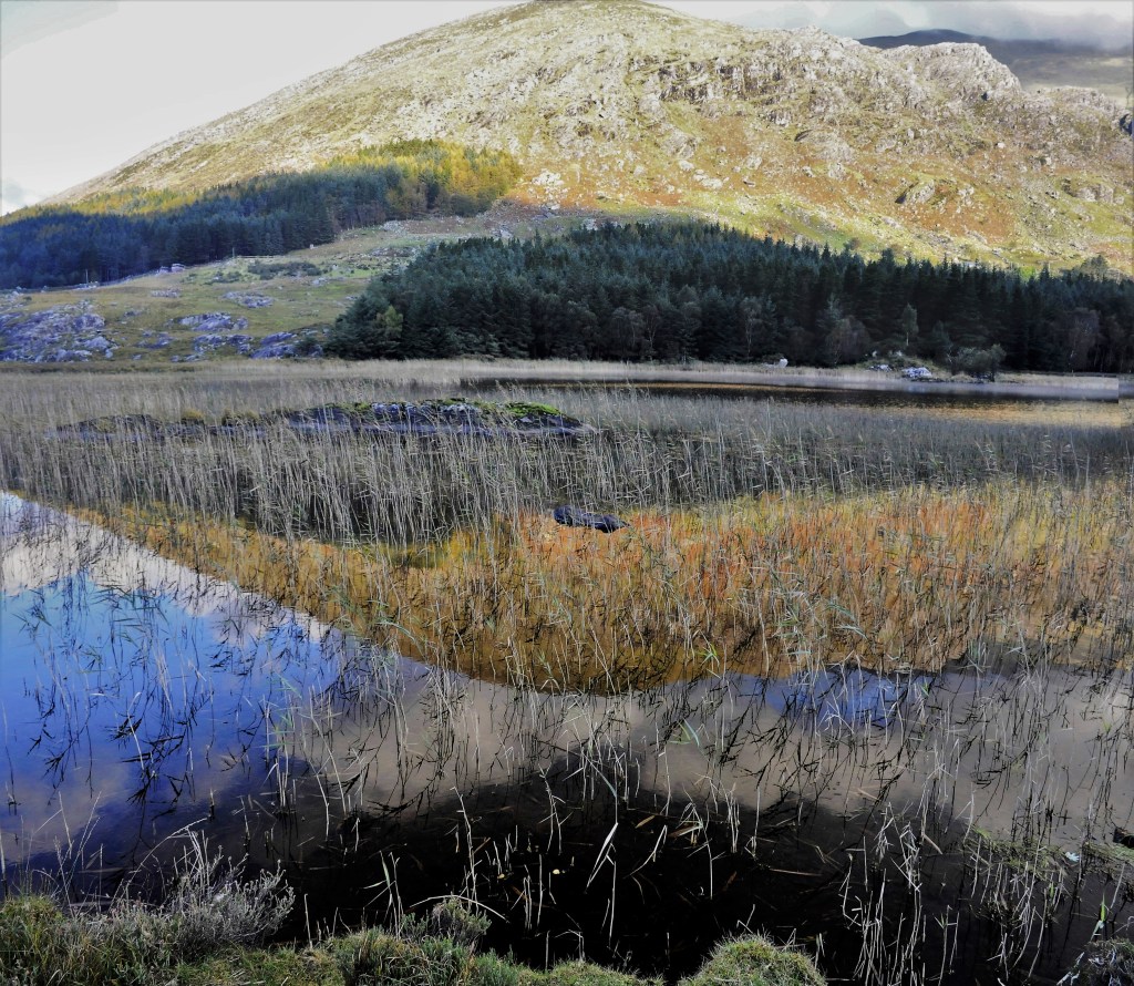
By Irish standards the weather was about as good as you could get it, i.e., partly cloudy, no rain, light winds.  Not perfect for photography but the best we could hope for.  However, there was another factor to consider and that was just being here amongst the mountains, called MacGillycuddy’s Reeks, that rose 3,000ft from the valley floor.  Part of the allure was their starkness, all rock on top with bracken ferns browning much of the lower slopes in amongst patches of grass and, farther down, the odd house.  Here and there were fence lines and old stone walls of indeterminate age in various states of disrepair while trees put in a spasmodic appearance only on the valley floor.  It was a bleak yet somehow attractive landscape and when we came to the lakes we were only too happy to record the moments we spent there.

IT’S ANOTHER WORLD AT LOUGH CUMMEENDUFF

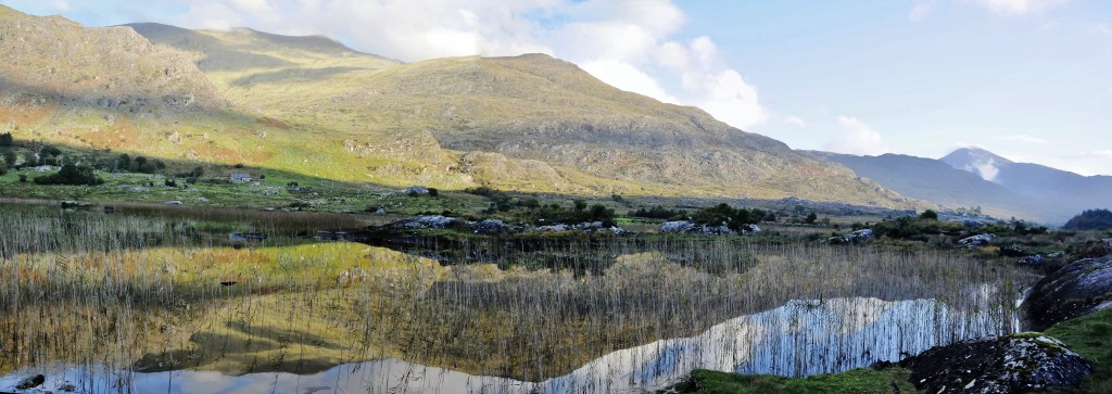
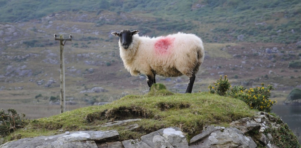
Just being there was spellbinding.  The stillness and quiet, the corrugated ripples on the tranquil water oscillating through the reeds, the eye-catching dominance of the mountains, the free roaming sheep, the bog we had to walk on to get the lakeside pictures, the ancient crumbling rock fences all played their part. 

LOUGH CUMMEENDUFF LOOKING TO MacGillycuddy’s Reeks

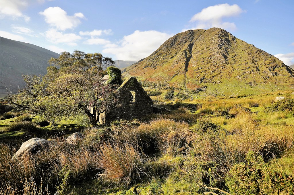
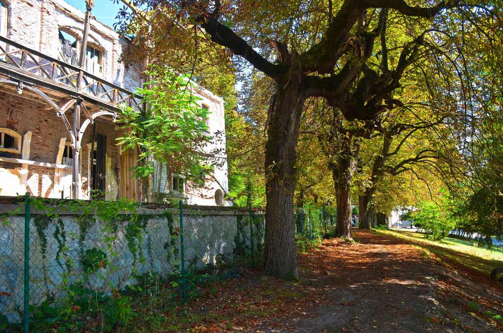
I was almost mesmerised by an old ruin on top of a rise with hills all around.  It seemed such a forlorn thing that once had been lived in but today was crumbling at the rate of about two bricks a year.  I almost expected an apparition from within as I made my way around the walls and the animal pens that once were.  You could almost sense the presence of a sheep herder checking a few ewes that he had penned up for safety before retiring into the minimalist dwelling attached.  No creaking old wind-blown gates here, just dry stone walls that only added to the bleak appearance of the place.

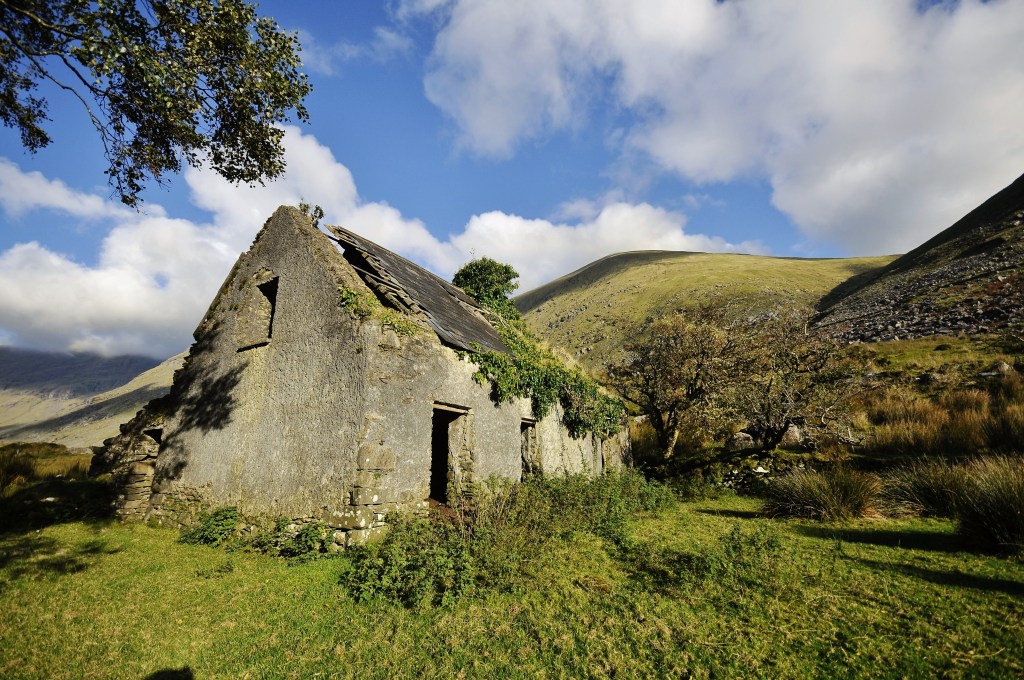
You could feel that the cold of winter would have been chilling and I wondered just what they did to fill in their time when the wind blew the rain sideways outside.

LOUCH CUMMEENDUFF

We spent some hours in the glen before returning to the irrepressible Sheila for some morning tea.

MacGillycuddy’s Reeks

A WAY TO FORGIVE

The story goes that a man was not happy about what his father had done; loaning money at exorbitant rates.  So, he decided to do something about it and build a chapel, covering it with art representing scenes from the bible depicting how your life should be lived and what not to do, plus the repercussions.

That man’s Christian name was Enrico and his father was Reginaldo Scrovegni, a usurer of ill repute who, in the eyes of his son, had sinned with greed.  However, Enrico himself was viewed by others as having sinned with pride; perhaps the chapel is reflective of that?

Whatever their sins, around 1302, Enrico commissioned Giotto di Bondone to do the frescoes inside and planned the Scrovegni Chapel as an extension of a mansion he built on the place where a Roman arena once stood that had been torn down to build apartments.

Figures are flattened somewhat due to the technique in straightening them.

All was going well except the friars from the next door Church of the Eremitani (hermits) protested to the bishop that it was too grandiose, the bells way too loud and represented competition with theirs, so it was scaled down somewhat.  For the Scrovegni Chapel, Giotto was asked to depict a series of stories from the Old and New Testaments, culminating in Christ’s crucifixion and resurrection and the Last Judgement.  The aim was to encourage visitors to the Chapel to meditate more deeply on Christ’s sacrifice and the salvation of mankind.
On the lower parts, Giotto planned a painted architectural structure in trompe l’oeil style with marble supporting the vaulted roof, decorated as a star-spangled sky, with framed stories of episodes in the lives of the Virgin Mary and Christ on the walls.

Giotto was one of the earliest artists to depict the illusions of real life, in terms of emotion and space; on a flat surface.  Along with Cimabue, whom he may well have trained under, though his works are vastly different, Giotto is often regarded as the founder of modern painting, as he broke away from the static stereotyped conventions of his day.  In fact, none other than Dante wrote, “Cimabue thought that in painting he commanded the field, and now Giotto has the acclaim…”  In 1334 he was appointed surveyor to the Florence Cathedral and architect to the city.  This was a tribute to his great fame as a painter not to having great architectural knowledge.

Enrico meanwhile got into conflict with the locals and eventually moved to Venice where he spent the rest of his life, though his tomb may be seen today at the rear of the altar, behind three statues by Pisano representing the Virgin and Child flanked by two angels.

These days each group is ushered into a small sealed theatre where much of the story behind the chapel is explained.  Not only do you learn something for 15 minutes but the humidity of your body and any smog is filtered away so the air within the chapel remains pure.  The biggest enemy, common to archaeological sites everywhere, is salt.  With frescoes it gets into the paint and expands, slowly rupturing the surface and decades have been spent planning, studying and restoring the chapel, today visited by hundreds of thousands from all parts of the globe.

DESCENT INTO HELL

Only 25 people are allowed each half hour and I still can’t believe how lucky we were because I walked up to the ticket office and was told the next session was open and would be on in 10 minutes.  Apparently you’re supposed to book ahead and it was obvious the groups after us were full.

As you finally enter this hallowed space you’re overcome by the colour blue, and no wonder.  Giotto used azurite with malachite and the rare green–blue mineral mixite, giving the work this wonderful cool blue look as distinct from the warm blue provided by ultramarine that was typical of the period.

The innovative expressiveness of the faces is also a feature of the work though, if you pay careful attention, you’ll also note that many of the faces are the same shape and style.  The straight nose, common lips and eyes can be overlooked when consumed by the overall body of work.  You also don’t want to look too closely at the dachshund-shaped sheep!

Our cameras click away incessantly, knowing there’s little time to record and being grateful just to be able to take images of this masterpiece.  It’s really special just to be here and Lorraine is almost overcome to the point of tears at the whole experience, her religious background playing a part.  As a devout atheist, I’m just chuffed to be here to view this wonder of the art world and recoil at the horror of the scene from Hell.  It definitely rates on the “Wow” factor scale.

Then, all too soon, we’re quietly ushered out and the experience is over but, it’s one of those you know you’ll never forget.

LUCK OF THE GODS

Arches National Park is an American icon, and rightly so.  In this one park alone it is claimed there are over 2,000 such features, more than anywhere else in the world.  I’d come here to see more than I did last time, a grand total of three and, on the day of my arrival I scooted up and nabbed another, Double Arch, which is a ball shaped hole in the rock with two huge gaps up the top.  I’d managed to climb into that and have my picture taken, along with about 10 other tourists at varying intervals.

Now, it was three days later and I hadn’t seen any more and I was off tomorrow.  Time to make some sort of effort.  In order to capture the best light I left in the dark and reached a spot where a feature called Balancing Rock stood.  It was there I pulled up because of the amount of other vehicles coming in, and I knew where most of them were headed, because Delicate Arch is the one most people want for a shot of the sun coming up behind an arch.

wHAT YOU CAN’T SEE IS THE COLD

So I sat there in the car while several others passed and, when the dark started to become light, stepped outside of the car.  It was about then that I realised my flannelette shirt and windcheater were inadequate for warmth.  The bracing wind off the nearby snow-capped peaks of La Sal Mountians took the short route and my exposed parts were freezing.  Trying to stay focused on the task at hand wasn’t easy but, having no idea of how the sun would actually strike the features, kept my mind alive to possibilities. 

THE UNNAMED OUTCROP

The first rays kissed the summits and it was time to move.  The thin band of cloud offered little in the way of assistance in colouring the sky so it was time to concentrate on the rock formations and wait for the sun to bless some of the walls.  Soon there’s a curved wall with brightness on its upper parts and I make for that and spend probably nearly half an hour wandering around its precinct.  To be honest, I’ve never seen shots of this particular unnamed outcrop and the fact that there are no footmarks indicates that it’s well down in the pecking order of chosen photographic subjects.  Still, there’s no-one else here fighting for an angle.

LA SAL MOUNTAIN RANGE MAKES A SPECTACULAR BACKDROP

Eventually I’ve worked the dawn here long enough and head up towards Devils Garden, the end of the road, but I don’t quite make it because I can see numerous opportunities en route for something unique, ever my goal.  The light is almost perfect and every venue delivers so that by the time I reach the Devils Garden loop I can’t be bothered stopping and head back to base once more.  Still, I did get to see Skyline Arch at one of the stops, that’s one more.

SKYLINE ARCH

Afternoon rolls around and it’s time to make one last effort, probably at Landscape Arch, even though Delicate Arch is the one most pictured and I’d intended to see it but, I’d been as far as the carpark on the first day and couldn’t get a spot so; for my last sojourn, I punched on to Devils Garden, the end of the road inside the park, stopping off to get some weird alternatives en route. 

Some of the weird formations where touris seldom go

There were quite a few of the desired features up here I was led to believe, including the thin Landscape Arch that you could walk beneath once upon a time.  That was prior to Wall Arch, located along the popular Devils Garden Trail, collapsing sometime during the night of August 4, 2008.

CARPARK AT DEVILS GARDEN

The Natural Arch and Bridge Society considers Landscape Arch to be the longest natural arch in the world. Three sections of sandstone have fallen from Landscape Arch since 1991, measuring 30, 47, and 70 feet in length, giving enough warning so people beneath could flee as the 70 foot slab dropped 180 tons of rock on the floor, leaving a decidedly thin lump of curved rock, necessitating the realignment of the Devils Garden Trail just before Landscape Arch.

LANDSCAPE ARCH

After parking I shuffle off on the sandy well-worn trail, bypassing two off-trail arches before Landscape.  It’s a cool arch but the light is difficult; it’s really a dawn shot, so I decide to continue.  Surely the next arch isn’t far?  Except that the trail gets difficult here and you climb up and along a rock slab to the next level before veering left.  There’s a turn-off to Partition Arch but I only probe 50 metres before returning and making for Navajo Arch.

WHERE THE TRAIL HEADS UPHILL

I have no expectations, just looking to get the numbers up so I can at least say I saw some.  As I near Navajo, it’s apparent that it’s more like a cave.  Someone else is taking pictures and, as it comes clearly into view, I bless my luck.  For there, right before me, is a rock pool beneath the centre of arch and late afternoon light is streaming through the hole, reflecting on the water and the light is rebounding to the roof of the cave.  Wow, my dream come true.  These circumstances would only come together if it had rained recently and it was the right time of day, approximately 15 minutes before the sun dipped below a nearby outcrop; and I had fluked it.

THE SCENE AT NAVAJO

Another hiker arrived and we all shared names (Corey and Brad) as we clicked happily away.  I was able to pass on some tips to Brad as we all shared this special place at a special time.

THE SCENERY IS WHY PEOPLE COME. GOTTA BE HAPPY WITH THIS

Then I was walking back to Partition Arch.  Suddenly I felt a lot more like going there with company.  It, too, was worth a view and you could walk underneath the Entrada sandstone and gaze at the panoramic views across Cottonwood Wash.  There’s also another small arch adjacent that, in time, will become part of the main one.

PARTITION ARCH

Strolling back with Corey and Brad was, yet again, a lovely experience.  There’s this camaraderie among hikers that’s hard to ignore.  Just wanting to be out in natural surroundings makes for a special bond, something you don’t get wandering around a supermarket, and it’s sad to bid farewell, but we all have to go our separate ways and I can reflect that, at least, I finally got another three arches.

BRAD AND COREY ON THE RETURN JOURNEY

CALVING ALONG THE WAY

Mossy Cave is the least notable of hikes around Bryce Canyon but it’s suddenly become popular because every other trail is closed.  It’s pleasant enough but the goal is unworthy so to speak.  There’s also a watercourse with a waterfall that falls short of the requirements to make a good picture, but I go anyway, remembering there was something here worth shooting.

I see it, high up on a ridge.  To go or not to go?  Bugger it, I’m off, the light looks terrific as I ascend yet another steep, crumbly rise towards the pillars that have shed the rubble.  Because it’s so fragile it’s like two steps forward, one step back, but it’s looking more promising by the minute.

The early morning rays have highlighted the two arches I’m after and the colours are at their brightest.  Then, winding across the ridge in and out of formations I reach a large curvy pillar that towers over most everything else and the view from there is an expansive 180 degrees over hoodoos, snow and forest.

Though my legs still complain on the way down I reflect that the rest of the day might be mostly driving.  It’s going to be one of those days that have been labelled “Type two fun” – god awful when it’s happening, sublime when it’s over.

Not too far down the road was a village called Henrieville.  Just as I arrived from the west, it was hard not to notice a standout butte, though its name is a mystery.  Try as I may all searches came up short but I couldn’t help but notice that it had a flagpole with the American flag flying.  Someone has gone to a lot of trouble to achieve that aim.

Dramatic butte at Henrieville

I’d checked my 21 pages of research and narrowed today’s must-sees down to Calf Creek, as in Lower Calf Creek Falls specifically.  After Scenic Byway 12 rolled off yet another high I called into the Escalante Information Centre to update my info and then down into another gorge.  The parking area was easy to spot, only $5 per vehicle, and the track was soon beneath foot.  Only trouble was, it was about 3 miles in and 3 miles back.  Had it involved more hills I may have backed down but, I had the time, so I set out, hoping it wouldn’t be too strenuous.

Scenery on Scenic Byway 12

Much of it was sandy, weaving its way through formations and around washes.  It was one of the more pleasant strolls I would do; people were friendly, as they mostly are on hiking trails, and the constantly changing vistas kept your mind off most of the hurt.

Lower Calf Creek Trail

At one stage you were supposed to be able to see ancient Indian grain storages but a few of us looked without result.  Just after passing a large lagoon the trail twisted into yet another canyon and it is at the end of this that water could be heard splashing.

I queried a young girl about how far to go and she said, “Oh, only about half a mile from here”.  About 500 metres further on I asked a mum with her children the same question and she brought out her GPS.  “Exactly one mile further.”  Mmmmm.

Through the canyon we go

From then on there were a lot of people returning, probably around 30 in scattered groups.  A father and his child had passed me some time earlier and he had been carrying a large tripod and a back pack.  I speculated that perhaps, once he had set up his equipment, he might have scared them all off; so it came as no surprise when I finally reached today’s goal and, presto, only the father and his effervescent child, scurrying back and forth in bursts of energy, were there.  His camera was an old bellows style with massive plates to expose but, for the life of me, I couldn’t figure out why he was shooting from where he was.  It did make it easy though because we weren’t about to get in each other’s way.

Lower Calf Creek Falls

The falls had a good flow, obviously benefitting from some snow nearby, and the angles were explored for a good 10-15 minutes before I retired, stopping for a while about a mile back, on a rock overlooking the lagoon, to soak up the atmosphere of this delightful place.  An old couple I’d befriended earlier apparently hadn’t made it but I was surprised to see some late arrivals just starting out when I neared the carpark; they clearly wouldn’t get back in daylight.

Time out

A couple of super fit looking women from Canada were also just starting and I queried as to how far they’d get.  They really didn’t care but were going to run it and they said I should come to British Columbia some time to hike.  Luckily I was able to mention that I’d done Grouse Grind (hardest ever) so I got some instant street cred as they jogged off.

Then it was onwards and upwards in the car, though I had no idea just how far upwards.  As the road meandered through the ever-deepening snow there were pull out points to take in the vast panoramas that offered themselves from time to time.  It meant taking a few steps through knee-deep snow but you wouldn’t want to miss out. 

Grand vistas near Hogsback

At the apex of the ascent of what I later learned was named Hogsback was a sign “Summit 9,600 ft”.  No wonder there was snow up here!  Finally the descent, a long and, at times, scary affair to the base of the snowline at a town called Torrey, which is where I’d spend the next two nights.

MINNEHAHA, A GEM IN THE CANYON

It was raining, only raining seems an overstatement.  The Blue Mountains were in a cloud, literally.  It was a precursor to what was to come, according to the weather bureau.  I’d considered doing something in the morning, casing Leura and trying to find out when Leura Cascades would be re-opening, but to no avail. 

TYPICAL FOREST EN ROUTE

So I returned to Cliff Drive and watched the clouds and drizzle drift by, ever so slowly.  Then my brain kicked into gear and I started ticking boxes.  Water = waterfalls.  100% cloud = even light.  Drizzle = no crowds.  Time to get off my bum.

GREVILLIA BEDECKED WITH RAIN

It was only 12 minutes’ drive away and the walk was only 2.7 kms return.  It’s walk 21 in my local bible, “Blue Mountains Best Bushwalks” volume 3.  It’s rated easy/medium, the latter because of stairs.  It’s also recommended for swimming and picnics.  Should be a snack, though the pictures didn’t indicate anything special.

ABOVE THE MAIN FALLS

I pulled up, the faint drizzle had actually become very light rain, which suited me perfectly.  I’d gone not 200 metres before heading sideways to the stream.  Cascades dotted the stream line, the delightful splash of the fresh waters as a magnet for nature lovers.  I’d worn my industrial boots expecting such a treat and splashed out into the rivulet to get better angles and the feel of “being there”.

MORE CASCADES BEFORE THE MAIN FALLS

Beside the flow, cobwebs held the dewy rain in bright droplets and the light made them sparkle like fine diamonds. Ferns were so thick they were deeply matted in places and occasional wildflowers flaunted their colours against the vibrant green background.  In places the track had been severely rutted by the recent heavy falls, a bit scary when you know there’s another severe system due in two days.

Four times I diverted to the waters, entranced by their rushing freshness over the sandstone and the surrounds, before the trail veered away or, more correctly, the water started disappearing in the forest in a serious downwards direction. I reached a lookout.  It was barricaded.  Would the waterfall not be visible?

I moved on, the track diverged right, along a cliff line and vistas across the canyon became visible.  Where was it going?  I soon found out, steps became apparent; a sign indicated only a few hundred metres to the base.  It seemed miles away but, I’m also aware how quickly steps can take you from one place to another, and so it transpired.  After only about 100 I was near the canyon floor and heading in the opposite direction.  The sound from the destination was magnetic yet only flashes of the falls were visible until I reached the crossing point.  It was just metres downstream from what must be one of the best swimming holes under a waterfall anywhere.  No wonder they advertise it as such.

FIRST VIEWPOINT OF THE FALLS

Minnehaha is impressive, named after a fictional Native American it roughly translates as “waterfall”, not “laughing water” as you may read elsewhere.  Its height is something of a mystery, but you won’t be jumping off the top to enter the pool.  There are several small drops hidden in the forest before it reaches a sheer drop that continues afterwards down a seriously steep slope. It’s a delight to the eye and several angles are possible and I try my hand at rock climbing to get higher, finally managing it in what many would determine to be a somewhat foolish act.  Though I pulled it off there were sadly no better vantage points on high so I had to slide down facing the rock face to get poolside again, a scary act full of risk I’ve no wish to repeat.

MINNEHAHA FALLS

The drizzle continued and there was an ascent of stairs remaining to get back up so I started out, got 100 metres and then realised I had lost my camera/phone.  Aargh, I was confident I knew where I’d disengaged with it and soon found it, crossing the river for the last time.

IT’S UPHILL FROM HERE

By the time the top of the metal staircase was reached I was drenched inside and out and took off my windcheater.  Back at the car I was cold but the satisfaction of near perfect photography conditions and the surprise of just how scenic the walk had been left me uncaring about my body comfort…..until I got home and headed for a 10 minute hot shower.

“AS CLOSE AS YOU GET TO THE EVERGLADES”

Thus spake the lady and, by the time she uttered these words, I was wondering just how good it was.  Heck, judging by the number of binoculars and cameras with obscene lens, it had to be good.

Catfish

I’d finally found Circle B Bar Reserve after I used a street number off Trip Advisor that turned out to be around 8 kms short and, after I asked someone, was told it was the next traffic light and turn left.  Sounded good except it wasn’t down that road, it was the second lights I should have ventured to.  All of which set me back about half an hour but, hey, I’d arrived at last.

I chose here because someone on the internet suggested the wildlife was fairly abundant.  That, and the fact that it seemed not that far away, set me out in my first quest for Florida nature and, as I drive in through the sphagnum moss laden trees, you can’t help but get the feeling that you’ve arrived.

The carpark was ample and around 5 chemical toilets were adjacent.  I’d only just gone past them when it was hard not to notice about two dozen people gawking up at a tree.  Binoculars and cameras all pointed in the same direction so I enquired as to what the excitement was about.  “Barred owl” came the bug-eyed reply.

Indeed there were a couple of said owls but you couldn’t get a decent angle on them.  I figured you needed to hike about ten metres into the knee length grass to get the right angle and wondered why no-one else was over there.  Oh well, off I went, was about to take a snap when Mr. Pedant said I wasn’t allowed to do that.  Apparently going off piste is verboten!  I meekly returned to the group thinking I’d wait for them to move on and then have another crack but, hardly anyone broke ranks, so I moved on.

CARDINAL

The paths are easy to follow and you can’t get lost…..unless you leave the trail which you’re not allowed to do…. I’ve been friendly to a few twitchers and they’ve reciprocated and bird sightings are readily shared.  Thus it is that I see my first cardinal, a bright red/orange bird that I get excited about but the twitchers are almost bored because they’re fairly common apparently.  One twitcher who had similar equipment to me said he took 3,000 pictures in a day.  That put my record of 900 into perspective.  Apparently he’s after birds in motion and does multiple shutter clicks while they’re in flight.

Blue Dasher

There are also dragonflies everywhere, I’ll see hundreds before the day’s out but it’s hard not to note that I’m the only one bothered with them.  Wherever you walk, water’s not too far away, and it’s that which supports the wildlife.  I mean, if you glance out across the swamp, there’s not a lot happening.  It’s when you stop and watch for a minute or two that you realise just how much life there is out there. 

Osprey eating a fish

Fish constantly flick the surface, birds wade through the plants, squirrels scurry up and down the trees, often at times when you’re least expecting it (much like the lizards), dragonflies dance on the tips of sticks and raptors constantly soar overhead, and sometimes not.  I’m startled when a golden eagle speeds across the track at eye height with a large fish in its mouth only 15 metres in front of me.  Wildlife?  It’s right here, right now.  Earlier there’d been an osprey on a distant dead tree branch ripping something piscatorial apart but it wasn’t up close and personal like this.

Box turtle

Then, of course, no walk here would be complete without seeing an alligator and I spot my first one, though it’s only just out the egg, basking right next to me.  Well, it was around two feet long but not really what you hope to see.  A larger one slid ominously further out in the pond, but it wasn’t anything to get excited about either.

Purple Gallinule

I move on, the heat and humidity starting to take its toll, even though it’s only around 9.30.  The trail is flat, just like all of Florida actually.  I stop at a shady crossroads with seats and pause for refreshments, blissfully unaware that the biggest reptile I’ll see all day is about 20 metres away on the other side of a mound.  It will be ¾ hour before I come across him.

Guess what this animal is

I head out again, into the world of grackles, limpkins and gallinules, none of which I’ve seen or heard of before.  It pays to pause, because much of nature is stagnant and there’s a lot of it to see for the patient eye.  When I reach the end of a shady lane I turn back, not wishing to swelter anymore and when I get back to the intersection someone sends me right to where they just saw a ‘gator.  I move 50 metres up and get a shot of its upper bits then turn around and head back and, bingo, there it is, the biggie I’d missed earlier and had just walked past without seeing.  They’re not frightening like estuarine (salty) crocs, but a little more ominous than Johnson River crocs and they have a presence in this place where dog eats dog and gator eats gator (and dog).  There’s a famous pic on google search of a big one chomping on a medium sized one of his brethren at this very location.  I’m not scared, but I wouldn’t want to upset him either!

Limpkin

I’m sated now and slowly move towards the carpark, getting lucky twice on the return.  First up it’s a mum with a little alligator on her back and another two beside.  They’re much brighter and look like snakes almost.  Then, when I get back beside the toilets, the owls have moved to a much more accessible spot and I manage to get 5 metres off the trail without chastisement and nail one, giving him a bird call so he’ll face me, though he’s probably wondering who the idiot is.  I’m over the moon, and stuffed as well.

Tri-coloured heron

It’s past midday so I’ve been out there around four hours and the air conditioning in the car is such a relief.  I reflect on what someone had said.  “This park is a lot more friendly than others.  People talk to you, take their time and share their finds, unlike other places.”  I had to agree, even though I haven’t been to the others yet.

Palm Warbler

CHIPPING CAMPDEN – A NAME TO REMEMBER

I’d done the research, it seemed promising.  Arguably the finest of all the Cotswolds’ villages yet without the tourist hordes such as you might see at Stratford Upon Avon or Bourton on the Water.  Still, it seemed like they were getting some tourist traffic.  So I went there, probably 15 years ago now, and it came up trumps.  It was, indeed, the finest I’d seen and yet there was still plenty for me to cause a return journey.

So it was that Lorraine and I arrived at Snugborough Cottage at Blockley, just 5 kms away, and booked into our accommodation in this unlikeliest of settings. 

Small lake at Snugborough

I’d tried to tone things down by not giving Chipping Campden a big rap and then having it fall short.  I need not have concerned myself, we’d spent barely a couple of minutes in the town before she was won over, and that was only going in for dinner. 

We’d eaten at Lygon Arms, the nearest pub to where we parked, and the food was simply so far in front of any other meal we’d eaten this trip that we decided we’d return another night.  The all-female staff were so friendly and the vegetable serving (“We only use local produce here”) was so fresh and properly cooked that we would have been happy with that but couldn’t resist a recommended sticky date pudding that was consumed with gusto.

The next morning we returned to Chipping Campden, only to almost immediately leave; for we were on a loop walk to Broad Campden via the country lanes that link it and then return through the fields to the end of the town where the church is.

Broad Campden

We Aussies call it bushwalking, Americans hiking but here, it’s so aptly described as rambling, wandering seemingly aimlessly along lush country lands, across fields where animals may graze or be used for grain harvesting and you’re right in the thick of it.  It’s such an English thing to do and we love it, but, after we clear the back ways of Chipping Campden, we’re following the sealed, but narrow, road to Broad Campden, dodging cars by leaping onto narrow verges as they trundle past.

Church of St. Michael and all Angels

We’re aiming for a few thatched homes we’ve noticed driving past but, before that, we come across the old Church on Angel Lane named, conveniently is seems to me, St. Michaels and all Angels.  That way, everyone will come out a winner!  

We’ve also passed the Bakers Arms, the only hotel, and soon we’re into the interesting thatched houses and topiary, cameras clicking madly over the top of the attractive dry stone walls.  The first one has a hedge that’s too high and we have to scale an embankment to get any sort of overall view.  After well over 100 shots each we’re winding our way on a marked route down the most improbable back alley about 2 metres wide right past someone’s house.  One false step and you’d fall through their window or door. 

Then it’s past the 17th century Quakers Hall, one of the oldest in Great Britain, dating back to 1663.  Worship there ceased in 1874 and the building was sold in 1931 but, thirty years later it was bought back for the same amount, 100 pounds, and restored to use for a small but active membership.  We’re heading through the Heart of England; at least, that’s what is says on the way markers – Heart Of England Way.

Quakers Hall

As we leave an expansive building called Maidenwell Cottage behind, the rolling fields stretch out before us to the square tower of the historic sandstone church of St. James peppered with tombstones all around and set beneath a classic Constable sky of rolling clouds. 

It conjures up scenes of carefree couples holding hands dancing down a path or hikers prodding their sticks as they move forward accompanied by sniffing spaniels, forever aware of a hundred scents, while the wildflowers flicker in the soft airs.  Time is not of the essence today, this is something to be savoured.

We meander our way, past the colourful berries and petals, beside hedgerows and through kissing gates, Chipping Campden edging closer, until we’re at the rear of what was once a country mansion that was mysteriously destroyed during the Civil War in 1645. 

Obviously they backed the wrong side because it was trashed to the point where only the ends of the building remain today, one having been converted to a B&B recently apparently while the other end, that you could walk around freely when I last visited, is now fenced off……still, it’s only a fence I thought as I clambered over to get the shots I desired.  By this time Lorraine was over towards the gravestones in the church and the caretaker there wasn’t overly pleased at what I’d just done, but continued on with his maintenance.

I joined Lorraine as we toured the cemetery, reading inscriptions here and there though, after about 150 years, the stone seems to become noticeably less readable. 

Baptist Hicks and his wife

The church is part 12th century but mainly 15th century and one of the main attractions is the tomb of Sir Baptist Hicks and his wife Elizabeth who built that previously mentioned mansion next door in 1613. 

Another notable item is the stained glass window not quite a hundred years old that was dedicated to peace after WWI and contains 10,000 pieces of glass and weighs over 2 tonnes.  We go inside the church but Lorraine’s more keen to get back to our digs called Snugborough at Blockley and recuperate so we make for the town centre and seek out an eating place, beyond the Alms Houses and adjacent to the old market place, all built by Baptist Hicks nearly 400 years ago, that survive still, despite being damaged in 2017 by a digger erecting the town’s Christmas tree. 

The Alms Houses

FALLING FOR AN ALTERNATIVE


We were slightly unsure just what to do.  The weather, undoubtedly, was going to play a part.  Cloud hung over the Dolomites, as, I guess, it does on most mountain ranges most of the time.  It would preclude us from heading up to the spectacular heights and seeing what was pencilled in as “must see”. 

So, as we chatted with the Americans over breakfast and we’d gotten past the part where they apologise for their president, they told us of a waterfall walk they’d done that garnered our interest.  Cascate de Fanes was the name and it was on the “B” list I’d conjured up.  The good news was that it was down low in altitude; well, by Dolomites standards anyway.

Our newly found friends had done most of the main things and still said that, as a walk, they probably enjoyed this one as much as any.  Again we looked outside.  There appeared no hope of a break so we decided to go, after packing up some meagre rations and fluid of course.

We had instructions on where the falls were and the carpark was just before a big U-turn.  Trouble was, we’d only seen a minor pull-up place when we actually reached the U-turn and here was a large carpark.  We figured the instructions were a little confused so, after parking at the U-turn we alighted and headed off into the pines.  We really had no idea exactly how far it was going to be or what to expect.

The thickness of the forest slowly eased and we glimpsed a mountain cloaked in misty cloud before descending to where the trees had been stripped from a high bank and the rubble from a landslide was all that there was all the way down to the river about 100 metres below.  Grasses were just starting to add some green but the harshness of the off white gravel was what dominated the scene.  There was nothing pretty about the river, it was stark and ugly.

The trail led us to higher up the stream where we eventually crossed it, working out that this wasn’t where the falls we sought were to be found.  We came across a post with five directional signs and worked out that none of them were pointing to exactly where we wanted to go; so we chose where four of them were pointing and went down further into the valley.

Then, suddenly, Lorraine shouted out.  I looked and, to our great surprise, there was a snake on the trail.  I only had a couple of seconds to grab a shot of what turned out to be a viper asp that apparently is poisonous, to what degree we still know not.

Next came a meadow with a log cabin in the middle of it and a cute drinking station fed by natural water.  It was a wooden affair that rose above a trough and the water…..well, let’s face it, there’s nothing like H2O from a clear mountain stream.

We started to notice some wildflowers and reached the next sign which mercifully had our destination on it.  Lorraine, getting a little tired, said we’d give it ten minutes before turning back but it seemed we’d already exceeded that when the trail degenerated into climbing over tree roots, something I’d really only come across in Tasmania before.  While it drained your energy, it kept you concentrating and it wasn’t too much further when we heard the magic of falling water.  It was all uphill here until we broke out from the forest and there before us was the magic of Cascate di Fanes.

It was on the opposite side of the canyon we now stood on the edge of and, as waterfalls go, it was definitely worth a look.  It roared out of a chute before bouncing off a rounded rock shelf and then disappearing into the abyss below, all 120 metres of it.  You can actually get in behind the bit where it comes down the chute but that would have involved a whole mess of stuff we weren’t going to do today. 

There’s a seriously steep trail that descends into the canyon and you can work your way back up precipitous trails to the other side or, if you’d parked at the first carpark, you can come at it directly from that side.  It’s also part “via ferrata”, the fabled trails where you have to hang on to a chain or wire so you don’t fall and kill yourself.  There are lots of them in the Dolomites and, if you’re not good with heights, you won’t be going there.  They’re narrow, somewhat dangerous and downright scary.

We took our shots, chilled out on some seats and ate our rations while we soaked up some of the atmosphere.  It’s a lovely walk with something worthy of seeing at the end and made the whole escapade that much more enjoyable on the way back when we even started noticing wildflowers all over the meadow.  On high the sky was slightly breaking up and the mountains were revealing their jagged profiles, exuding a power that belied their fragile nature.

It had been a special walk, the kind that leaves you feeling a warm inner glow when you’ve finished and you look forward to sitting down to an Italian restaurant somewhere and reflecting on the experience.

A MASTER-FUL BUILDING

         I confess without embarrassment that I’m an unabashed Tiepolo fan.  For those of you who aren’t aware, this was the name of not one, but three famous painters, a father and sons combination renowned for fresco work during the late Renaissance and touted as the finest of them all.  Three of Tiepolo’s rare paintings are actually in the Victorian Gallery in Melbourne, one insured for 300 million dollars.  It is the father Giovanni Batista Tiepolo (aka Giambattista) who is responsible for the bulk of the works though, and that’s whose art I came to see.

BISHOP’S PALACE ON RIGHT

So it was that this time I was passing through Udine I’d made a point of seeing what I missed out on last time; the Patriarchal Palace.  Inside were some of the works with a piece de resistance apparently in a hallway.  I yearned to go and see the rooms that Patriarch Dionisio Delfino had had painted in order to impress.

We lucked out with parking, found a spot but two blocks away from the palace and beneath the museum on the hill which was number two on the list.  We found our way to the Diocesan Palace by asking locals and duly paid the entry fee, a modest six euros for old farts and they’re not concerned about which country you come from – pensioners are welcome, unlike in Britain where our own head of state disowns us.

DOMENICO FABRIS

There are so many works of art in this building you’re rubbernecking all the time from the second you head up the stairs.  Domenico Fabris’ 19thC ceiling fresco of the mission of Saint Ermacora (a local Aquileian lad) looks like it was painted only last week.

NICCOLO BAMBINI CEILING

Then, time in the hallways and library (the first public one in Udine –dating from 1711) with Niccolo Bambini’s ceiling, set above gilded framed portraits of cardinals, will have you gazing upwards in awe.   You can’t help but notice the meticulous stuccoworks that line each room and stairway either, and that all the frescoes are in excellent condition.  On a wall somewhere, Tiani has a voluptuous and decidedly buxom La Maddelana gazing at angelic figures high in the woods which catches my attention, probably because her breasts are exposed.

TIANI

In the Sala Azzura, yet another of the highlights, the intricate work of precious grotesques is by Giovanni da Udine, then it’s on to fifty three pieces of unusually crafted Friulian wooden sculpture, laid out chronologically from the twelfth to eighteenth centuries. 


We wind up in the guest gallery, designed to impress, a masterpiece by any standards.  It’s an elongated hallway with stunning works from Tiepolo, exquisitely composed and elaborately framed, reflecting his use of light, depth and space.  The fresco of Rachel stealing the idols, from Genesis 31, has me shaking my head.  I also can’t believe we’ve got the hall to ourselves (and most of the museum for that matter).  Were this in Rome or Florence there’d surely be a queue waiting to get in?

TIEPOLO’S MASTERPIECE

It was here that Tiepolo’s ascent to fame was completed and he was then sought after everywhere.  I tarry in this gallery a tad longer than Lorraine, happy to wallow in such splendour, whose like I may never see again. 

ANOTHER OF TIEPOLO’S WORKS, YOU CAN TELL BECAUSE THERE’S AN ARM OVERLAPPING THE FRAME; ONE OF THE QUIRKS OF TIEPOLO TO MAKE THE PAINTING MORE REALISTIC

All too soon we’re out in the 30 degree temperature again, back adjacent to the carpark and walking up a mercifully shaded zig-zag route to the top of Udine’s only hill where the Civic Museum is located.

BLEEDING IN BLED by Ian Smith

It’s bleeding hot, one of the hottest summers in Europe for some time.  Every day is over 30 degrees and today is no different.  The only positive I can find is that it’s not overly humid, which would explain the constant dryness in our throats and longing for liquids.

0LD STYLE BOAT CALLED PLETNA

Our goal today is Bled or, more specifically, Lake Bled; the one of a million postcards that emanate from Slovenia and, why not?  Here is a body of water with three things going for it, two churches and a castle.  This puts it a couple of rungs above any ordinary lake though it has to be said there’s a temptation to take a dip in the water, one of the reasons we brought our swimmers.  The ones that are in our luggage that still hasn’t turned up that is.

We head off around the lake, not sure how far it is or how far we’ll go, but the walk is pleasant, there is no gradient and there’s lots of shade to be had.  We’d already enquired as to how much it would be to tour in the grand manner of horse and carriage but decide the 50 euros is a tad more than we’re prepared to part with.

The 1000 year old castle is perched precariously atop a dramatic 130 metre cliff and constantly diverts the eye while the bells from the Church of Mary the Queen, that sits delightfully on an island, reverberate continually and divert the ear.  It once had a temple to the pagan goddess of love, Ziva, but that was built over in 1465 when the tower was built and, in the 17th century it attained its present baroque form.  There are 99 steps leading up to it and grooms are expected to carry the bride up every one of them should they choose to get married here.

With every 100 metres the view is different, the alignment of things giving varying perspectives of the same highlights.  As we meander further a main road is encountered and we pause a third of the way around for morning tea.

There are many ways to enjoy this venue.  There is the pletna, a traditional boat dating back to the 16th C which is propelled by two vertical oars in gondolier manner but it’s about twice as wide and flat bottomed.  You can also hire rowboats, paddle boards, canoes and kayaks, all of which are out on the surface as we get moving again.  We’re both amused by a young lad with his dog on a paddle board.  The dog starts barking and won’t stop so he is dispatched overboard and the boy paddles away.  This seems to work and the dog is quiet when he’s retrieved about seven minutes later.  By this time we’ve subconsciously decided that we’re probably going to walk all the way around, though we have no idea how far it actually is.

Now we move into a forested area where there’s shade aplenty and we come across a swimmer or two.  By the time we reach the far end there are more swimmers and then there’s a tiny village where there’s a hundred in the water and just as many sunbathing on the grass.  There’s also no end to the number of walkers and cyclists, seemingly representing half the countries on earth. 

By the time we sit down for lunch on a low balcony in soothing shade at the end of the hike, we’ve worked out that it was 6 kms all the way round and well worth the effort, especially when we get served up one of the best meals we’ve had on the trip and Lorraine tries a special type of spritz full of mouth watering flavours.  Some days are diamonds.