I kept looking at the back fence. Just the other side of said fence is a national park, Lane Cove as it turns out, even though it’s nowhere near Lane Cove. This is because it gets its name from where the creeks end up in Sydney Harbour, a place where you can hire boats, park your car ($8 thank you) and generally have a family outing. Up here it’s more for fitness people and bushwalkers, you certainly wouldn’t be paddling any canoes in the waters here at North Epping.
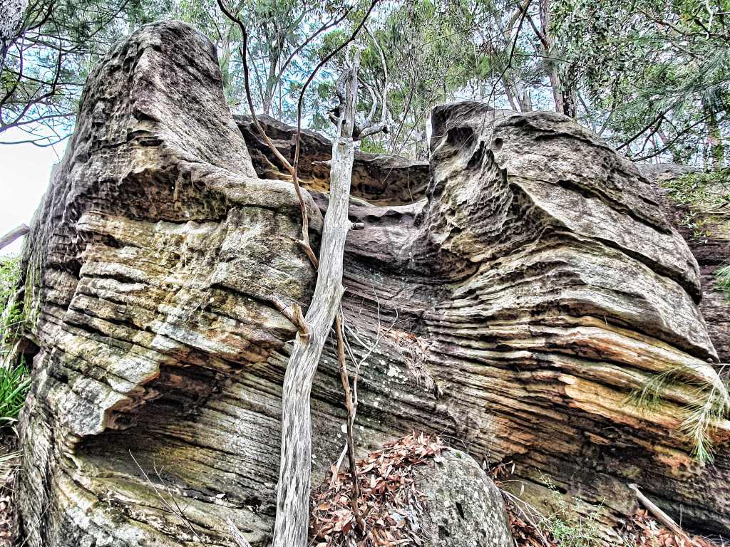
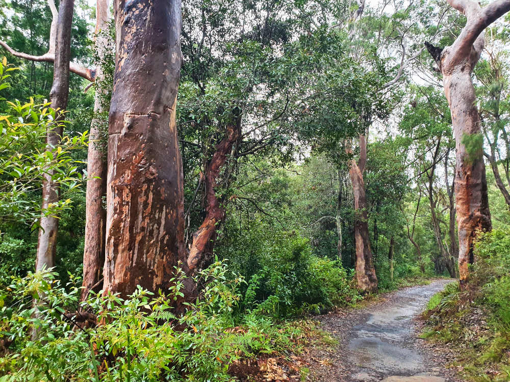
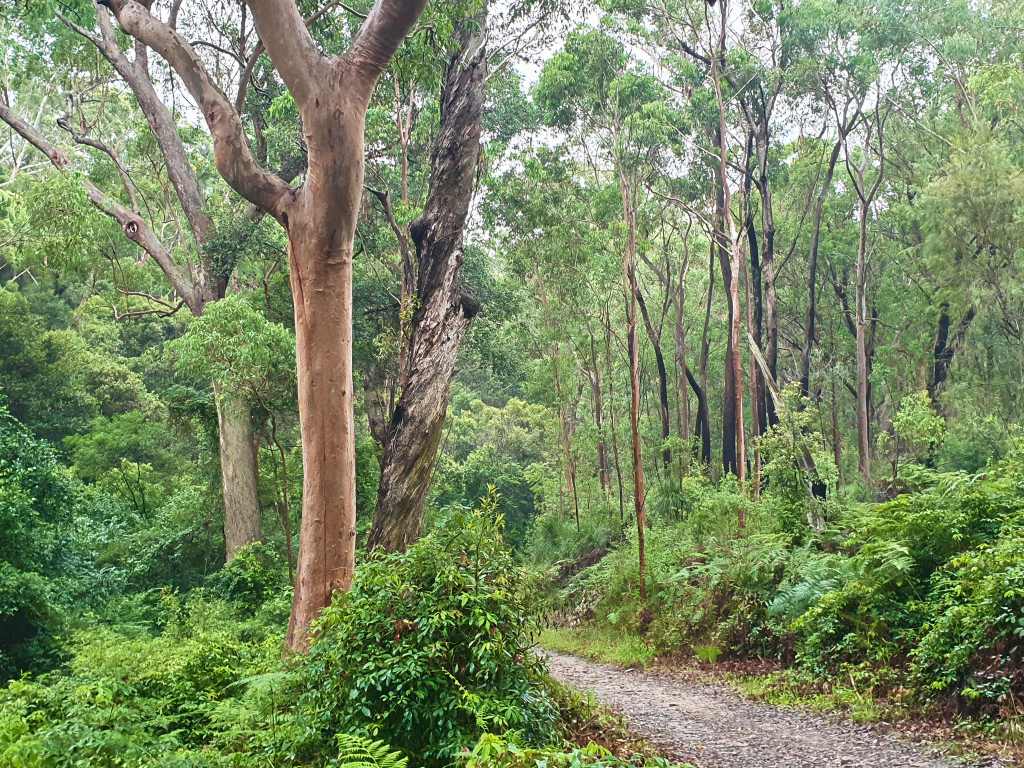
Just beyond the fence line of my house sit is virgin bush and the land falls away from a sandstone outcrop lined with intriguing patterns. On my first foray I find myself stumbling through where there are no tracks and the thought that these walls have probably never been photographed before spurs me on. I have no idea where I might come out, focusing instead on the image opportunities, and there are many.
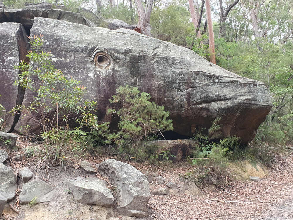
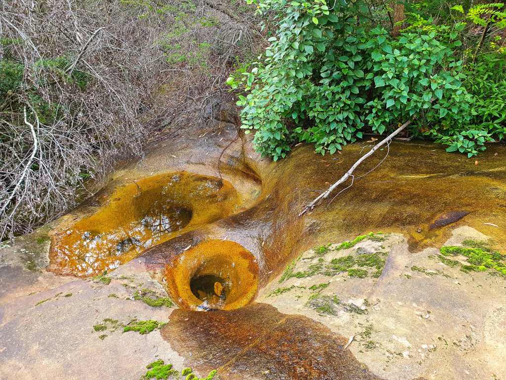
Eventually I stumble upon a rough track. It will lead me down to one of the main trails and, when I arrive, notice a map on the other side. It transpires that I was at one of the more famous landmarks, Whale Rock. I turned around and there it was, right beside where I came out. I’d walked straight past it. It’s quite extraordinary how the rare whorl formation that represents the eye is perfectly placed.
There’s another place not far away, Ducky’s Waterholes, and I decide to head off west and check it out. There’s no sign I can see so I bush bash down a slope to a promising looking waterhole and shoot that before calling it quits.
The next day I head the same way to the fire trail but turn right instead of left at Whale Rock. I’m a bit jealous as a few bike riders pass by, mine still not available for a couple of days yet, but it’s easier to forage down to Devlin’s Creek not having to worry about two wheels.
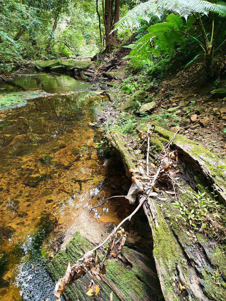
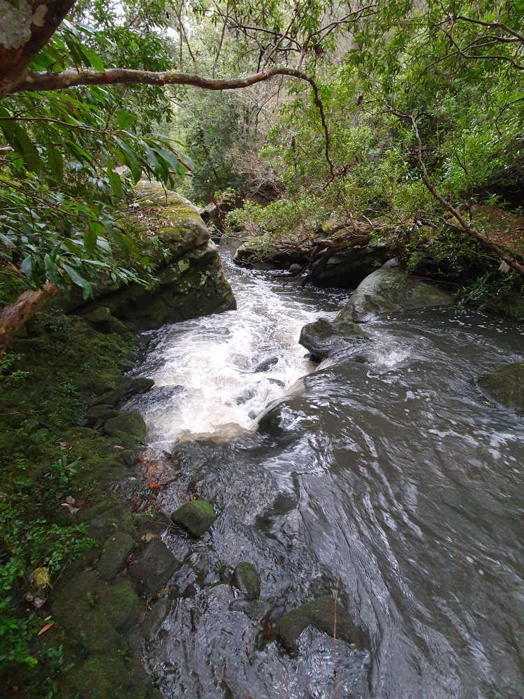
Though it’s barely fit to be called a creek, Devlin’s has some delightful waterholes that reflect the forest and some of the bizarre rock shapes on their banks. At the first ford I come to you can see some potential downstream but access appears impossible. I climb away and, from on high, it’s apparent there’s opportunities galore down there but I can’t see a way down.

I trek on and reach the Step Track, a 2km diversion “designed to help you enjoy our wildlife, morning, noon and night”. I divert and, not surprisingly, immediately find myself on the first of a couple of hundred steps. Apart from one or two sections, there’s little to get excited about until I reach the lookout, so called, but that’s even more disappointing. I stop on a boardwalk section and get a drink from small waterholes etched in the stone beside it. It’s ill-advised but I’m so thirsty by now. It tastes terrible but fills a hole. I head for home and await my bike in case there’s a reaction, but nothing happens.
Two days later I’ve discovered there may be a better way down, on a trail at the back of Ron Payne Park where I walk the dog. I’d asked a couple of people but no-one is sure just where it goes. The down slope turns out to be a bit of a nightmare if you’ve got a bike, it goes back and forth following faults in the sandstone ridge and jumping tree roots until you’re delivered at the bottom, walking your bike the whole way until it finally flattens out and intersects with the main fire trail.
At last I’m down and away, pushing on past the Step Track into new territory. Here Devlin’s has become the Lane Cove River. At last I can feel the wind on my face as I launch the Giant down a steep pinch across another ford. Other cyclists zip past at intervals, mostly on fitness levels notably above mine. I’m heading east and am surprised at how far I’d walked two days ago.
Aluminium trail maps are scattered along the route and I check one out because my goal is Browns Waterhole. However, it transpires that I’m already there. Frankly, there’s little to see here so I push on and it’s lucky I’ve got a granny gear because there’s a nasty pinch to climb, accompanied by huffing and puffing and then I reach a T-intersection where there’s serious road work going on so I decide that will suffice for the day.

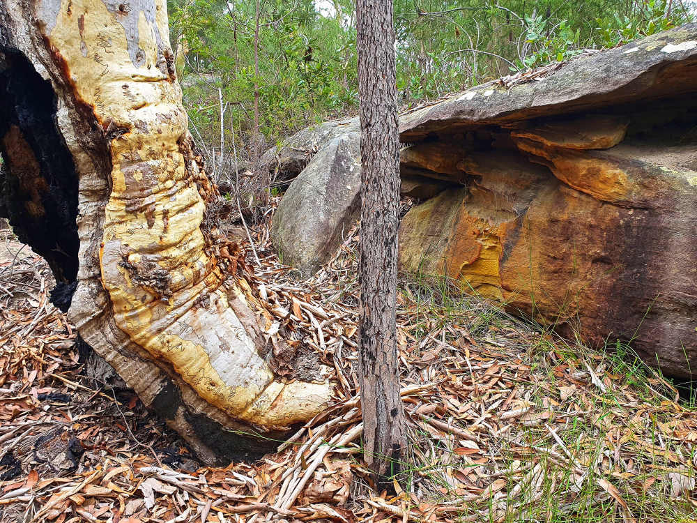
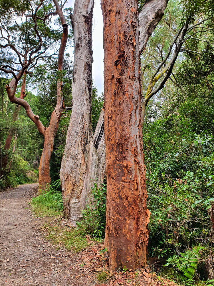
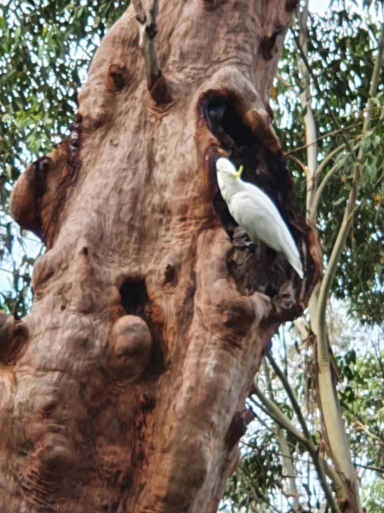
Scribbly gums and angophoras are the stand outs at trail’s side. Many of the older ones have been riven by lightning strikes where the current has found the internal moisture and followed it to the ground before exiting via an exposed root, wreaking havoc en route as the juices boiled, sometimes encasing the insects in resin. Where branches have broken off, leaving knots, the ensuing flames reach for oxygen, cooking any birdlife nesting places.
Some have survived, almost miraculously judging by the amount of damage done. The charred internal remnants are cloaked by new epicormic growth that sprouted from unseen surviving buds, almost obscuring the charcoal within.
There are no straight trunks; drought and poor soils see to that. Many are wrapped around sandstone outcrops, their roots hidden in small cracks as they search for elusive moisture.

When I get back to Browns Waterhole a woman who was there earlier remains. She’s fiddling around on the ground and she’s gathering rocks for some filter or other. I ask her to take my photo because there’s a “Great North Walk” sign. Though I’ll never do the whole walk I’m surprised at how many times on excursions I’ve been on the track over the years and envy those who have actually done the over 200 km hike.

Picture taken, I enquire about the Browns Waterhole Trail, on the other side of the crossing, which takes you to Boundary Road. I ask because it should be visible from where we are and I can’t see it. She offers to show me the way as she’s heading back home up that very trail. When we reach the start it’s no wonder I couldn’t see it. The entrance is narrow and obscured by vegetation. Again, there’s no hope of riding so I have to lug the bike up, as the lady does with hers when she’s not walking. We converse and she says she comes from Wisconsin and is doing a Phys Ed university course at Macquarie Uni. Her name is Jane and I’m careful to refrain about any crass “Tarzan” retorts, especially when she insists on helping me carry the bike up steep steps. I feel uncomfortable when I accept but have to concede it’s a relief. We bid farewell at the top and I actually know my way home from the exit, having researched before I left.
The second last day in the park I descend from the bowling club where I originally went down. It’s easier but there’s only a few places you can actually mount. I go in search of the ponds I thought I’d reached on day one.

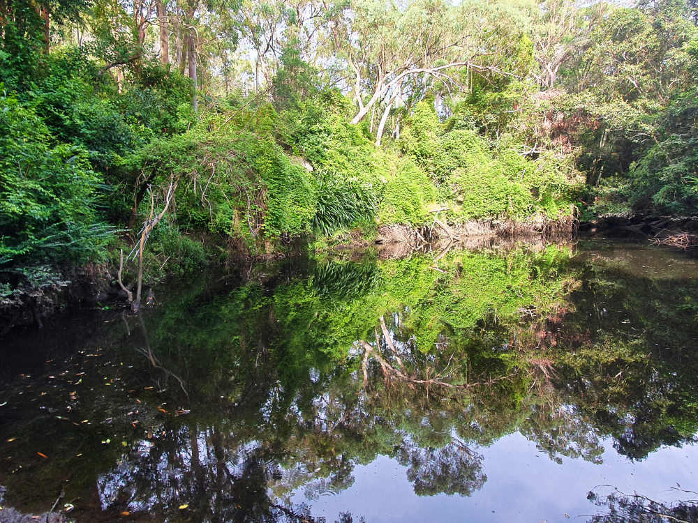
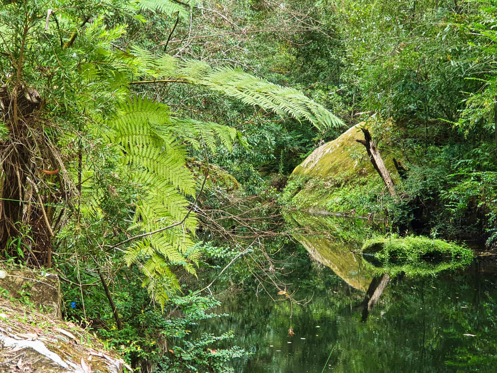
Gurgling waters are testimony that there’s moisture down there somewhere deep inside the scrub. Along the main route there are glimpses and, in time, I find a place to scramble down, vegetation clawing at my ankles and cobwebs at my face en route. It’s clear from glimpses that there’s a significant pond and I burst out beside an unruffled surface of reflective water and rattle off a record of it while a water dragon scurries by.
Then I head east again, trying to go further than I had previously. When I reach Browns Waterhole again I fall in with another cyclist called John and query him about what’s ahead and where there might be a café. He elaborates about all the possibilities and warns me that, on the ascent to West Pymble, there’s the worst hill anywhere, though he proffers that it’s probably because it’s his last climb before he gets home. However, as I follow his lead and we reach the mount, I have to agree with his initial assessment. The hill is a brute with four irrigation humps to further torment you. I pass John halfway up but, 2/3rds into the ascent I dismount, wheezing considerably as I do so. John is zig-zagging just to make headway and we go over the top not too far apart.
He gives me final directions as he peels off to his house and when I reach the small Phillip Mall shopping village I’m so pleased to be able to savour a large milkshake accompanied by apple tart and recover somewhat at the award winning Munch Deli Café.
I start back, reach the hill again and immediately grab a fistful of brake. One mistake here and you could do yourself serious injury.
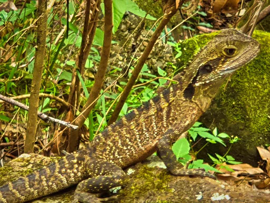
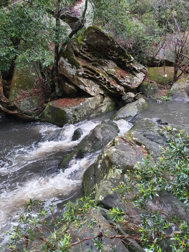
Eventually I come to the place I’d espied on my second outing that I thought inaccessible but today a descent seems possible. Grabbing a few tree trunks on the way down I’m quickly there, hardly disturbing a lizard who’s trusting its camouflage which allows me to get a close-up. I’ve found a bit of photography heaven and rattle off several before pondering whether or not to take a dip. It’s all too tempting with a backdrop of odd-shaped rocks and soon I’m in up to my neck and wondering just how pristine the water actually is. Best not to think too much about it.
Refreshed, I head for home, awaiting tomorrow’s forecast rain and wondering how it will affect this area. At Whale Rock I choose a different route. Though steep, it’s a proper road and so much easier than scrambling through the bush.
The showers commence that night and continue through to the morning when it becomes constant rain. I can’t stop thinking about what might be going on below. By the mid-afternoon it’s back to showers again and I take the dog out to see what the weather’s up to. While threatening, I decide to return the dog and take a chance. No sooner am I home than it starts raining again.
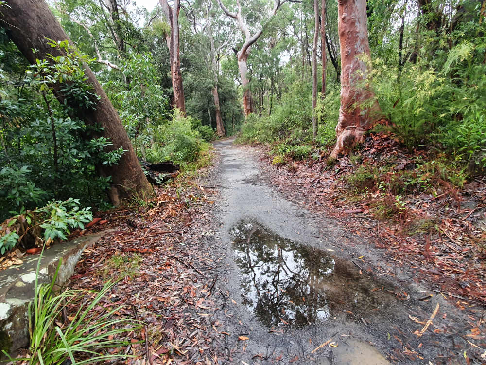
A half hour passes and I decide to give it a go. Now I’ve found the quick way down for bikes I extend my foray west. The trail is riddled with puddles and one or two minor washaways but the light is perfect for photography. The trail splits in two and I look down to a crossing. Amazingly, a fitness freak is wading through it. At thigh level it’s getting close to dangerous whereas yesterday there would barely have been a trickle there.

I reverse and ride to where the rocky pool is. It’s the next ford and I decide to give it a go. My shoes are submerged but it’s only a short breach and then it’s up to the ledge where I’d descended previously. Below is so different. The water is rushing over the substantial rock barrier upstream whereas yesterday it was weaving its way out of sight. There are no reflective pools and the colour has changed. There will be no swimming today.
Water rushes past and flushes debris downstream. It’s interesting to watch but the light is fading and it’s time to head back for the last time. As I cross the ford I get drenched as water hits my leg and splashes up all over me. I figure it’s been a small price to pay to get the shots I’ve acquired and return to North Epping totally satisfied, climbing out of the gorge for the last time. It’s been a real eye opener and left me wanting to see more, closer to Lane Cove. Hopefully on my next sit in Sydney.
