There was no-one. In fact, the previous time I’d camped overnight and left early, the golden hour in fact. The light was exquisite, the temperature cool, the trail enticing and I was alone; but that was decades ago.
Near the start
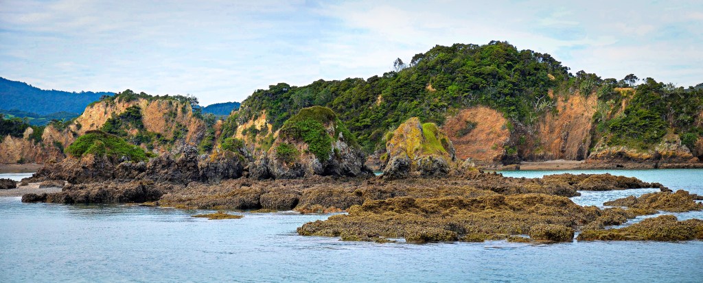
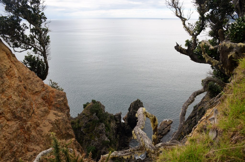
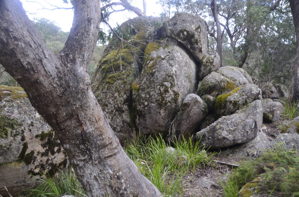
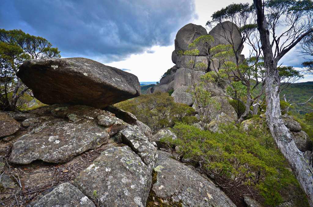
The ragged rock faces, weathered over millennia, seemed not to have changed as I got into my stride, though these day it’s more of a shuffle. Somehow, being alone with nature enhances the senses.
The low angled winter light filtered through branches warped from a harsh climate. Ever seeking the sun they’d probed higher, in places surmounting the shade of the rocks, casting their branches skyward.
There were places that bespoke of the origins of the sandstone; tubes that had once housed worms in a sea were present in places though they seemed out of place this far from today’s oceans.
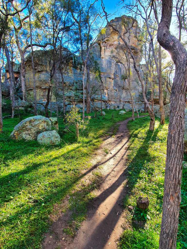
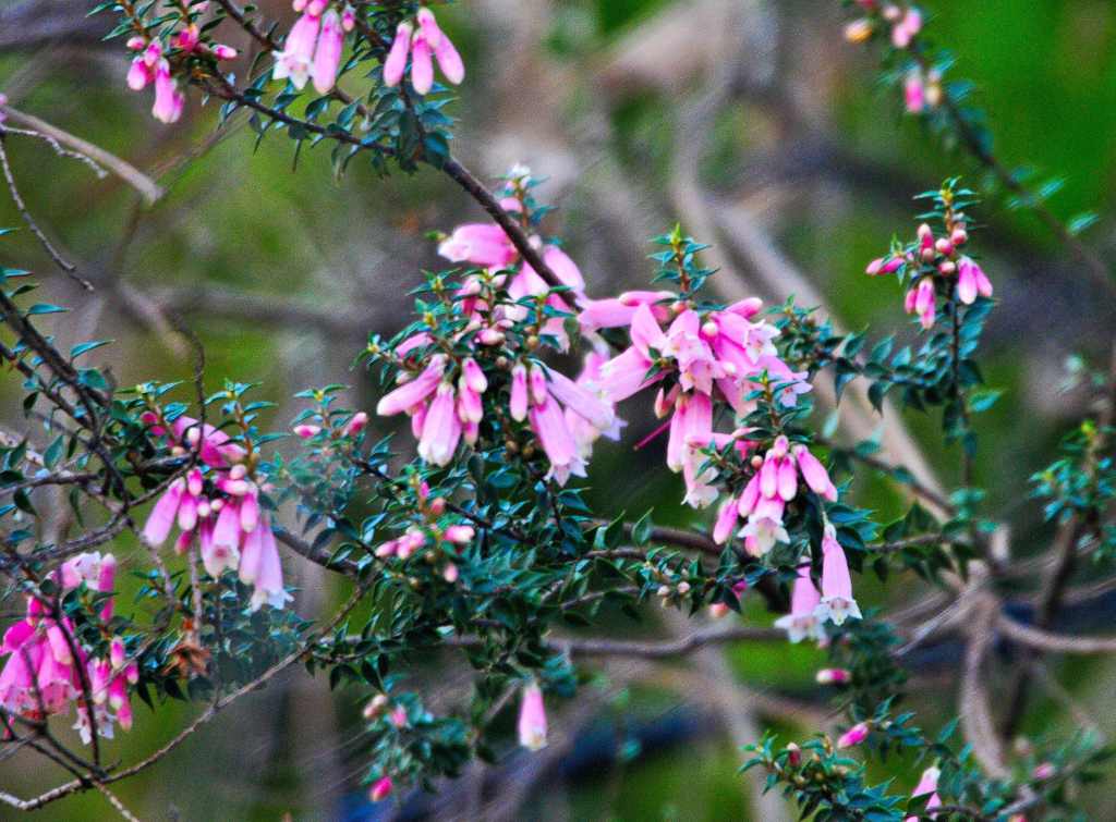
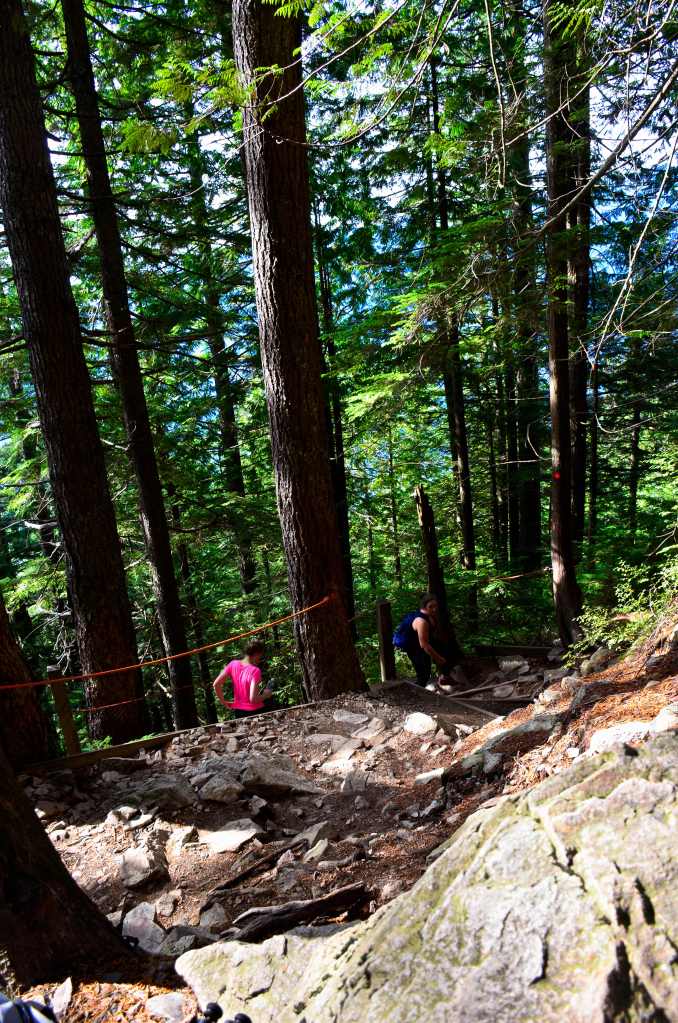
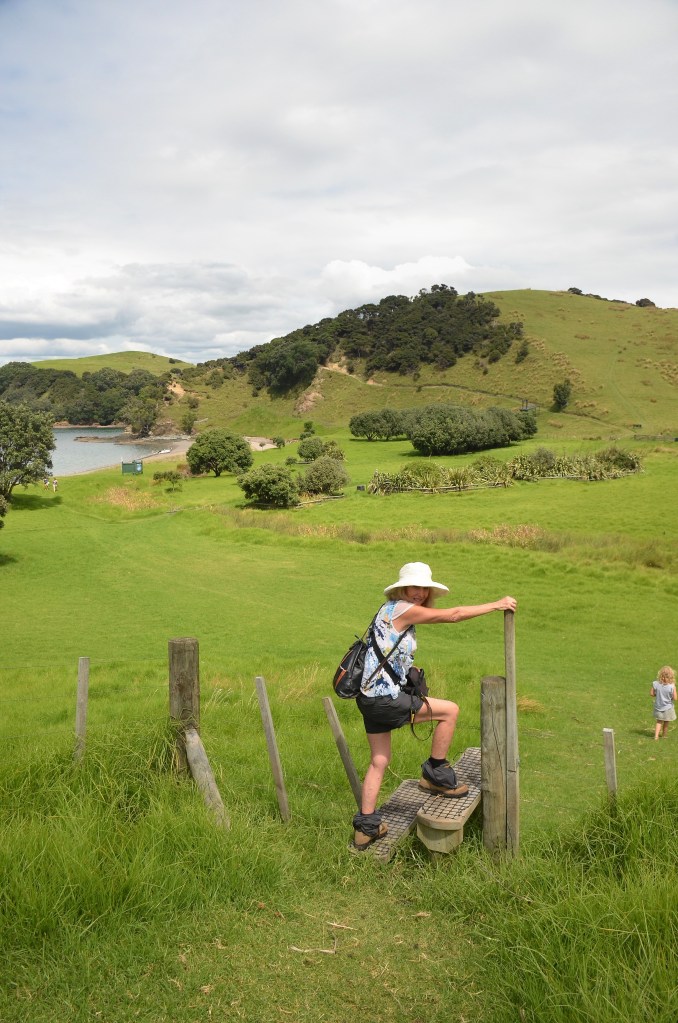
My work boots left prints in the soft sandy track while the numerous birds serenaded my progress. Pink Erica dotted the sidelines as I reached the first drip. Somewhere above a tiny amount of water eked its way through the subsoil and fell over the edge, drop by drop. Behind me the ripply bits of the crystal clear stream created an audible sound that somehow blended in.
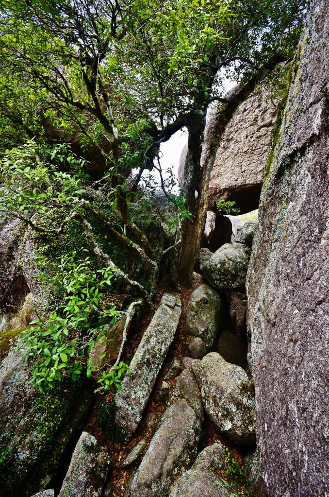
The concrete steps are an addition since I was here last. The brief ups and downs of the trail made easier by their presence but whoever thought they’d stay put on the soft sandy bottom where they cross a small stream obviously hadn’t quite thought it out. Now warning signs were about the danger of uneven footing.
The dodgy crossing
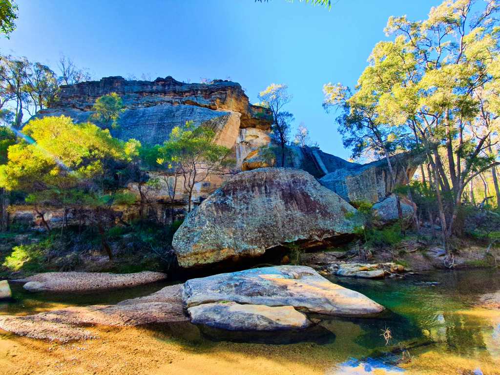
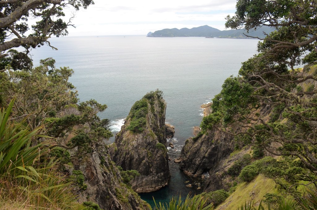
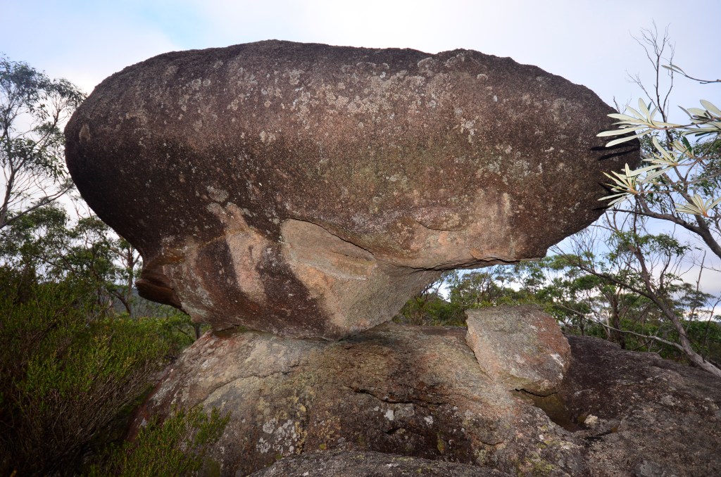
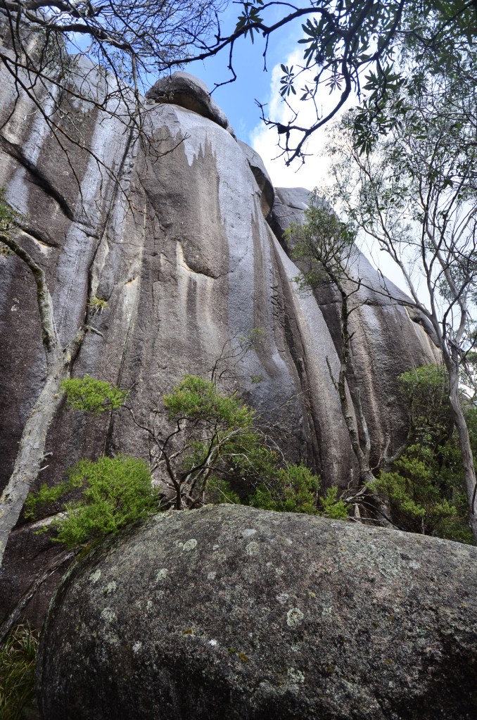
The shapes lent themselves to all sorts of inspiration for the camera. One feels quite blissful in the surrounds and then, just over a kilometre in, the way splits into two, 20 metres to the lookout, 30 metres to The Drip, for that is the name of this attraction, though it’s not unique, you can view similar in the Blue Mountains, but not the same.
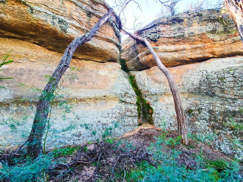
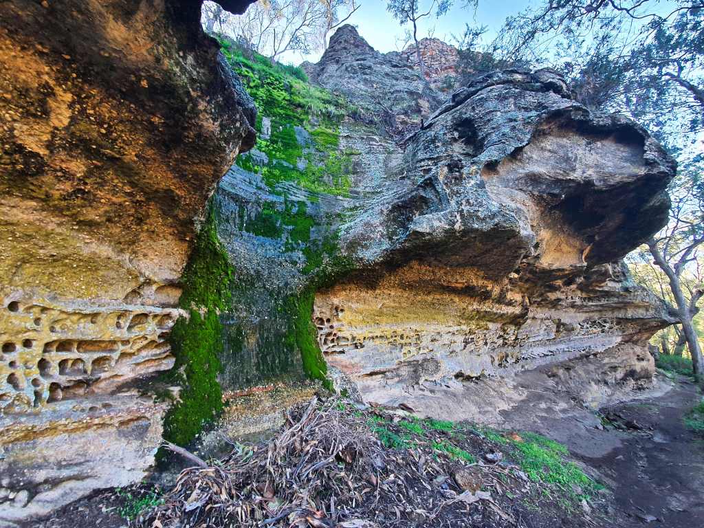
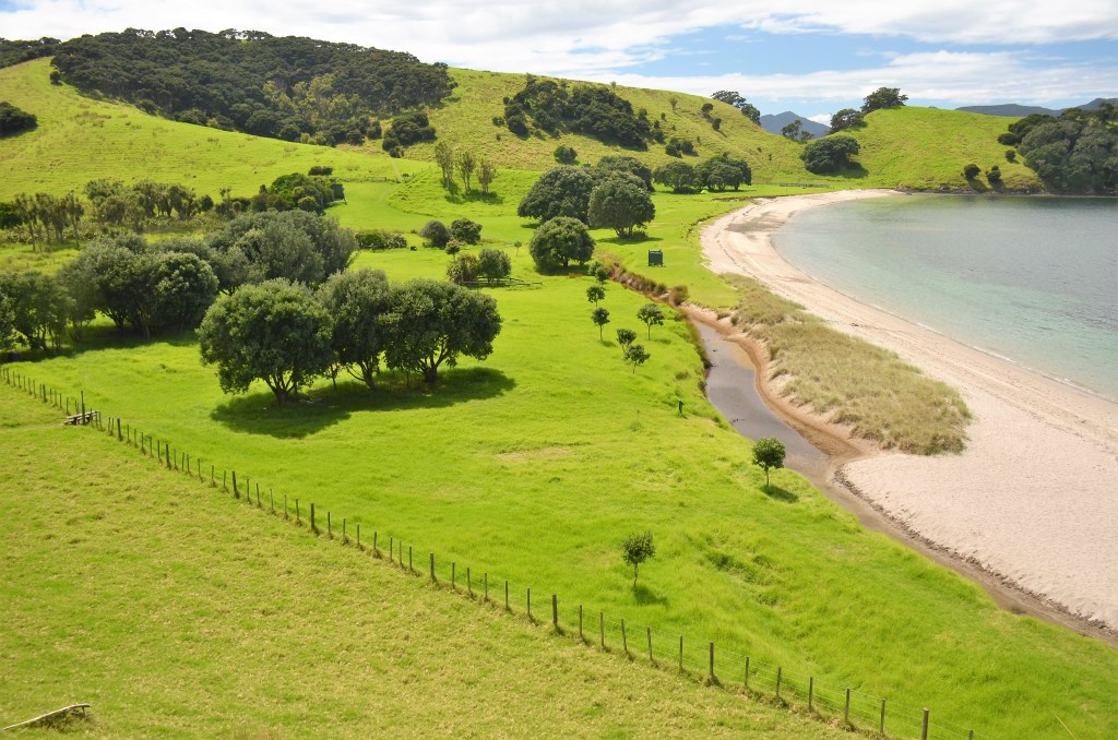
It’s a long and towering sandstone wall and, in a pronounced horizontal layer about the middle, there’s flourishing green tussocks of leafy twig-rush and a modicum of moss that contrast readily with the coarse surrounds. It’s here that the stream changes its course slightly and undercuts the bastion before sweeping away towards the coast.
The Drip
Sated at having viewed it once again years later, I turned and headed back, meeting group after group on the return. I hadn’t been alone after all and counted eleven vehicles and two laden push bikes back at the carpark. Having conversed with most I was mildly surprised to learn that it was the first time they’d been here. I hope they enjoyed it as much as I had.
Sintra; I’d done the research and it all came up with positives so we got directions from our host in Lisbon and headed off, Entre Campo our initial destination. This is one of the stations en route to Sintra and was the beginning of a journey that really opened our eyes. At least here they had a ticketing system and we boarded our train and set off through the suburbs of Lisbon.
Oh, what a reality check that turned out to be. For mile after mile it was so reminiscent of the housing blocks in Eastern Europe decades ago. Tall high rise apartments with intermittent items of clothing strung out on makeshift lines and why all the paint used in endless graffiti couldn’t be better utilized making the housing look better I don’t know. Lorraine remarked that “graffiti reflects the wellness of society”.
There were unpleasant odours to be had in many areas, the train being one of them. Some cheap chemical had been used to partly, but not entirely, remove the offensive aroma. Flaky or non-existent paint seemed the norm in some suburbs and all this was such a contrast to a man on the train with a small stylish personal mirror who spent the entire time of his journey picking hairs out of his face one by one with a pair of tweezers.
We hoped for better when we finally arrived at Sintra and joined a queue for the bus. At least here we could buy tickets for the bus before we boarded…….or so we thought. No, what we had actually bought were two tickets to the attractions, which didn’t include the bus fares. We had to buy them off the driver and, of course, you couldn’t buy them until the bus arrived.
PERHAPS WE’D HAVE BEEN BETTER CATCHING A HORSE AND CART?
We didn’t know it at the time but the buses are scheduled to run every 20 minutes. When we were waiting two arrived simultaneously. Later on while eating we noticed that three arrived with 30 seconds of each other and then a gap of nearly an hour before another turned up by which time more than a busload had accrued at each stop.
THE JOYS OF ALLEY SHOPPING IN SINTRA
We bail out at the village centre and go for a walk up the steep streets lined with shops clearly geared to the tourist market and nothing else. The cobbles and narrowness are accented dramatically when a car tries to drive along one, scattering people every which way. Some cars end up having to stop right where they are and later reverse out, something fraught with difficulties we Aussie drivers could only have nightmares about.
THE REALITIES OF SHOPPING IN SINTRA
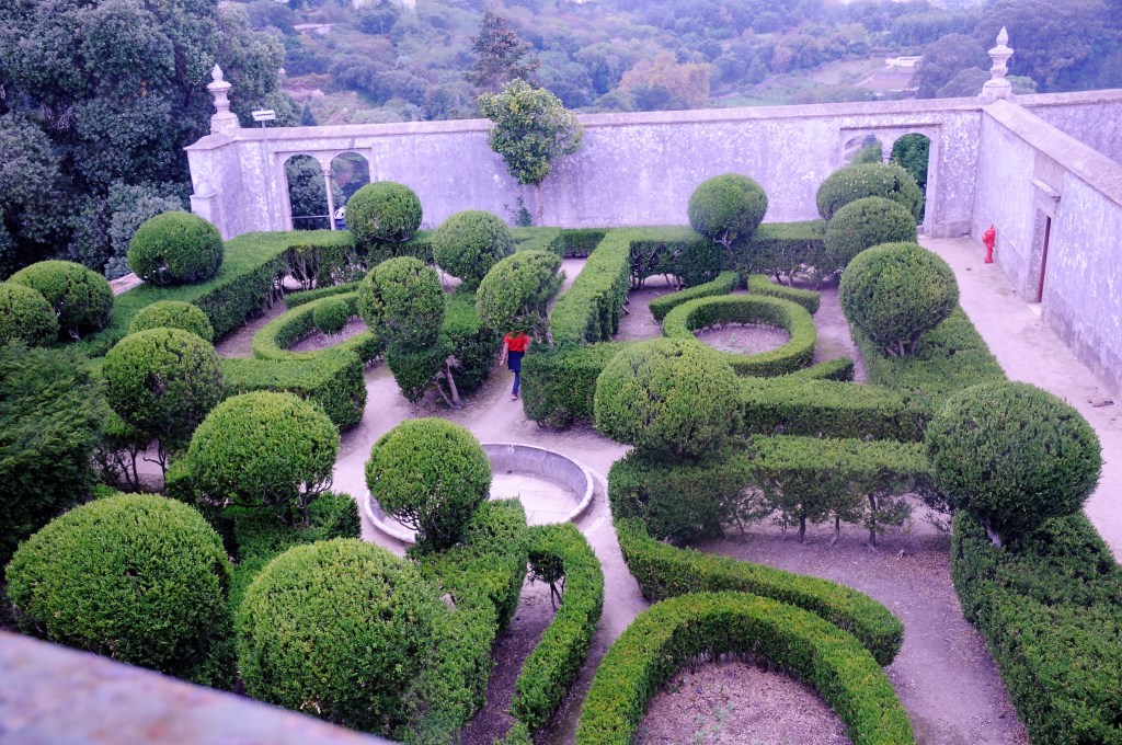
Our first viewing was at the National Palace with its Gaudi-esque sculptures attached to the outside walls. However, if there is one piece of architecture in this building you can’t avoid seeing it’s the massive chimneys at one end and we’re curious to know just where they are in the structure of things. Meanwhile, despite pre-paying for our tickets, we still have to queue but it’s not that long and soon we’re in an edifice that was used extensively by the nobility between the 15th and 19th centuries.
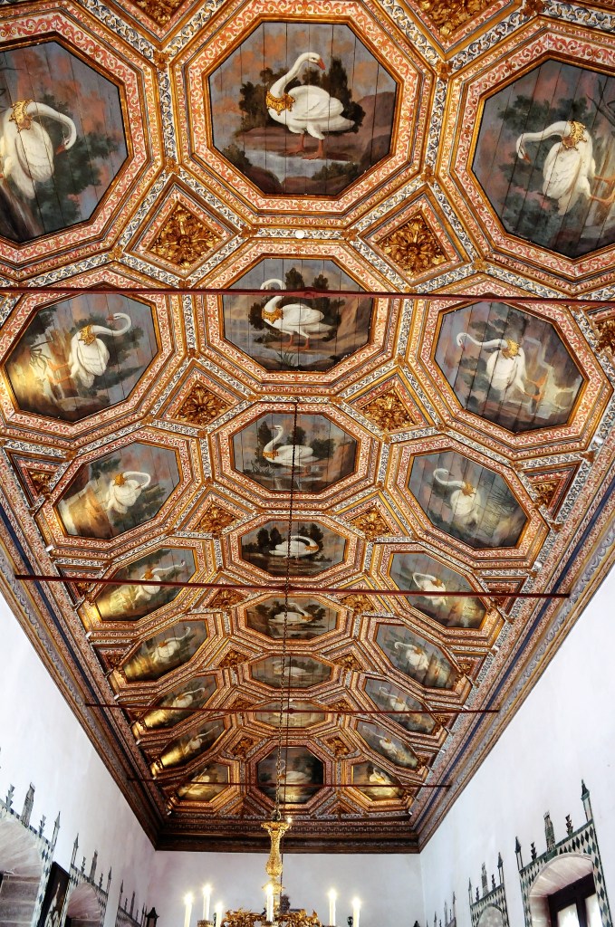
CAN’T THINK WHY THEY CALL IT THE HALL OF SWANS
As you enter the hall of the swans, so named because on the ceiling are more than 20 paintings of swans set inside ornate octagonal painted frames, you’re aware that it’s something special. It’s an impressive opening to what started out as a Moorish palace in the 11th century and was adapted to Portuguese tastes after they conquered the Moors. It still retains much of the original design, particularly notable in the garden layout, surmounted arches and glazed tiles. The paintings, tapestries and ornate writing desks with multi rows of drawers so obviously belong to later periods.
The other notable thing is the crowd; they compare to my recent visits to the British Museum and National Gallery as we constantly try to move between tour groups from the buses, but there are many of them. It’s a multi-level dwelling and it’s hard to work out what rooms are what but the one place that leaves no doubt is the kitchen with its massive chimneys. We’ve never seen anything quite like them and the spacious area around the preparation tables makes it obvious that many people worked here and numerous were the dishes that left these walls.
THE EXTRAORDINARY CHIMNEYS
We’re getting hungry ourselves and repair to the Café Paris across the road. Here we want to sit outside and watch the world go by but it’s fairly crowded so we somewhat reluctantly head indoors and see what an error everyone has made by not going indoors. Here the décor is very tasteful, white tablecloths, chandeliers, ¾ length mirrors and painted cornices all add to a special aura while we sit right beside a window with full view over the street but without the noise.
HARD NOT TO LIKE DINING AT CAFE DE PARIS
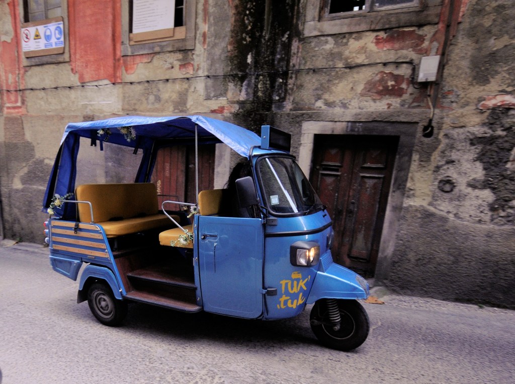
It’s so touristy outside it’s almost nauseous and I’m taken by the assorted motorized vehicles that people have salvaged in order to attract tourists to ride in them. There’s a Citroen 2CV with a sun roof and Rossi’s racing number (46) and name emblazoned on the door; an ancient Renault ute; an UMM 4WD (something I didn’t know existed) floats by, it’s a discontinued line of Portuguese vehicles and there’s a dune buggy, a ubiquitous Tuk-tuk and who knows what else; all calculated to successfully suck in the tourist wanting that little bit more from their experience.
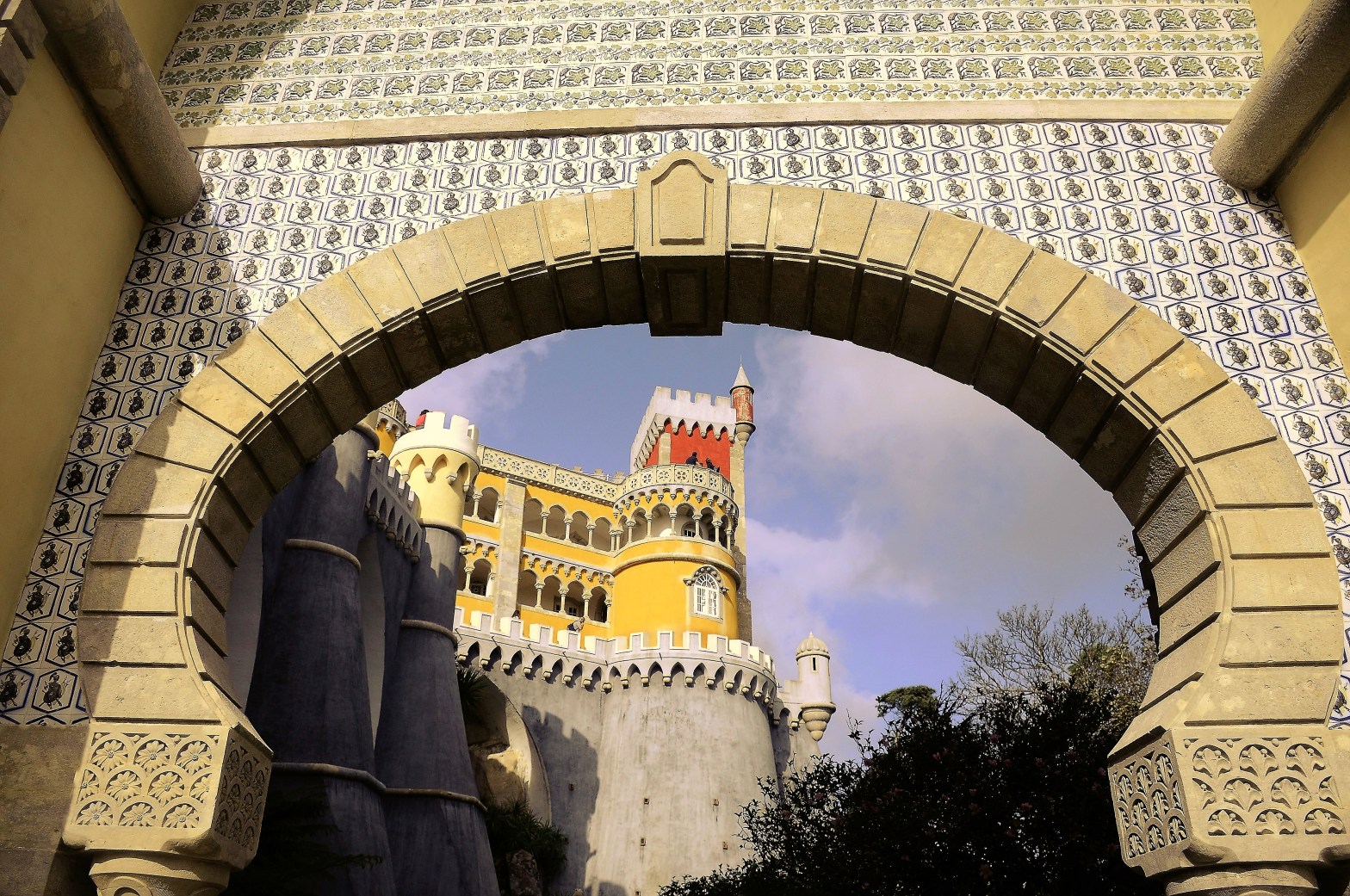
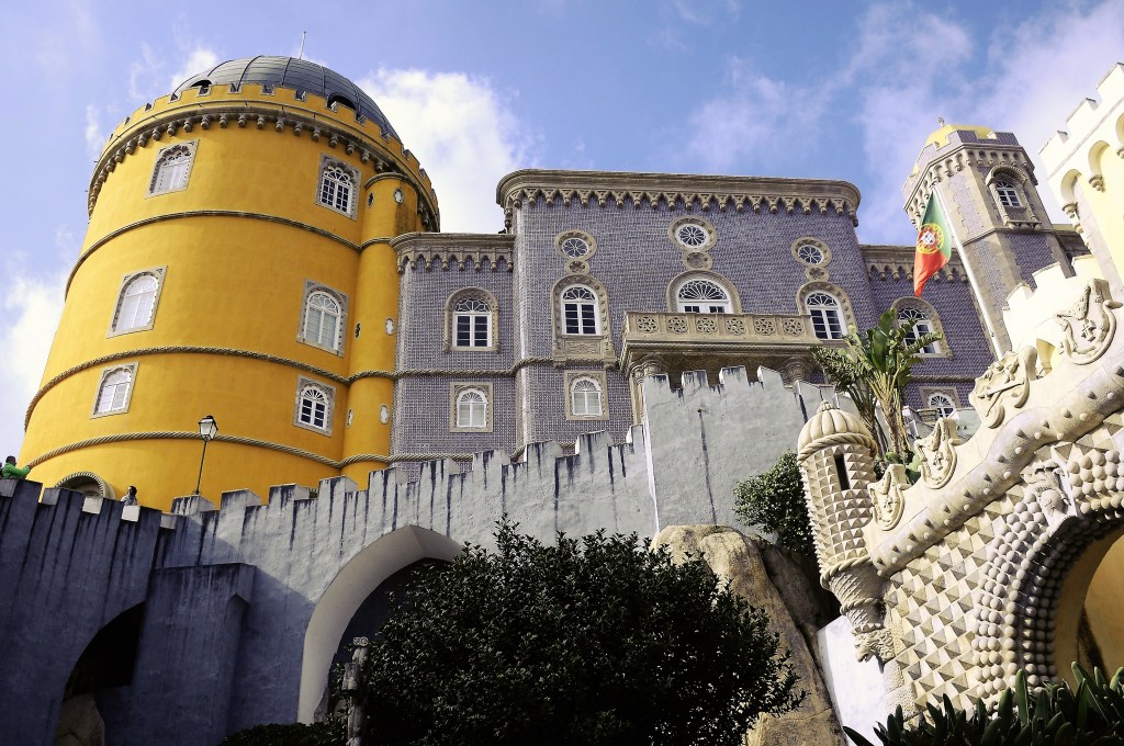
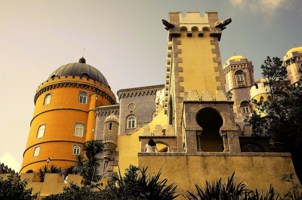
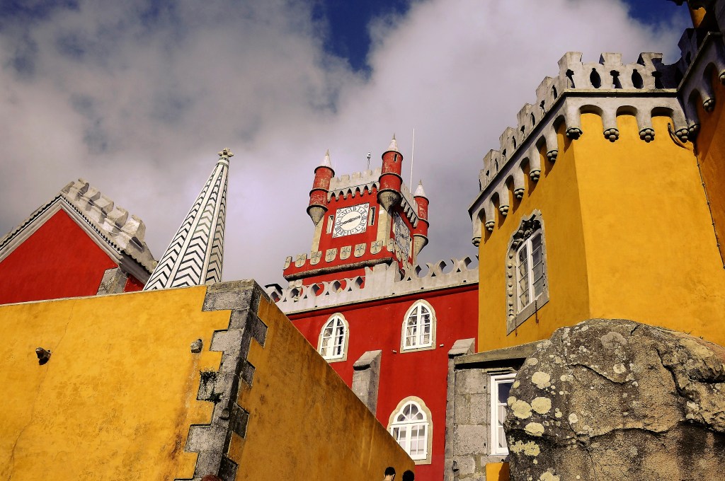
We go out to catch our hop-on, hop-off bus and wait for ages before one arrives and we finally climb the slopes to Pena Palace, which means “feather place”. The variety of architectural styles should offend the eye but somehow it all works, as do the seemingly garish combination of colours, from Tuscany red and yellow to sombre blue to grey and lemon beige, it all blends in somehow and leads you into a magical mystery tour of one of the world’s great castles, albeit built upon an older chapel site created from where King Manuel I purportedly saw Vasco da Gama’s fleet returning up the Tagus River.
THE VARIANCE IN STYLES IS UNMATCHED IN ANY OTHER PALACE
It is to Ferdinand II, consort to Maria II and later king when their first son was born, that we owe this building, as much asGerman architect Baron Wilhelm Ludwig von Eschwege. It was started in 1840 but wasn’t finished until 1885, the year the artistic Ferdinand died. Just four years later it was purchased by the State, fell into disrepair after the 1910 revolution but has since been fully restored to the wonder it once was.
HARD TO TELL THE FRONT FROM THE BACK
Gothic, Manueline, Renaissance and a lot of Mudejar style can all be noted in this unforgettable building that climbs over exposed rocks and has panoramic views from all the battlements and castellated walkways that jut out in every direction.
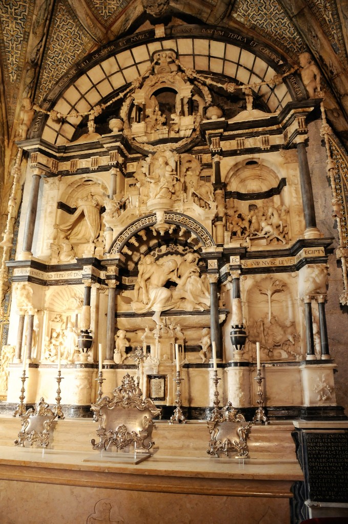
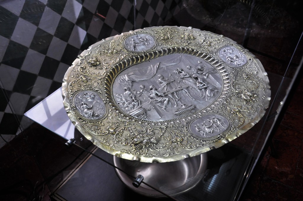
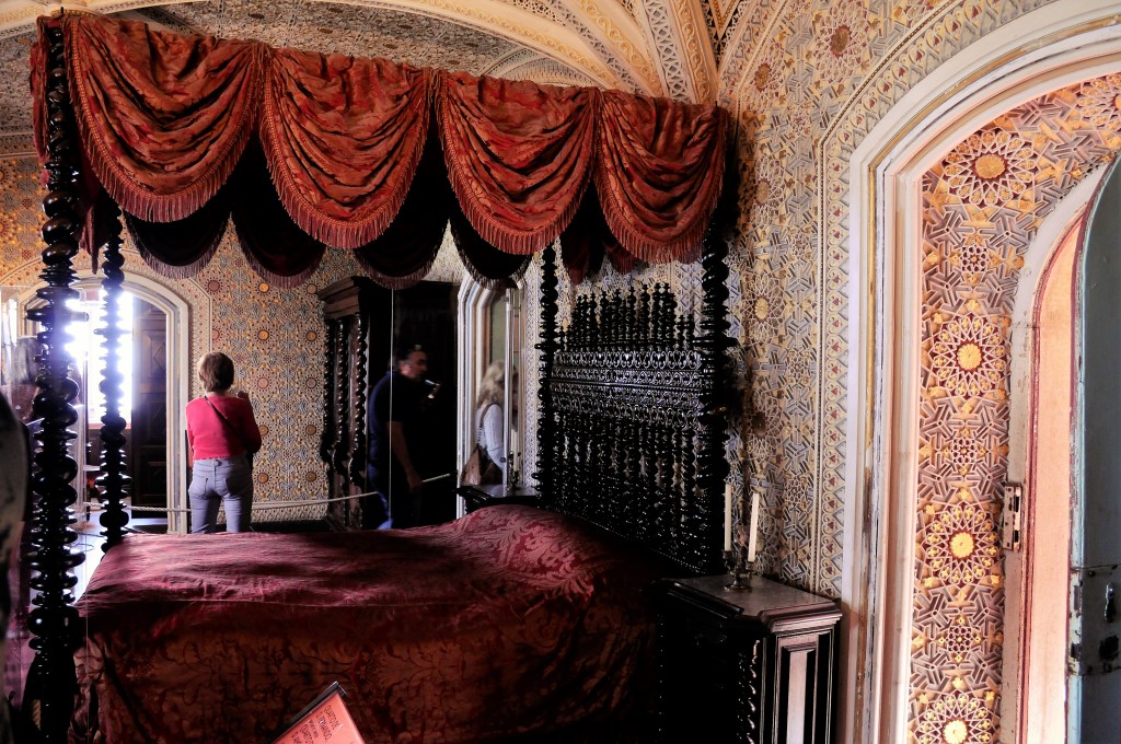
Inside is just as convoluted with a variety of styling. I’m taken by the 16th C alabaster and black limestone French altar that is left over from the monastic period, unlike any of the genre that I’ve seen before and there’s a Julius Caesar room with a 16th C Flemish tapestry of the Roman ruler himself that hangs from floor to ceiling.
SOME OF THE PIECES ARE EXTRAORDINARY
However, there’s a lot more to see within, so why don’t you drop in and have a look.
I can still conjure up, without any effort, my mother expressing the view that she’d like to retire in Bundanoon. She’d extol its virtues and beauty but it was never going to happen. Even I knew that growing up. We never even went to Bundanoon as a family, but the name echoed in my brain through the years as she was dying from all manner of ailments and when she passed away; who remembers the day, certainly not me because I’m not good at such things, but I can vividly recall numerous visits to her in various institutions in her decline and the day I cast her ashes into Lake Macquarie at Rathmines and into an onshore wind which blew some of them back over me and incited all manner of thoughts, particularly the one wondering if she was still trying to tell me something.
As I was trying to say, one of the things I did recall was Bundanoon, and it’s never left me. Thus it was, when I purchased my motorhome, one of the places that flitted now and then in my brain was Bundanoon, until I finally made the journey south from Lake Macquarie with my mother in mind, if not in reality.
As I neared the area there was a large branch hanging off a pine tree right in my path as I rounded a curve. I started to swerve to the other side of the road but a milk truck was coming the other way so I slammed right into the branch as the better alternative, cracking the upper front curved portion of the cabin. It was a disappointing start to the adventure. Was my mother still trying to send messages?
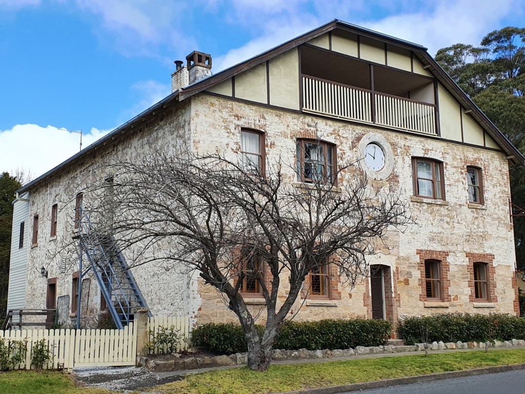
THE GASTOF-STYLE PILL FACTORY FROM THE 19TH C IS NOW ACCOMMODATION
Bundanoon turned out to be a really enticing place for me. Dated buildings scattered everywhere and a real mountain feel, i.e., cold, quirky people, unique gardens and atmospheric cafes dotted along the main street. The only problem is, the railway goes right through the centre of town and the constant stream of freight trains does add to the noise content considerably at night.
It has also achieved fame beyond its size. It is the first town to ban bottled water! HOORAY I say. I still haven’t come to terms with what’s wrong with the water that comes out of our taps, except during bushfire situations of course. Bundanoon banned it over a decade ago and the village is still intact; amazing, didn’t hurt at all.
It also happens to be right on the doorstep of one of N.S.W.’s largest national parks, Morton. To those who live outside the area it’s not what you’d term “well known” but it does have some notable areas although I prefer those nearer the coast where the rainfall is more plentiful.
Still, after realising Bungendore, which has a fabulous art gallery, wasn’t where I was aiming and arriving at Bundanoon when I really meant to be at Bungonia, I decided to spend the night. Getting there in the dark I pulled over at the large information board and thought, “This will be a nice spot to camp”, but soon after was on my way when the first freight train roared past.
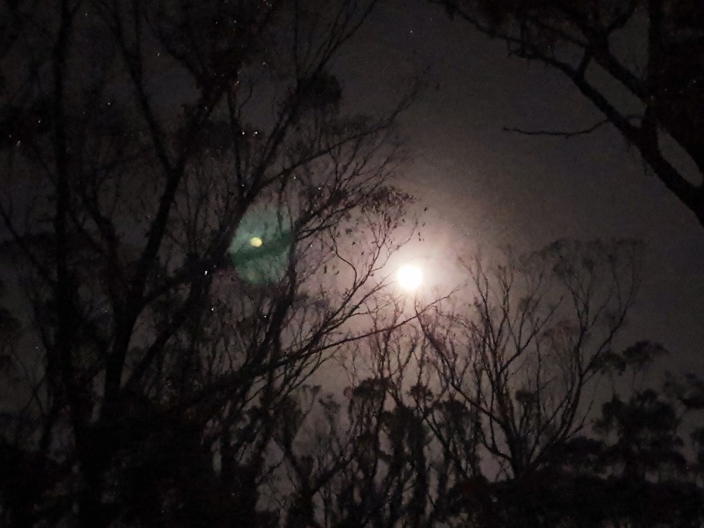
I found a spot not 100 metres from Morton NP entrance where others had obviously stayed and pulled up there. The quiet was beguiling. The moon highlighting the already charcoal black trees was mystic…..except it was freezing. Welcome to the Southern Highlands some remarked the next day when I dared speak about the cold.
Next morning I drove into the park. During the pandemic they’ve had some time to get the roads up to scratch but not to repair all the walks. That will take time and more money. My normally mundane trip to their toilet became excitement central when I spied a male lyrebird. Though not fully displaying his tail at least it was better than the somewhat drab females.
I’d really forgotten most of the walks I’d done here so reconnoitred the area and checked out the maps displayed. All this led me to the fact that the walk I really wanted to go on was “Closed”. Still, as I’ve said in the past, it’s only a sign so, after checking out the lookouts I pencilled Fern Gully in for the afternoon.
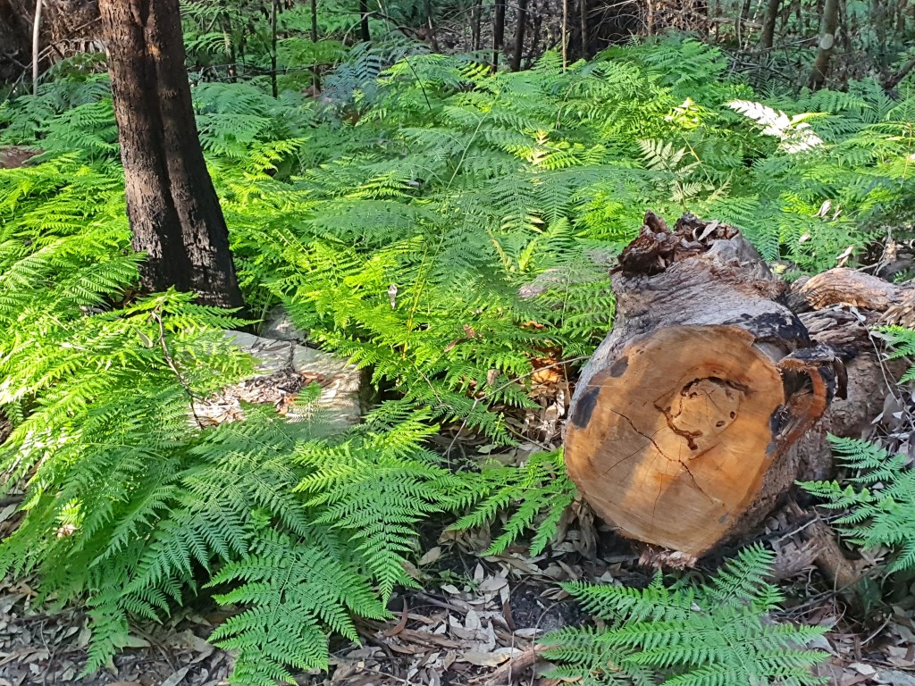
Further down I arrived at the start of the walk. Fern Gully, an aptly named section, was about all I was going to get to. It’s one of the “must-do’s” here. A lone female runner, ears embedded with plugs, jogged by just as I was pulling up. I wasn’t alone after all.
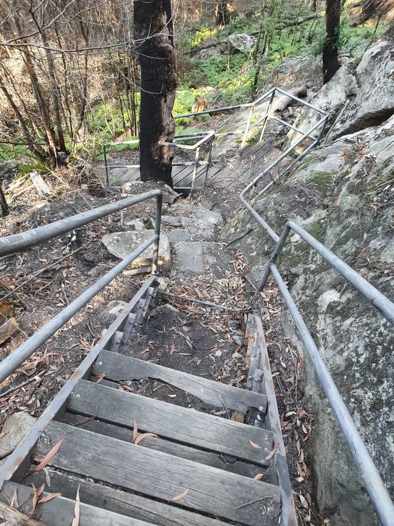
Down the rutted and rocky trail I went. It’s only 500 metres but, halfway down, there’s a set of stairs, with the third lot of warnings and barriers I’d come across. It was here that some damage was evident, with 4 ½ steps missing from a made wooden staircase.
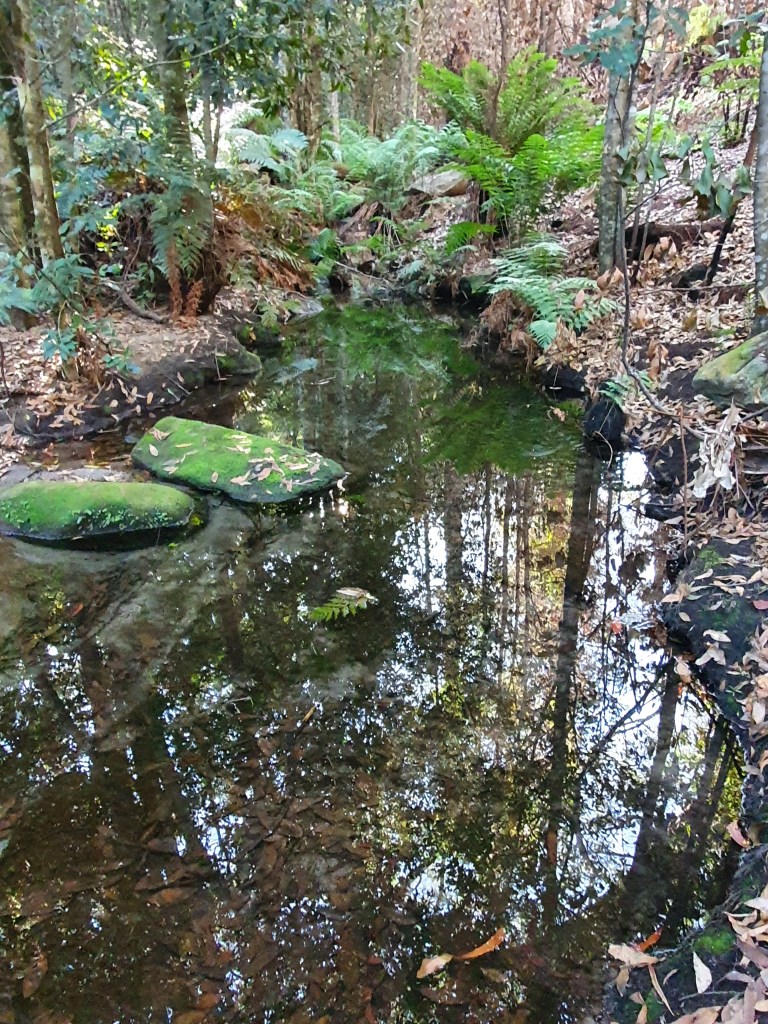
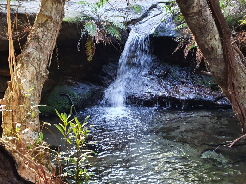
I scrambled down, the sound of water gurgling on sandstone as a magnet. Through the ferns I strolled, shrouded by the tranquility of the bush, until I reached the point where the stream disappeared over the edge. There are times when I’ll try to get closer to get a shot, today wasn’t one of them.
I felt privileged just to have been there and turned around to climb back out again. Bundanoon had me for a couple of freezing days, but I wouldn’t forget it for the right reasons.
The girl looked, no, winced at me. As her eyelids thereafter rose I enquired about the lift ticket. It was around $50 AUS including tax.
My original intention was to mix it with the birds and the bees. The wonderful (as per their advertising) bird show had, however, closed for the season….as had the bees and the butterflies’ pavilion.
I pointed pleadingly outside to the glorious sunshine and almost cloudless sky. Surely the birds and the bees would be loving it? Apparently not, so I’d come around to the cable car option but, after the price had been uttered, plan B emerged. I’d heard of the Grouse Grind and, my mind kept saying, “You can do it” and so I asked the girl, who was from Sydney, and she sympathetically replied that it would take 1-1 ½ hours (insert wince where appropriate). I then budgeted for 2 ½ and set off.
AN UNABASHED WELCOMING PARTY
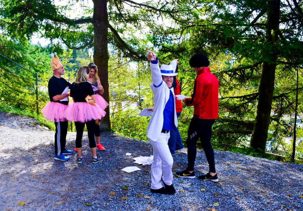
I walked outside and a kindly lady walked me back through the carpark to the start and off I went….to be greeted by strange people, in pixie uniforms and such, dancing around on the start of the trail. Tutus apparently were de rigueur for the day, I felt embarrassed I’d left mine at home……not. It was something to do with their office but I didn’t really want to know.
The path takes only one direction – UP. The only variance is degrees of up. It ascended at a steady rate, not one that you could comfortably push yourself on, especially if you were carrying camera gear and a tripod. In hindsight I should have left my 5kg of it at the base.
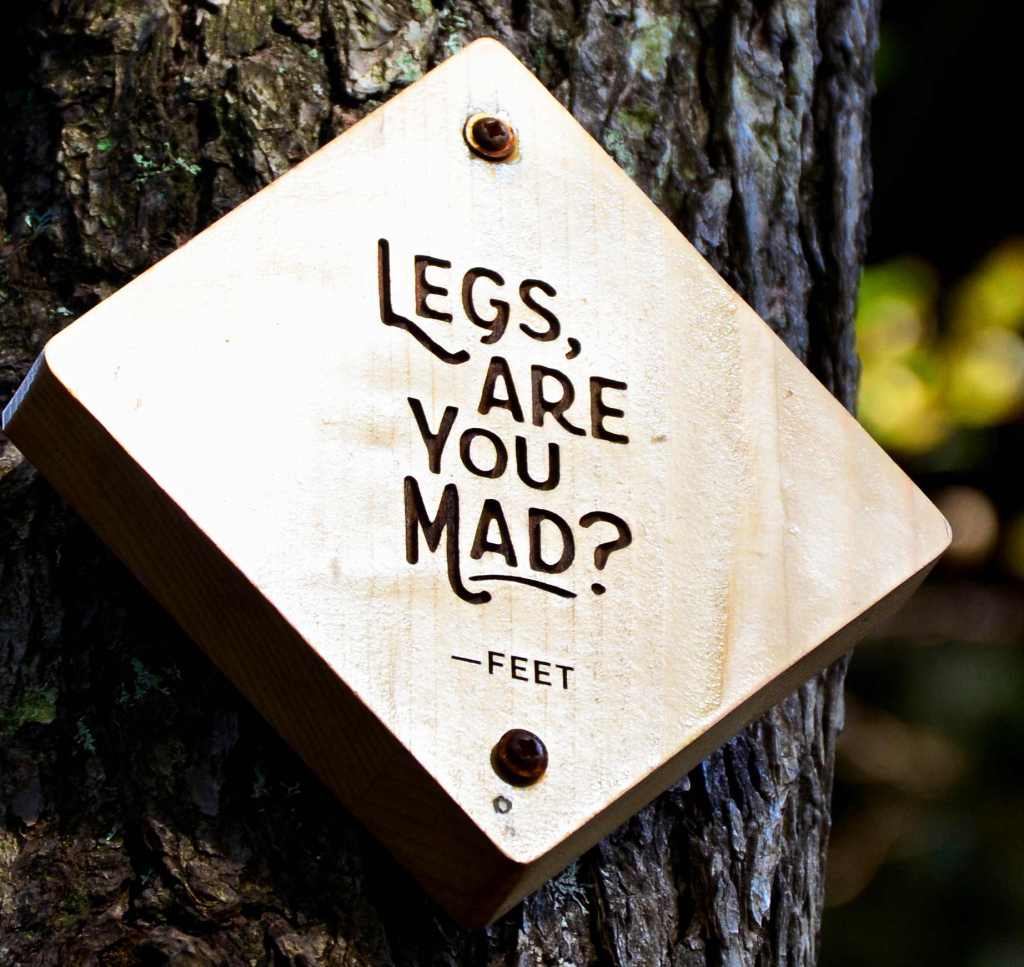
You may twist and turn on this trail but, believe me, there is only one direction that you’ll ever remember, and that direction is UP. There are little markers, 1 of 40, then 2 of 40 etc., and they, as best as I can figure, are vertical indicators. In addition, there are humorous boards that someone with a lovely sense of the absurd has posted. There was one more sign, it read “Living in the moment could be the meaning of life”. I would have cause to reflect on that later. Another said, “We’re smiling right now – Lungs”.
DOES THE WORD “RUGGED” MEAN ANYTHING TO YOU?
I plunged on, the track often had smooth slippery rock steps cambered downwards and prominent “DANGER” signs were plastered here and there. The main problem was that it was uneven, making your leg muscles work overtime.
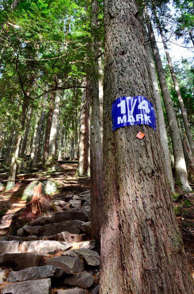
Around 16 of 40 the ¼ WAY sign loomed up. 5 different groups had passed me earlier, now it was my turn. Moving slowly and methodically carrying all my unwanted camera gear, I kept up a pace I had taught myself in the German Alps. Slowly enough so you don’t have to stop so much and your body can keep up with your mind.
I inched by five groups of climbers by the time I was 1/3 distance but the track was deteriorating. Mostly there were no made steps, just clambering up uneven rock after uneven rock.
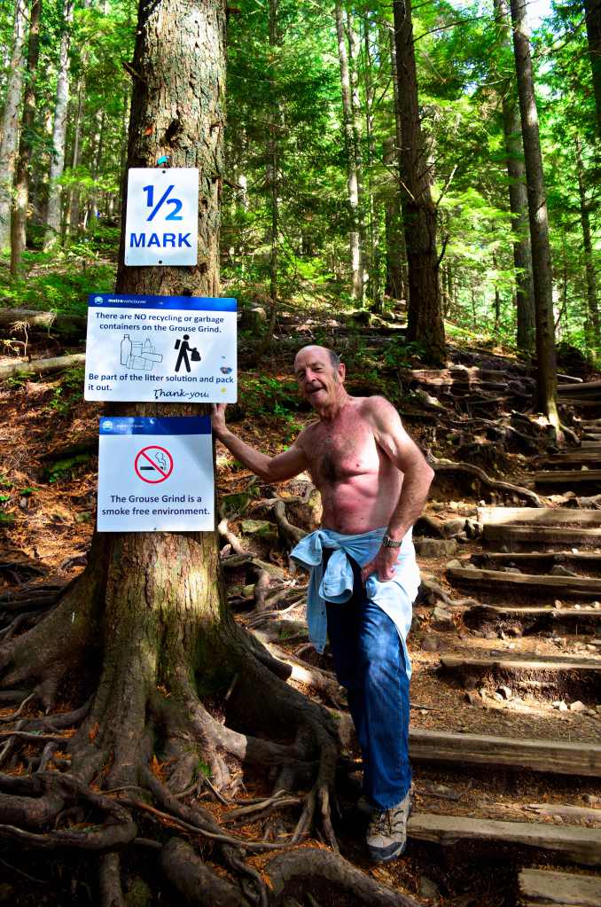
Passing the other hikers had made me feel mentally good, but, at the half way mark, I was a wreck. There were seats here and most climbers were stopping. I was also stuffed, really stuffed; pulling up and taking a drink and having a chat to others also resting. They probably weren’t as relaxed when I took my shirt off and exposed my torso.
In the middle of us all was a sage man of some years who spoke without expression, “It gets steeper from here”. His poker face denied any emotion but it was clear he was crazy, it couldn’t get any steeper.
It did.
What had gone before seemed benign as I loaded again and laboured up with my baggage. My shirt was off and tied around my waist and the sweat was running down all over my frame. It must have been somewhat frightening for the kiddies and young girls I chanced upon but my comfort was paramount.
All I focused on now was the fact that I’d reached halfway and that every step beyond that was closer to ¾, a point from which I knew I could make it.
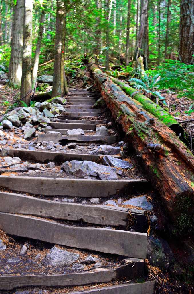
Occasionally, there were some lovely wooden steps, at times with handrails, and what a blessing they turned out to be. You could grab something to either rest or pull yourself up. Sadly, they were only teasers, soon it was back onto the rocks again whose surface continually unbalanced you and my weights seemed to exaggerate that fact.
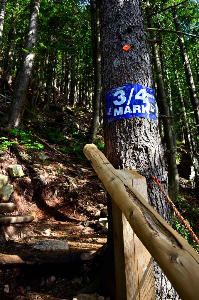
At times I lurched in an unsound manner from side to side, grasping ropes when they were available, taking time out here and there for a drink and recovery. Just after the 34 of 40 the ¾ mark appeared, from here I could taste the end and it was lashed with succulent relish. Somehow the infusion of such thoughts takes away some, but not all, of the pain.
A middle aged German who’d been tagging along just behind me for some time moved past as I paused for refreshment. He informed me he had medical qualifications, had worked on oil rigs; knew about underwater resuscitation. “Fat lot of good that will do me here,” I thought, as I prayed for an end to the misery.
I thought I must be nearing the end but, nay, there was a sign saying, “The last ¼ is the worst”. I was shattered, surely not.
Then you’re looking for a gap in the trees, hoping the light will stream in, an indication of the end of the tunnel of torture. No more gasping, a place to sit and relax, enjoy the view. Still the steps keep coming, there’s supposedly 2,830 in total. It’s only 2.9kms but it ascends 854 metres in that time. Every metre a step…..arrgh!
Suddenly I can see the chair lift again, and a restaurant. This coincides with an awful sound emanating from immediately behind. Someone was severely dry reaching, just the thing to brighten up your day. “What’s the time, what’s the time,” he blurted out between dry vomits just before he collapsed.
Stripped down to bare essentials, this guy had run the Grind, made it in under 40 minutes and was now paying for his efforts. His body was sending him a message; perhaps he’ll heed it more next time.
I took about an hour longer, but with no upheaval of the stomach, just gasping for breath. I consoled myself with the fact that few 69 year old plus Australians would have bothered to attempt such a feat, and I can’t blame them for that, but it does give you boasting rights when you get home.
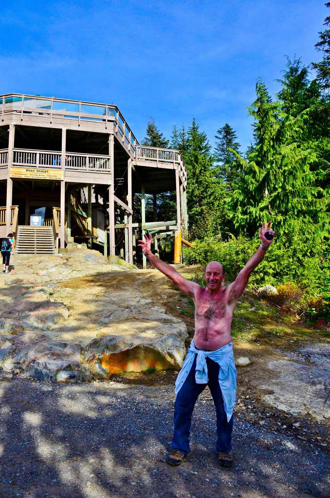
The stairs to the cafe seemed like someone’s sick joke as I laboured up them and purchased a smoothie. Because it was frozen it took ages to drink, which was probably a good thing as I collapsed in a bench seat.
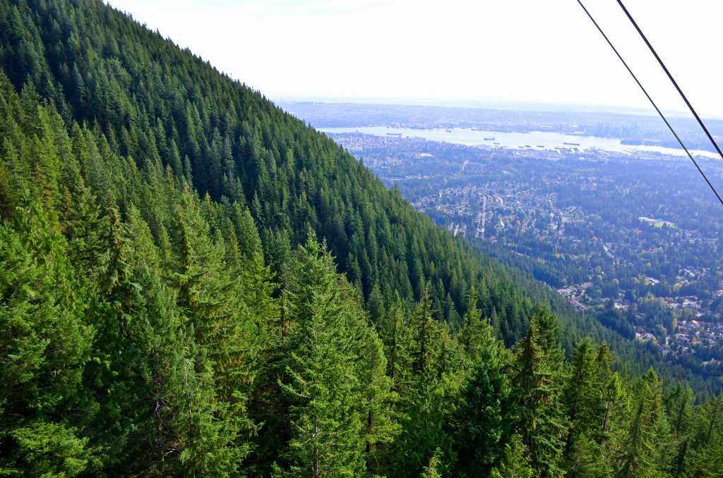
If the walk had been for the view I’d have been disappointed. A hazy, smoky sky took the edge off the panorama over Vancouver and I was glad the fare down was only $10. This is mainly due to the fact they don’t want walkers going back down the trail.
After about 20 minutes I finally got on a cable car, joining the throng who’d mostly caught it up. There were other things to see on the mount that I hadn’t bothered with, but not birds or bees.
Nonchalant. Now there’s a word that perfectly describes how I felt, sitting by Lake Macquarie with an hour and a half to spare. The breeze of the afternoon layered the surface with ripples as I leant against the bench contemplating life. Clouds were not apparent but still the chill of the late afternoon wrapped itself around me.
Above in the tall pines the ospreys were apparently content, deigning not to fly anywhere. “Should have been here this morning”, I thought. I had been earlier a couple of days before and they were active but I again failed to get any fish capture, though one, almost unseen, had chomped on a reasonably sized fish for around 20 minutes with dregs occasionally falling to the ground through the pines.
This afternoon was a nothing time as I relaxed, noting a small flock of gulls, half a kilometre away, feasting on something and the yachts of Marmong Marina making a nice backdrop to the activity.
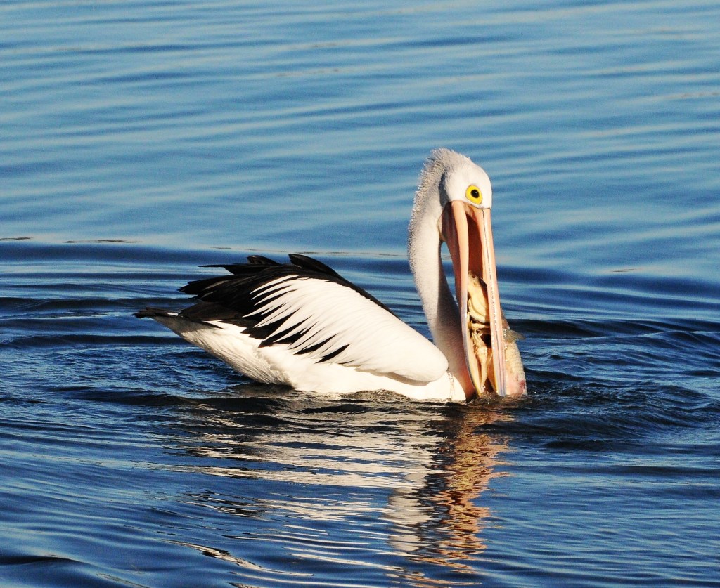
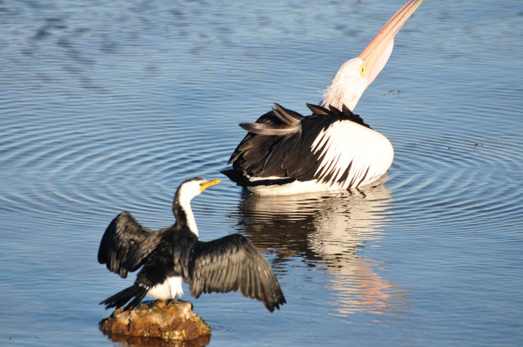
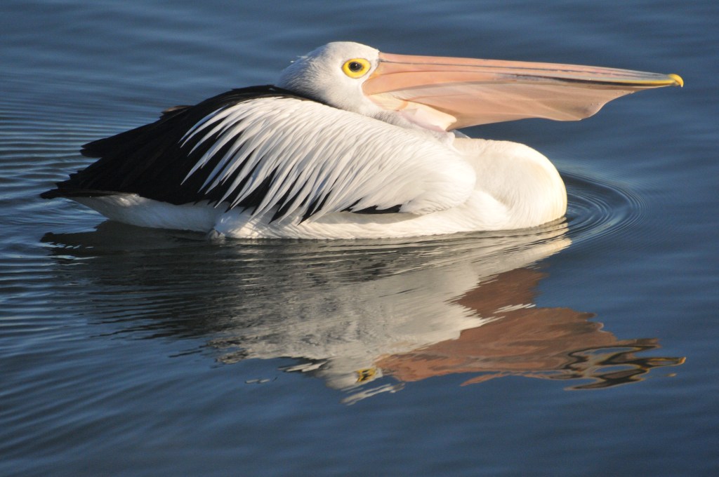
A lazy lone pelican drifted by but twenty metres away. We caught each other’s eye as his wake spread before him. I was born nearby 73 years ago and they have always been a part of this body of water, the largest of its kind in Australia. I was always surprised when visitors got excited by them because they were as common as the sparrows once were, though the latter have long departed, apparently modern architecture having a lot to do with their absence.
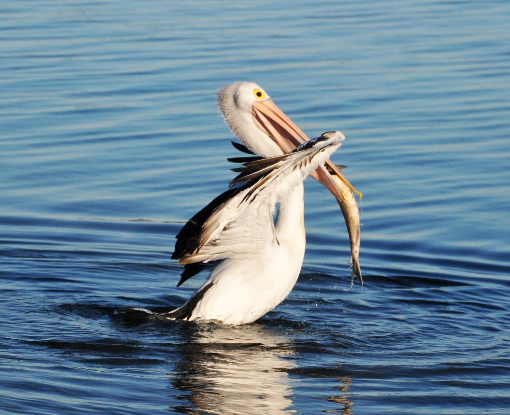
Suddenly the pelican thrust its beak into the salty waters, but missed whatever it was after. It was only a matter of seconds though before it struck again, and this time I had the camera ready as it grasped a large fish, by pelican or my fishing standards. Immediately it had trouble lifting it but thrust its head upwards, eventually getting it into the large fold of the bottom beak. Next came the swallow, as it threw its head upwards and the fish commenced its slide into the pelican’s gullet. But it wouldn’t go! The fish was too big.
Slowly the pelican paddled away, utilizing its large webbed feet. It was more like a drift as I rose to follow it, curious as to what might happen next. Then its head started moving, shudder-like, from side to side, as it eased eastward.
I watched with interest aroused, who needs the ospreys now. Around 100 metres away and slightly closer to the shore, it stopped and turned around under the watchful eye of a small pied cormorant who’d had its meal and was now drying its feathers. This was an archetypal vision of life on the lake.
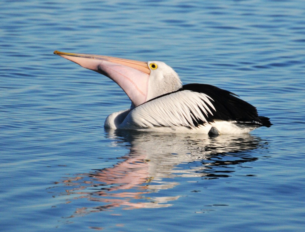
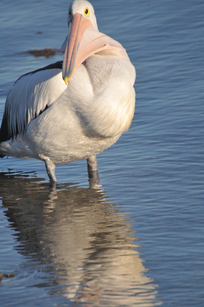
The pelican moved in slow circles, its head constantly moving from side to side. All I could envision was that there must be digestive juices floating in its bill because the fish would have long ago ceased flapping. It was around 20 minutes since the capture and still the bulge looked like some huge malignant tumour.
In time the pelican placed its feet on the bottom and raised itself, tilting upwards. I couldn’t believe the capture would slide down its throat. The pelican knew better but it was a tediously slow process and the bulge in its throat, as it went down, was something to behold. With the three minute swallow coming to an end, I was nothing short of amazed that the pelican paddled away, nonchalantly of course, and you couldn’t tell that it had just eaten a meal as big as any in its life. Nature’s like that.
Urupukapuka. I looked at the word. Some part of my mind wanted to blank it out. Didn’t want to know about a word with that many “u”s in it. After years of playing Scrabble, Words With Friends, delving into cryptic crosswords and testing my etymology knowledge on anagrams, I’d decided that “u” was my least favourite vowel and second only to “c” as my least favourite letter, the latter because there are no two letter words containing “c”.
So it was that when I was talking to locals about it or trying to book a boat to take us out there, I started saying, “That island that begins with ‘U’”. After a couple of days I started to feel inadequate and decided to add the word to my vocabulary. Couldn’t be that hard, surely. No, it wasn’t. When you realise that the bulk of it is only the same two four letter words it suddenly becomes a whole lot easier. In no time at all I was pronouncing it and flaunting it in conversation as if to show off my new found skill. I hoped the island would be the same when it came to walking.
SNAPPER AT THE WHARF
There are three islands available to the casual traveller and Urupukapuka is far and away the most popular. Research had indicated that the trail was good, though the reviews were mixed and the eating house, the only one on the island, didn’t get rave reviews from hardly anyone. At least I was prepared for that.
We booked the day before we caught the boat; at least the catamaran ferry wasn’t as packed as the Russell boats, but it was still reasonably full as we departed the Paihia wharf under nine tenths cloud. While Lorraine thought they harboured precipitation, my take was that they’d burn off as they’d done the previous day.
TAYLORS ISLAND
That the skipper was a comedian became evident early and we looked forward to his occasional interludes. At one stage he remarked that the Duke of Marlborough, where we’d had a cuppa the day before, was the first licenced premises in New Zealand and that Russell was the first capital, though it was also known as the Hell Hole because of all the debauchery that was partaken in by the lads from the whaling fleets, and others. These days, he said, only nice people lived there. He was one of them.
MAIN STREET, RUSSELL
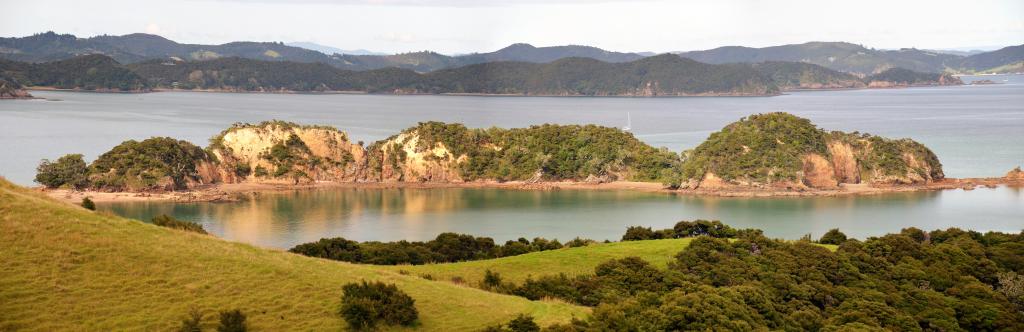
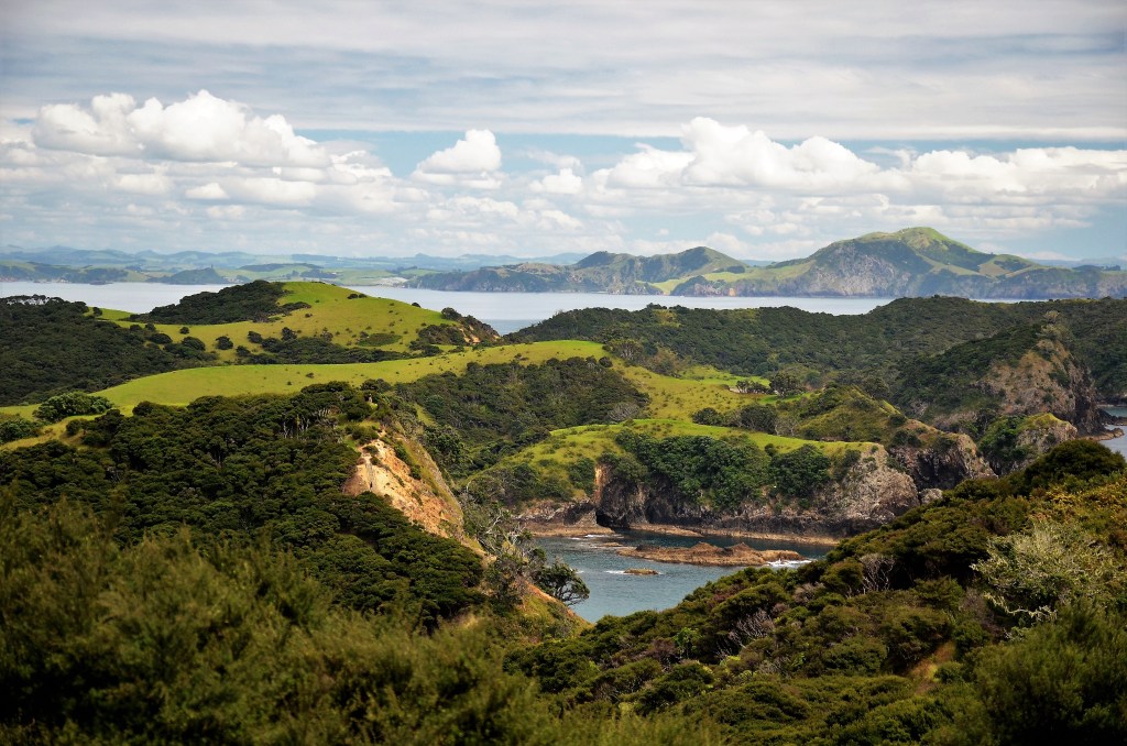
From Russell it’s a long way to Urupukapuka, around ¾ of an hour, but the time passes quickly as you cruise past one picturesque island after another. Rocks jutting from the water, odd shaped trees, occasional lichen and, in front of every one, all manner of craft, with the accent on yachts, because this is their paradise. 100 sheltered coves, a lee shore around every corner, secluded beaches, for what more could they ask. I ponder the idyll of it and reflect that in two days the bad weather is supposed to roll in. I’m glad I’m based on shore.
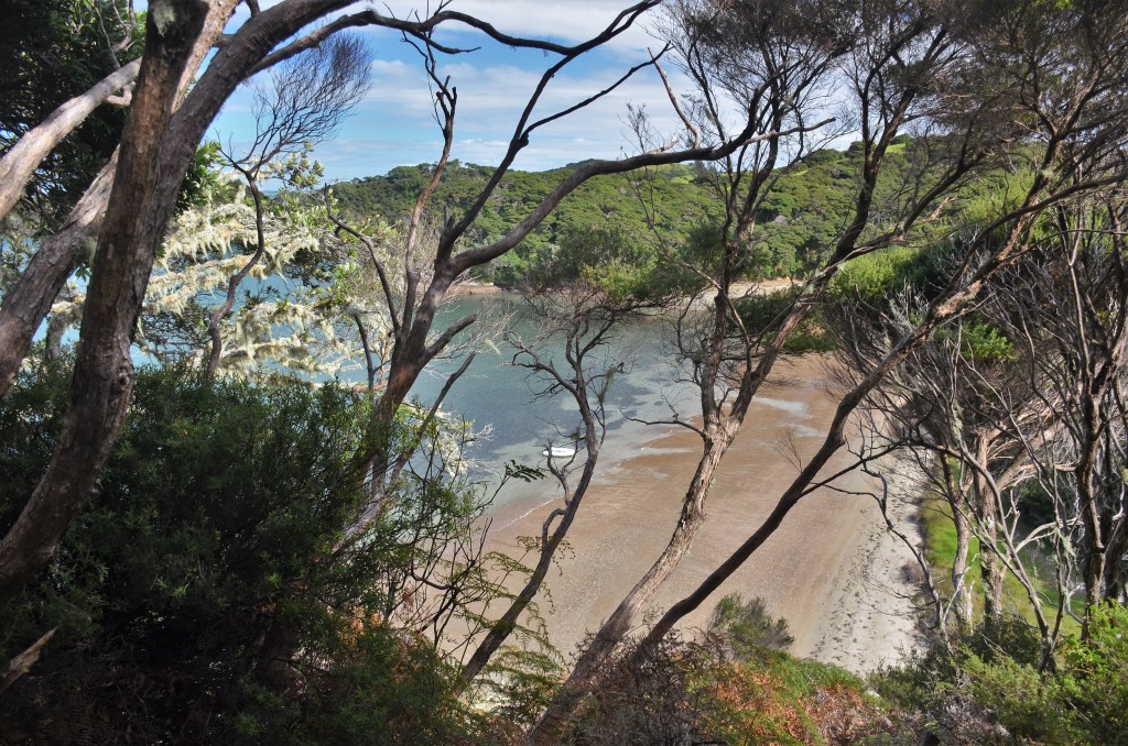
Then we’re there, filtering down Otehei Bay to the wharf and everything is new to us as we embark. We’re fortunate that I’d asked the female attendant about tracks on the island and she’d indicated where the maps were and suggested to do the main loop (which was what we’d intended) but add in the Cliff Pa track.
WE’RE OFF
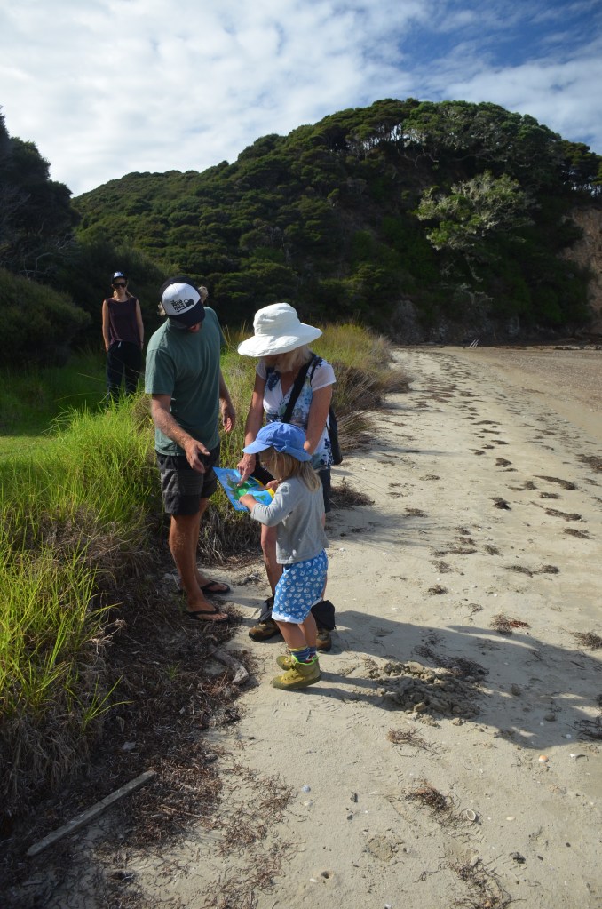
So we trudged off past the eatery and around the back of the restaurant into a number of shacks and we had to ask a young man where do we go from here and he pointed us in the right direction. Apparently we’d come around the wrong side, but we weren’t the only ones. An effervescent American lady of Chinese extraction from Boston asked if she could link up with us because we had a map and knew where we were going, ha, ha.
Then we were at the start of the track, or should I say, tracks, because there were several in fact, but to access all of them you started here…..unless you had your own boat and could pull in anywhere.
WHAT’S NEW ZEALAND WITHOUT ITS SHEEP
The lady couldn’t stop chatting as we ascended the first hill and I guessed, correctly, that our association would be a brief one. We passed through the first gate and made a beeline for the second, our gaze fixed upon a sheep that was scratching itself against the adjacent fence. In doing so we completely ignored a marker post, one of many dotted around the island, and slipped through the second gate. Immediately after there was an intersection in the trail, itself only a mown path through luxurious paddocks.
LET THE VIEWS COMMENCE
Somehow it just didn’t seem right but the trail headed uphill, as I’d been told it would, so we must be going in the right direction. At the next intersection we took a 5 minute diversion to a lookout over a bay. While it was nice, nothing prepared us for the 360 degree panorama when we reached the top of the hill. The vastness of the Bay of Islands was apparent from here and our cameras happily clicked away. Then we referred to the map again. I saw people back from where’d come earlier and they were taking an intersection we hadn’t noticed. Immediately it was clear that we’d come the wrong way again but now, having our bearings, it suddenly became obvious. All the trails on the map fell into place.
LOSING THELADY
So we had to backtrack and Chinese lady disappeared over the hill, never to be seen again. We’d only lost about 20 minutes so it wasn’t that bad and as we started the climb from the main intersection I remembered the lady on the boat had said it was a hike up the first hill, something I bore in mind as it ramped up more than a few degrees. It was time to give Lorraine a push or two as we laboured through the first bit of cabbage tree forest we’d come to.
TIME TO CHILL OUT
Reaching the top was blessing, because I’d gotten the impression that this was the only major hill around the place and we’d climbed it. Everything else would be a breeze; except we’d soon after come upon another hill and then started descending rapidly, which meant only one thing, we’d have to go back up again at some stage.
THE VIEWS ARE ENDLESS
The long descent would up at a beach and, referring to the map, we figured we’d gone the wrong way yet again. Lorraine no happy. Actually, I was disappointed as well. We met a family coming the opposite way along the beach and complained about the maps to them. We’d worked out that we were at Paradise Bay, some distance from where we’d hoped to be and we’d just added about an hour to our journey. The family indicated there was a sign not that far ahead and that would hopefully set us right.
SHOULD’VE ASKED THE KID EARLIER!
And so it did, except that it clearly said “Entico Bay”, while our map said Otiao Bay and had “Indico Bay” written in brackets. Near enough, neither sounded remotely like Paradise Bay. Happiness reigned, we were on the right trail, even if the signs and maps were like an unanswerable puzzle.
ENTICO BAY WAS A NICE DIVERSION, HOWEVER UNNECESSARY
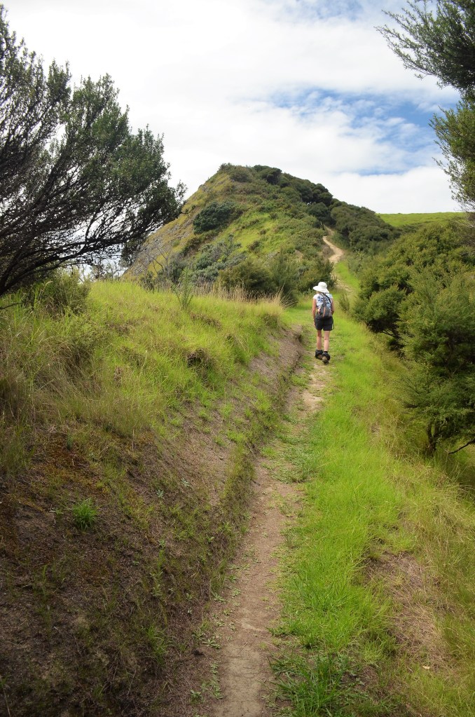
We were climbing again, heading towards the recommended Cliff Pa loop and finding it about 10 minutes later. The sign clearly indicated where we were and we turned off with confidence and started heading seriously uphill again, a long, winding trail where the grass hadn’t been manicured for some time. As we gained height, more islands became clearly visible. It was beginning to be the most picturesque portion of the whole walk. In fact, over 1/3 of all photos I took this day were on this section.
The next thing you came to was a steep stairway descent that led to the cliff, the first of a few, only it would more accurately be described as a severe cleft in the rocks. Then you ascended once more to the summit of the cliff on the other side and here were vistas over the bay that exceeded anything we’d seen so far, though that hardly had seemed possible 10 minutes ago.
CLIFFS OF CLIFF PA LOOP
The climbing and steep downhills were relentless but the rewards were many as our shutters clicked obsessively in an effort to encompass all before us. This was also the most taxing of the entire walk, and that was saying something. At some point we agreed to stop for lunch, though it had only just gone 11. It was atop the final descent from the Cliff Pa Loop before you made your way up to the main loop again and, by the time we reached it, our bodies were sending clear messages that they weren’t entirely happy with the situation.
WINDING ALONG CLIFF PA LOOP
We still had about 1/3 of our drink supply as we moved up to yet again another cliff, every one seeming more dramatic than the last. At times the trail skirted with edge and when we were in the middle of a forest section soon after we stopped for a drink. As I sat down I had a dizzy spell. Though it lasted only 3-4 seconds it was scary. You couldn’t help but think what might have happened had I been adjacent to a cliff.
THE VIEWS ARE CONSTANT ON CLIFF PA LOOP
At the next intersection where the Pateke Loop meets the Urupukapuka Loop a decision had to be made. I was firm in my decision to go left, a seemingly slightly longer route but it took us over terrain we hadn’t been on before. Though this met with severe disapproval from the other member of our team, for once in our relationship I won out, despite continuing protests for the next 15 minutes.
THE LONGER ROUTE OFFERED MORE DRAMATIC SCENERY
This would take us past Urupukapuka Bay, one we’d overlooked briefly at the commencement of our journey. Luckily it was the right choice. There were other people for a start, two dads with their 3 young daughters were frolicking along the trail, much to our amusement because the track was riddled with sheep droppings and one of the bubs was barefoot and doing everything she could to avoid the trail. At the bottom of the slope leading to the cove was an unlimited water supply and I gleefully refilled our water bottles and we drank like it was our last on this earth. The joy of drinking plain water had never seemed so good.
I’M HURTING!
Now there was but one hill and one member of our party was suffering as we approached the four hour mark. It seemed every part of her body rebelled against the thought that it had to go further as the sun came out and made us sweat even more, although that’s an area I excel in.
LAST VIEWS OF URUPUKAPUKA BAY
The blessed view of the café at Otehei Bay meant that we only had a relatively short downhill to go and the seats there had never borne two more overjoyed posteriors than ours I beg to suggest.
TIME TO LEAVE
We had 1 ½ hours to wait for the ferry and as we downed our ginger beer/beer/salt and pepper squid/hot chocolate and magnum we gazed out over the delightful sands and regretted not having a pair of swimmers so we could be even more refreshed, as some others were.
Still, it had been a grand, if tiring, day, the rewards had been many and we had much to retell. We figured it ranked somewhere in our top ten day walks ever.
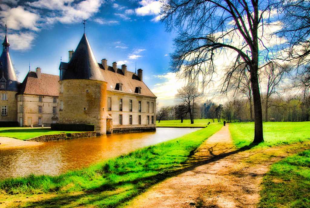
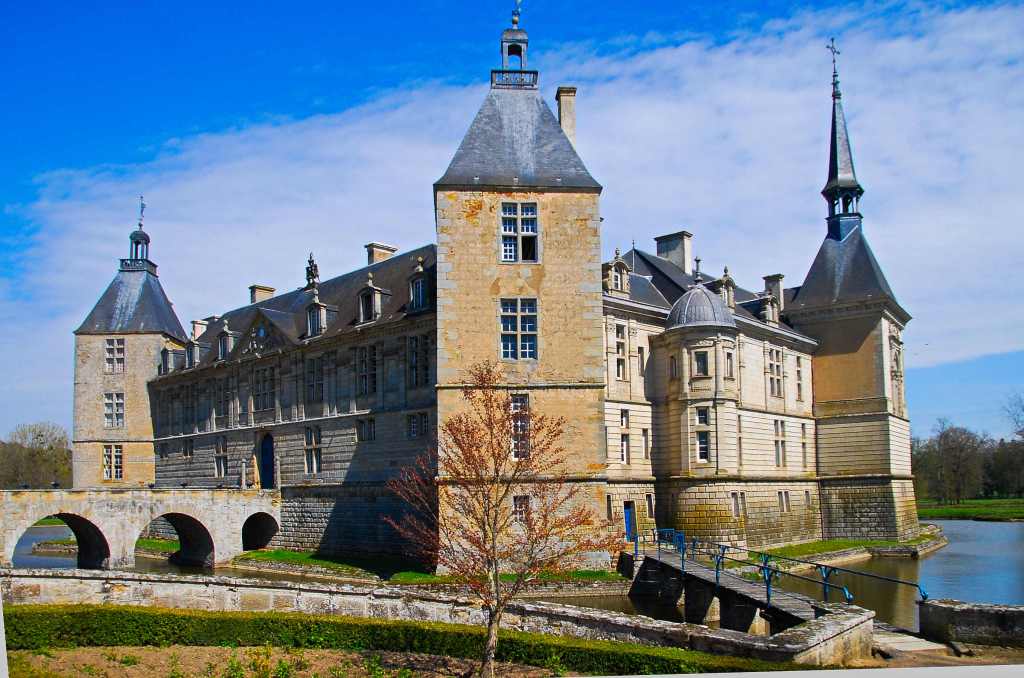
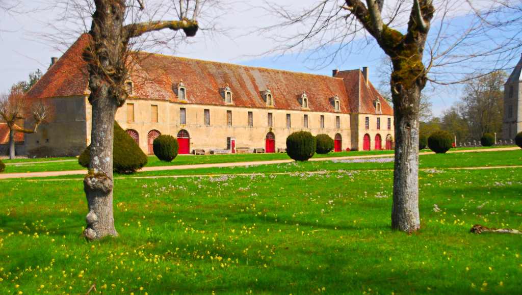
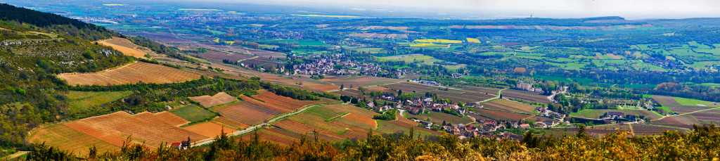
When you’re in the Dijon area it’s hard to avoid chateaux because this is the place where a lot of serious wine is grown and the term originally meant a house linked to a vineyard.
Here many prospered, and still do so today, but the big chateaux are suffering and tourists are needed simply to keep many of them afloat. I had a long list but, surprisingly to me, many of them only open during the summer months. Still, that left a lot.
COMMARIN
By the time our chateau day arrived I’d picked out Commarin and Sully. The latter was interesting because they had some Flemish tapestries from the 16th century that still retained much of their colour, something most haven’t managed due to exposure to light.
SULLY
It was also interesting because it was in Irish hands. How this came about was that the original owners, named Morey, decided to liven things up a little and one married a 19-year old. She did liven things up a lot to the point where the doctor was frequently called to the 60 year old Morey until he died. The once 19 year old was so enamoured of the charming Irish doctor that she married him. They had seven children and lived happily ever after but a French farce ensued.
SULLY
Louis XVI came to the throne in 1774, the Marquess died the following year and, when the French Revolution was in full fling fifteen years later the situation didn’t look too good for the old Marchioness Charlotte or her château. Her two sons had taken up arms with the Emigre Army but the Revolutionaires, declaring them traitors, came to Sully to confiscate their belongings. However, the old Marchioness sent them packing as she said the house belonged to her: her sons and their activities were not her problem.
Stupid old hag, thought the Revolutionaries, she’s bound to kick the bucket soon, we’ll come back in six months.
Six months later, they returned. The Marchioness had died. However, thanks to the quick-witted estate manager, Claude Beaune, the château was saved. He had placed the body of the Marchioness in a trough (in the fireplace of the Grand Drawing Room) filled with local brandy and when the Revolutionaries appeared she was whipped out, propped up in bed with a lace mob cap, the curtains drawn. Everyone went around speaking in whispers saying the Marchioness wasn’t at all well this week and the Revolutionaries would do better to come back at a later date to see her…’
And so the château was saved from destruction!
Commarin
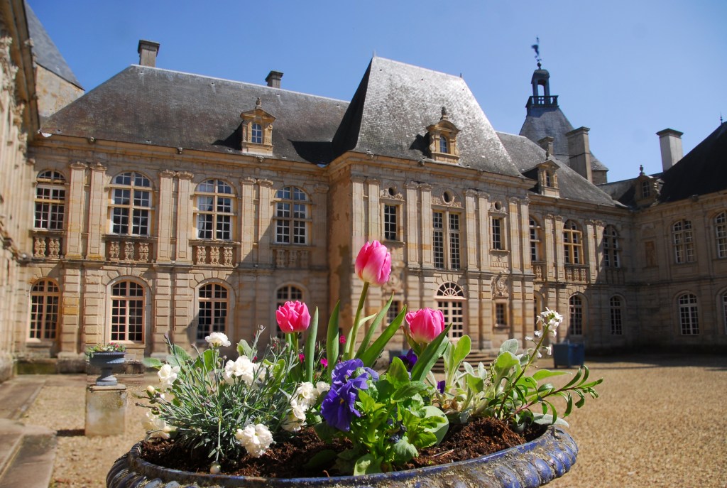
These days it takes just under an hour to get a nice tour around some of the rooms and you can wander the gardens at your leisure, pretty much the same at Commarin where the gardens cost 2 euros but you get a refund if you do the whole tour. Commarin is in a better state of preservation and has a lovely moat like Sully.
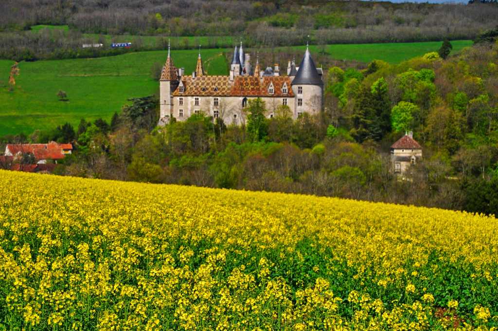
La Rochepot
To get to Sully we’d passed Chateau Rochepot near Norlay, smack in the middle of some serious wine country. It was Tuesday and most French public museums etc. are closed on that day, as was the splendidly situated Chateauneuf where we’d had a wonderful meal the day before with a nice warm fire and an English host in this small village of about 80 houses all around its standout chateau.
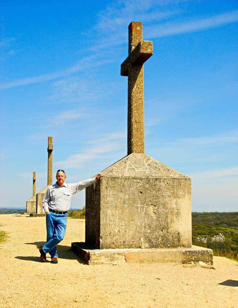
NOLAY
We’d also hiked up to the mount of the three crosses which, at 531 metres above sea level, rates with Michelin and gives expansive 360 degree views across the countryside.
View from Mont de Sene
The Mont de Sene has been of significance since Neolithic times and the Romans, who built two temples, and the Celts, whose dolmen are still there if you know where to look, both had a presence.
Les Trois Croix
As for the current crosses, we owe this name to one Pierre Millard who, in 1767, was a leather merchant originally from Santenay (a small town at the foot of the mountain). It was he who originally had three crosses built on the summit as an act of martyrdom. Though destroyed during the Second World War, they were rebuilt in 1950.
It made a frightening noise; so frightening that I recall seemingly jumping nearly as high as where the branch had come from. How lucky was I that it was 50 metres behind me though the odds were definitely in my favour that it would miss me. Still, I couldn’t help but look back for the next half a kilometre, it was certainly unnerving. By now my legs were seriously tired and I had to concentrate on merely putting one foot after the other on what would normally be called an easy to moderate track.
APPARENTLY TREES FALL FROM TIME TO TIME
Two days clambering over granite rock towers had drained my strength, though my exhaustion was tempered by the thought of having achieved my aims and maybe having shot a good picture or two.
Woolpack Rocks had been easier than today; though, starting at 5 a.m. in darkness, the first time I’d ever done so, had been mentally draining. With a fisherman’s light on my head I’d walked beneath stars so clear they danced among the branches, flecking the sky with their brilliance. I’d put on a jumper but in no time at all it became luggage as I paced along in the humid air.
There was no stopping for sights and I found it hard to get used to the lack of noise. No roos bounded into the scrub, no owls hooted, no wild dogs howled; it left me slightly on edge; if there had been a noise I would have jumped…..but there was nothing.
After an hour I reached a point I remembered was below the outcrop, about a quarter of an hour from the top. That meant I’d walked blindly past the swamp I had expected to see en route but had arrived in plenty of time before the sun’s appearance. The faint pre-dawn light beheld a stark silhouette above, that of some of the lower Woolpack outlines.
A sudden wind caressed the forest; at last there was some noise and yet, when I finally reached the top, I also saw what it had brought. Above me rolled ten tenths cloud; all thoughts of a photo of a starry sky outlining the outcrop disappeared.
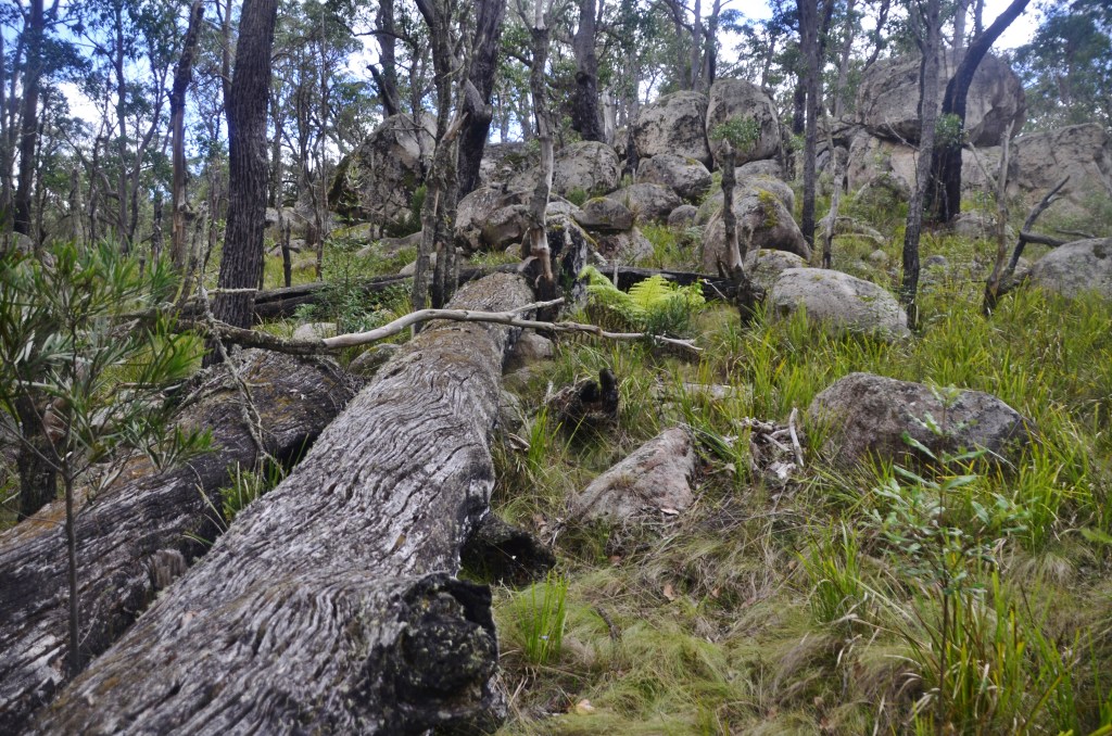
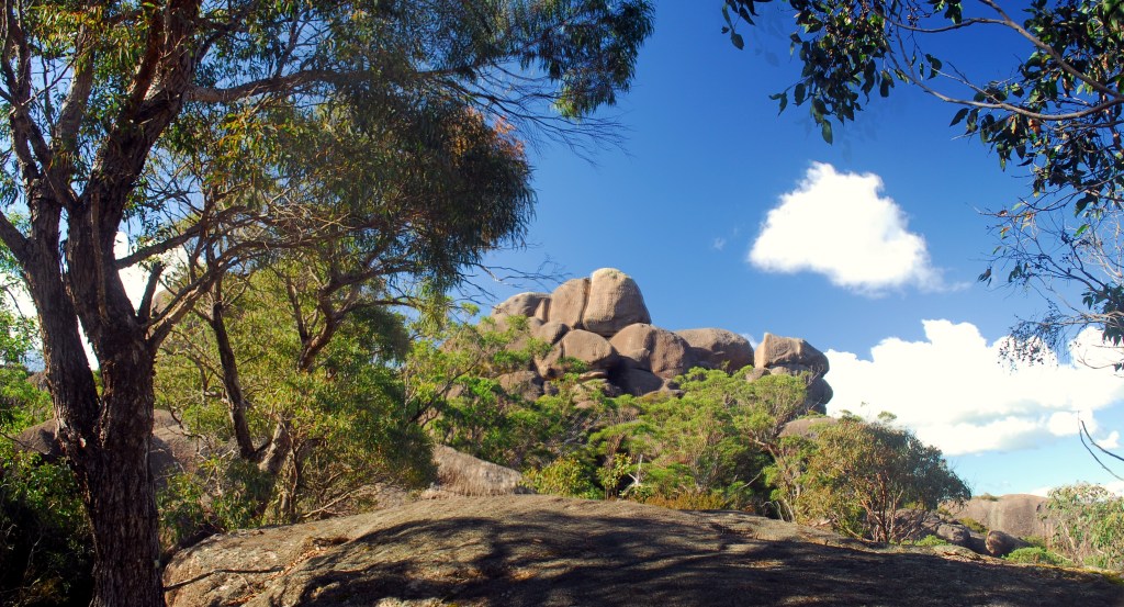
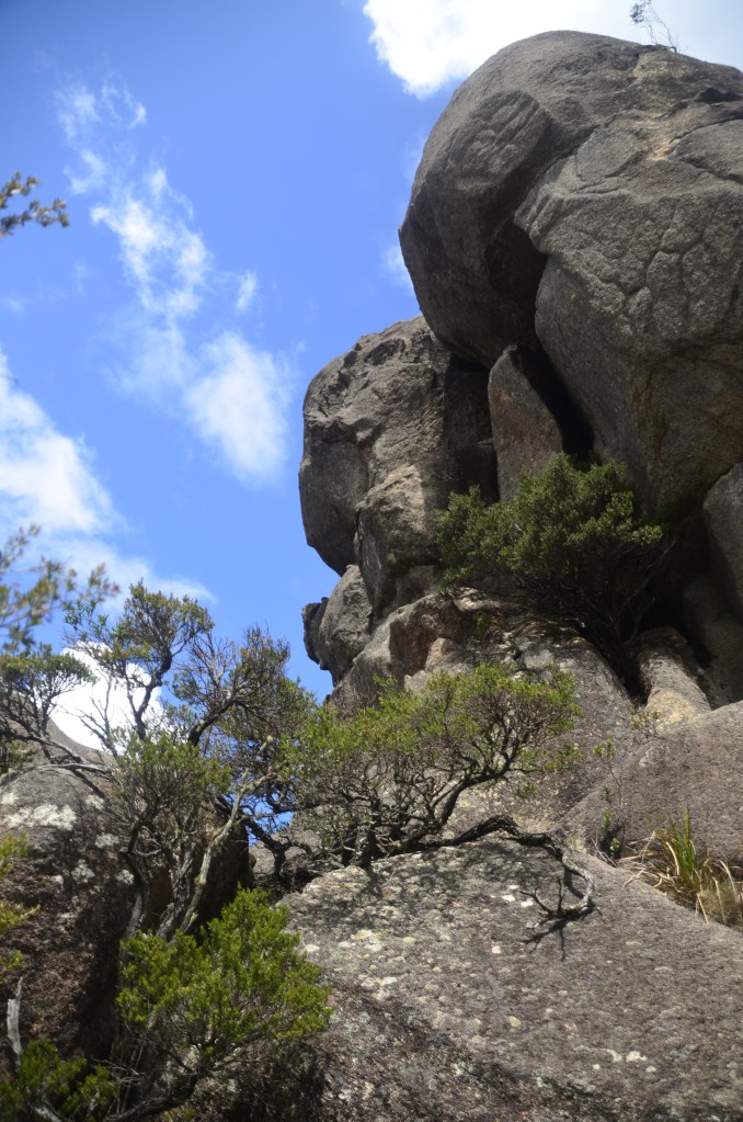
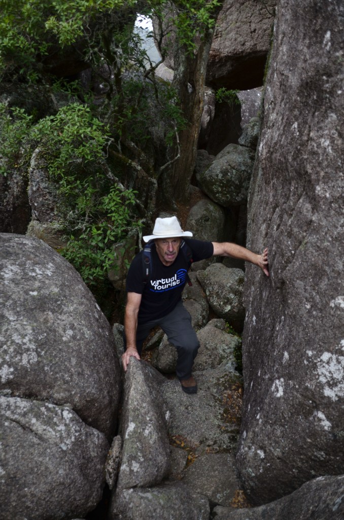
Though disappointed, I moved on with my thoughts and figured it would give me time to explore the area. The main body of rocks are only about 250 metres away in a direct line so I started off. There were many potential leads; nice smooth surfaces that invariably rolled over to gaps in the rocks where a small line of trees had taken root in the limited soil. There were more impassable routes than achievable ones and it was around an hour later before I reached a point where further progress would have needed ropes and rock climbers and there was certainly no way to the top.
POINT OF NO MORE PROGRESS
Then I turned around and the first of the sun’s rays that had broken the clouds lit up an outcrop at the end of a long chute behind the largest of the entire Woolpack cluster. I clambered and stumbled across fallen shards of granite that littered the abyss until I broke out onto an area unseen from the normal viewpoint.
I had part access to the rear of the great rock and got to see others I’d probably never encounter again. It gave me a great feeling of achievement; at least I’d seen something new, something few others would have bothered to try for but, who could blame them? Clambering beneath resting boulders and scaling others hadn’t been for the faint hearted and required a patience sometimes lost in this fast world we live in.
I retreated, back to the “Walk Ends Here” sign, and pondered its appropriateness as I sat down. I tarried awhile beside the sign, soaking up the atmosphere, sucking a lolly and emptying my bidon. A calmness overcame me and I was at peace with the world; a peace disturbed only when a creature emerged from a low overhang. I was stunned, I’d never seen one before, but it was instantly recognizable. The tiger quoll sniffed the air, looked in my direction, then eased sideways into another crevice. Frustratingly, I got five shots off but only one was in focus due to a faulty lens that I’d been considering replacing. Still, I had finally got to see this normally nocturnal creature in daylight.
MY EXCITEMENT KNEW NO BOUNDS AT SEEING THE QUOLL
Somewhat satisfied, I packed my gear and headed back to Native Dog camp ground, being mildly surprised at what I’d passed unseen that very morning. A Kiwi came by and warned me about a snake he’d seen. Somehow, these days, I was only mildly interested, thinking more about getting a picture than any physical pain I might have to endure.
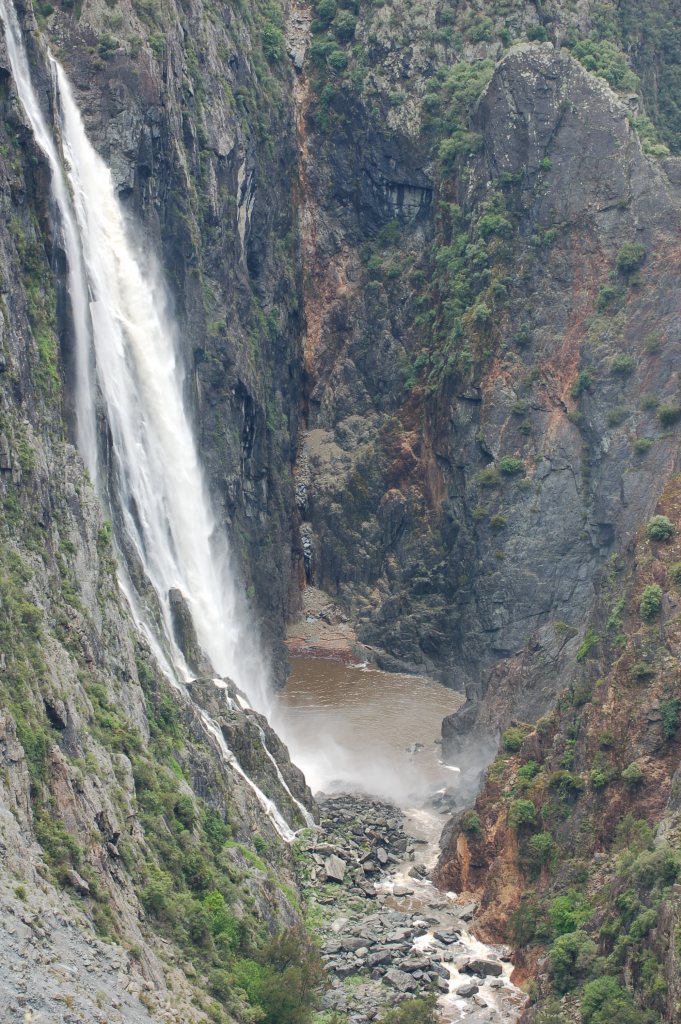
WOLLOMOMBI IN BETTER DAYS
So it was that after lunching with a friend I ended up camping at Wollomombi that night, too tired to push on to Cathedral Rocks, happy to stay in familiar territory. By the time I rallied enough energy to walk over to the lookout the next morning the clouds were just starting to build, hopefully to release some precipitation for the falls were a forlorn sight; not a skerrick of water tumbled from the heights of one of Australia’s greatest waterfalls.
So I had morning tea and pushed on to Cathedral Rocks; there were two vehicles already in attendance. The loop was just over 6 kms, rated medium and a time of 2.45, and we’re not talking minutes here.
You initially pass through swamps before gently moving upward and then you start to come across quite a few steps at regular intervals. After just over an hour you come to an intersection with an offshoot to the summit. This side trail is not included in the “medium” section; in fact, it doesn’t really rate a mention until you’re at the intersection.
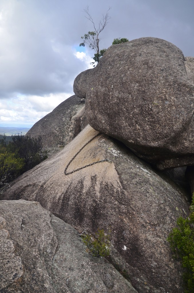
Obviously I hadn’t come all this way to not scale the heights but this outcrop can fairly be described in one word – daunting! The massive boulders tower into the sky, reaching heights that seem improbable from your lowly position with little indication of route…..and it gets steep as access zigzags along the improbable trail to the top.
I passed a couple from Redcliffe that I’d camped next to at Native Dog camp area two days ago and they said they’d reached as far as the chain. Well, he had, but his wife hadn’t even got that far. “Where’s the chain”, I asked.
Turns out it wasn’t all that far from the top but they advised me to leave most of my gear behind. For once, I took someone’s advice, and dumped all but my camera about 100 metres before the chain. Life was so much easier without my load as I gazed at the amazing route across a huge rock indicated by the markers and chain and climbed onwards. Suddenly the air was rent by a stark crackle that reverberated around the granite; it was thunder but the crisp sound was unlike any that I’d ever heard before, an octave or two above the usual and it was disconcerting to say the least.
Finally I could see the end; it was a throne-like remnant where I imagined thousands had had their photos taken and soon I would join them. Overhead, threatening clouds were drifting towards me and I had no ambition to be the victim of a lightning strike so I hastily retreated to another area where I had some chance of shelter.
BENEATH THREATENING SKIES
Crawling around the unknown I found some untracked places and a comfortable spot in shelter as the rain finally fell and made a mini-waterfall off the granite above. You sort of assume it’s going to finish soon without knowing for sure. This time it did and I scampered off the high points back to the intersection and turned right for the motorhome. It wasn’t that long after when the branch missed me.
Looking for angles to shoot the heights I’m constantly surprised at just how far you can go up and down in a relatively short time while walking. Mind you, my legs weren’t surprised and my gratitude at seeing the motorhome and knowing the relief therein was palpable.
CATHEDRAL ROCKS SIMPLY TOWER OVER YOU
There was a middle aged couple from Nowra just refreshing themselves and he got to tell me that when he’d sat on the “throne” up top he’d been bitten by a wasp. I immediately thanked him for removing that danger from my life.
IT WASN’T ALL THIS HARD
They told me they’d just finished walking to Woolpack and back which was just over double what I’d just done. Again I felt inadequate but reflected that there were many 67 year olds who hadn’t been here today; in fact, I was the only one I knew of, though when I drove down to nearby Ebor Falls and collapsed for a couple of hours, frankly, I couldn’t have cared less.
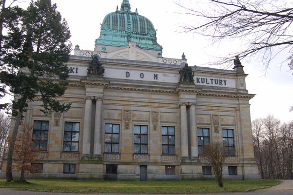
GOERLITZ At night it looked so different. A series of lights along the waterfront with some barely discernable buildings behind. I had no idea what it was called or what was there. The Goerlitz map showed just a few buildings beside the river and the “living house of J. Bohme”, whoever he was. I left my digs and knew where I wanted to go but there was a railroad track in the way. I figured I’d just walk across the tracks but a very fast train was coming and I just managed to leap into the grass on the other side before the train came through. I’m glad a certain person wasn’t with me at the time.
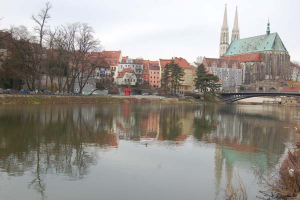
Imagine my surprise as I strolled along a side stream, over which there was a massive stone bridge, until it met with the main river Neisse.
There was another city on the other side, Zgorzelec. Once upon a time it was all the same town and it had prospered by being part of key trade routes, the Via Reggia from Kiev to Santiago and the Salt Road from Prague to the Baltic.
It’s difficult to imagine with my very limited knowledge but I would guess there’s anything between 80,000 and 100,000 in the combined towns and, come September, they will be joined as the border crossing will come down. I couldn’t help but ponder on the stupidity of man when one day there will be a border control and, the next, nothing. What on earth is the difference and who are they stopping now? Australians without passports for one. I’d found that out the night before so I had brought mine today but was the only one to get his passport stamped while over 100 regulars just flash theirs as they hurry pass. Still, everyone knows you can’t trust those Aussies. I got talking to one of the guards and he was anticipating being out of a job when the rules changed.
THE POLISH SIDE
Another aspect makes me crack up as well. In Germany it costs 600 euros for a fishing licence and you have to do a short course in marine biology. Judging by the ever increasing number of anglers setting up on the Polish side, similar rules don’t apply. I wonder if the fish have worked out which is the safe side yet. Probably not, since they’re not as clever as us.
There’s a large broad green stained copper roof on a hill so I make for that after I get across the bridge and it turns out to be in the middle of a park and it’s a square building of majestic proportions with the expected sculptures and bas reliefs on the front. It’s something to do with culture and it’s at odds with much of the rest of the town that has apparently suffered in terms of neglect.
The place is, frankly, depressing, though, in some areas, it echoes Goerlitz with some delightful baroque streets but they are more than overshadowed by the gloom of a grey, featureless concrete, peeling paint and crumbling brickwork elsewhere, victims of the Polish economy. Mired in such mediocrity it is easy to see why a new memorial to the recently deceased Polish pope has been affixed to the bridge just where you enter Germany. I guess they want to flaunt what little they have going for them.
At one stage I hear the sound of a car approaching from behind me. Without turning around, I know it’s a car I’ve never seen yet I know the brand immediately. It’s a Trabant with it’s distinctive two stroke motor puffing blue smoke from the rear.
I’m determined to eat here though, just to day I’ve done it, and save my appetite for the last restaurant before the footbridge. It’s a restored 1829 building that once was called the Three Wheel Mill and it’s situated on the crossing of the 15th meridian and Via Regia (Royal Route), the shortest way from Paris to Moscow. The original building dated from 1273 but, when you’re that close to the river, the floods won’t miss you and they had some fires in addition. Though no-one here speaks English they trot out an old menu where the price is still in zlotys. I manage an order and sit back and admire the low vaulted ceiling and lovely coloured windows with local scenes and historical persons featured. It’s very atmospheric and the meal goes down well. Then I try to return over the footbridge. No, sorry, you can’t come over here. Note the sign. “Only European Union and European Economic Union (Iceland, Lichtenstein, Switzerland)” Wow. Memo to John Howard – Note we don’t even rate above Lichtenstein. I have to return to the main crossing, get my card stamped and then I can return.
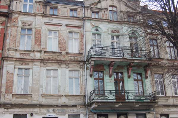
I digress, as ever. I wandered off through the lower parts of Goerlitz. Some of the streets are truly out of a postcard factory. Imagine 4-5 storey baroque buildings lined up side by side all done in beautiful pastel shades, some with decorations.
Others, especially in the old city, narrow, cobbled and winding, with several dating back to the 1520’s and a massive church spire at the end of them. Definitely worth a look. At the main church I went in. It was freezing. No, I mean freezing. It must literally have been 10 degrees colder. Outside I had been stripped down to my shirt but I immediately went for my jumper.
CHURCH OF ST. PETER AND ST. PAUL
What a great place for wine storage I thought. It was a lovely church, the organ the finest I’ve seen (no jokes please, I’ve already run them all through my mind). It was set amongst exquisite green coloured stuff made to fill in the gaps between the silver pipes with some filigree work here and there. There were quite a few other special works, such as paintings and sculpture, but it wasn’t overkill like you get in Italian churches. Someone approached me. This was getting to be quite a habit.
It turned out to be Rudiger Buench and he was an affable young chap who offered to show me the crypt. “You can get stale in here and very cold. It’s good to have a break.” Indeed it was, the crypt being warmer than the church. Then again, everywhere other than Siberia would just about qualify in the northern hemisphere.
He showed me a 16th century much faded fresco of “Peter and Paul, but we don’t know who the other figures are.” He then enlightened me on other small carvings, very reminiscent of my East Grinstead tour. The Via Sacra (Holy Route) meanders for 341 miles (550 kilometers) through Germany, Poland and the Czech Republic connecting some of the most significant religious sites in Europe. The 15th-century Parish Church of St. Peter and Paul in Goerlitz is one of them.
THE FAMOUS 14thC CLOCK TOWER
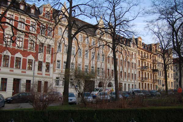
Then I wandered off up through the old city. It’s a treasure. In time, tourists will come to this place but, for the moment, the buses don’t come so you have the place pretty much to yourself though there are some around. They could seriously handle 50 times more before it becomes crowded.
The Gothic Dicker Turm (Fat Tower)
There are over 4,000 listed historic buildings here, my digs are in one of the lovely baroque buildings, obviously not designed originally for lifts as the lift that is there stops on every half floor so, no matter where you are, you have to walk at least half a flight of stairs. The room is comfy and, at last I have CNN again but I ended up watching the UEFA cup live. They cover all three games and flit from match to match to it’s full on entertainment.
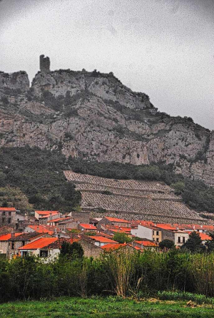
I’d waited, waited because there are a thousand postcards of Peyrepertuse with the sun shining on its crumbling old walls atop a spectacular outcrop of rock; but in the end I was denied. Instead of improving, each day the weather seemed to get worse. The weather for the whole trip bar one half a day has not been conducive to photography. It seems the more I pray for a decent day the more fickle the weather becomes; and always driven by Le Mistral, the cursed wind from the north.
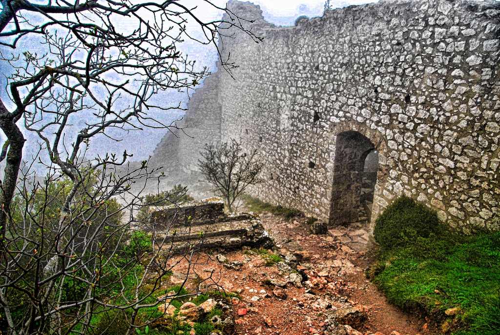
The day before had seen ominous clouds wafting overhead all day but nothing eventuated though rain had seemed imminent. Today, the rains came in the form of a misty drizzle that lasted the whole day. Still, I was determined to see Peyrepertuse, an ancient Cathar stronghold. The Cathars were a religious sect who were vegetarians and abstained from material things. They also rejected Christ’s divinity and ultimately became strong in the Languedoc area of France.
Of course, this represented a problem for the control of the Catholic Church so they prompted French noblemen to do something about it which culminated in a series of Crusader conflicts lasting over 100 years. Eventually they were exterminated with the most infamous episode coming when Beziers was under attack. In this town were many Catholics but the local abbot, in his frenzy to rid the church of opposition, told the troops to kill everyone because god will know who to save.
The Cathars built a lot of sanctuaries on rocky outcrops for protection and the ruins these days attract tourists from everywhere, partly because of their dramatic locations.
CUCUGNAN, WHERE WE LATER STOPPED
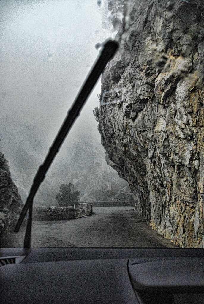
En route to Peyrepertuse I planned to traverse Gorges de Galamus, one of a number of gorges in the area that I’d never heard of. May I say here that those of you who think the roads of Capri and the Amalfi Coast are scary need not apply to drive this route. I still can’t believe why anyone would bother to put a trail through here.
ONE OF THE FEW PULL OVER PLACES
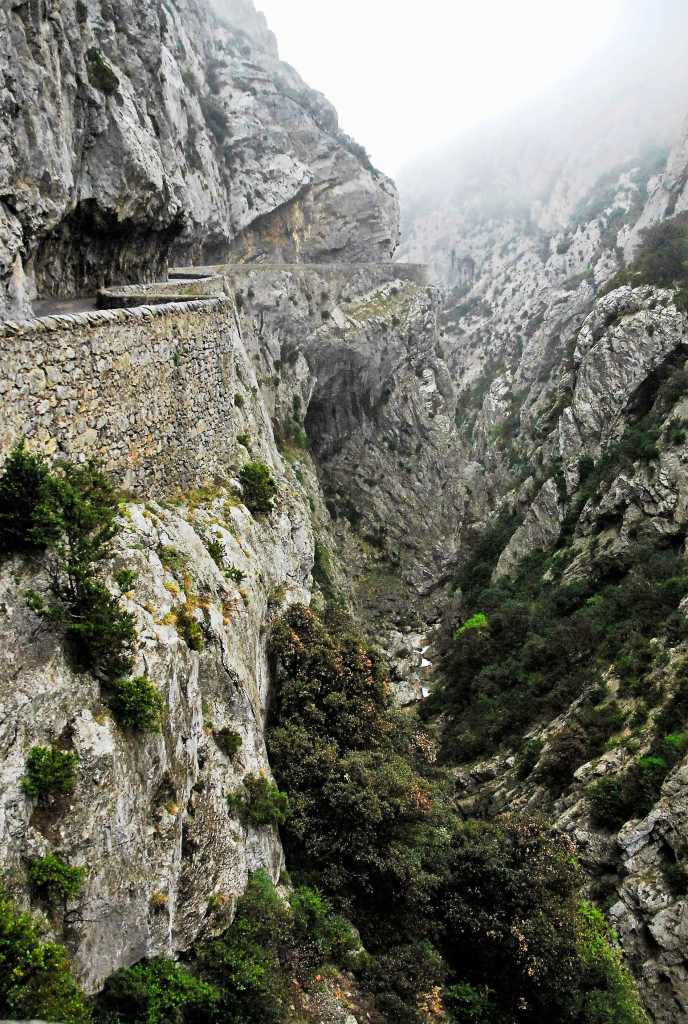
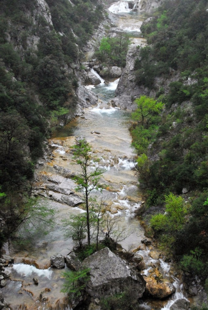
Literally cut into the rock that still partly overhangs it, the road has no straight sections at all and the warning signs that it’s only 2.7 metres wide are to be heeded. I have no idea what you would do if you met a car coming the other way. Fortunately I was parked when the only one we saw did come through. The thick dripping mist only added to its atmosphere and the roar of the unseen river far below and the knowledge there was a religious sanctuary beneath a cliff down there just made it more unforgettable.
THE TRULY AMAZING GORGES DE GALAMUS
I briefly went down some steps beneath the dew and got a couple of shots before returning but down the road aways it was a little clearer and we got to see more of the dramatic chasm below.
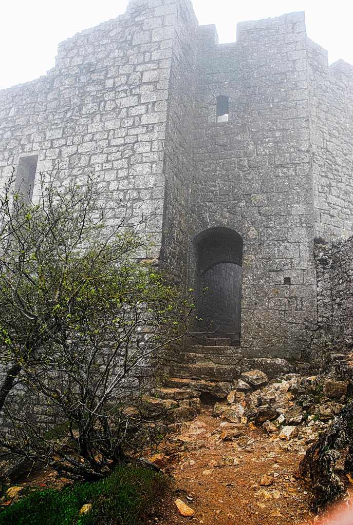
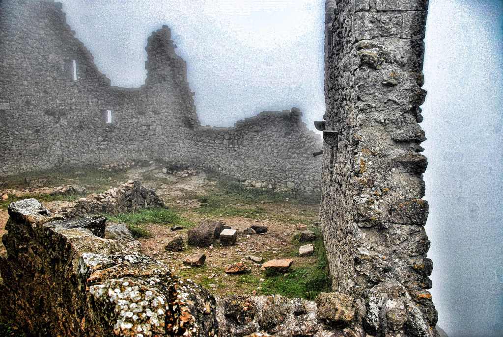
Next was Peyrepertuse but it, too, was covered in mist but brave Cheryl with her dodgy knee came up with me to view what we could of the edifice. Other than hail I couldn’t image worse weather to view this castle but we soldiered on up the narrow rocky trail past moss laden branches interspersed with white flowers and got close enough (visibility about 20 metres) to see much of it but not the broad panoramas that it offers from the ramparts.
Still, the atmosphere was paramount as the moist air drifted through the ruins; you could almost hear the ghosts of the past walking past you as you touched the grey weathered stone of the walls.
I was fascinated by the toilet arrangements. Similar to the Tower of London there was a room hanging slightly over the edge of the walls where excretive matter plunged to some forgettable place below.
LA TOILETTE
Rooms became visible as silent cloud lifted momentarily and then were invisible again. “Eerie” was a word that was so apt on this day, straight out of a Hitchcock movie, as I imagined the Cathars and their dilemma as they were rounded up elsewhere but this castle was never besieged. It was handed over and was still in use until the 18th century by various military establishments.
We started for home, calling in first at a cute hamlet called Cucugnan that we savoured before enjoying a repast in the windmill that had first attracted us to this spot.
AT LAST A PLACE TO EAT
We pushed on to Tautavel, with its archaeological museum containing the oldest human skull found in Europe. They’ve spent a lot of money here but we only had 45 minutes to view what I should have allowed 90 for. Still, what we saw was very interesting.
The wind came up a little and pushed us home and we searched yet again for the restaurant we’d eaten at the first night we stayed in Canet but, despite having three cracks at it on different days and taking well over an hour zipping up and down streets, we never did find the place again that was only about half a kilometre from out accommodation.