VICTOR-Y IN SIGHT

Clearly, Terrace Falls aren’t meant to be found.  I checked my guide book.  Lots of times.  I followed my GPS.  Clearly it really didn’t have a clue.  There’s supposed to be a carpark but where in Hades it was located was a mystery to us all.  The only thing I came across was a dead end with a locked gate blocking any entry into Terrace Falls Reserve and the main road going through it.  So, when I came back there again after travelling all the back streets of southern Hazelbrook, I parked.

As luck would have it, there is just enough room for one motorhome.  Any other vehicles and it would have been overcrowded.

It had spat rain en route so I put on all my wet weather gear and left the safety of the motorhome.   I say safety because I must have been about a kilometre into the walk down the fire trail when the cracks and rumbles started.  Thoughts that I was here on my own, about to be struck by lightning, no one knows where I am, all crossed my mind.  I could not work out where I was and pondered going back but, when you’re stuck with the explorer gene, that’s hardly ever an option.

The first small fall I’d stopped to photograph, but I knew there had to be more and then, I reached it – the carpark.  Actually, carpark 3.  This was what I’d read about in my guide book.  Only difference was they’d had access to get down here.  As an added bonus there was an information map.  Hallelujah!  I photographed it for future reference which turned out to be the best decision I made, despite its numerous discrepancies.

Accordingly, I continued on, keeping a watchful eye for a trail that went right to the stream above the falls.  Where it was supposed to be, there wasn’t anything, save for a track someone had bush bashed through that was about 15 cms wide. Virtually next door is a semi-famous loop walk with four drops with car parks and understandable directions.  No wonder more people go there.

Somewhere down there’s a waterfall

Not to worry, according to the map there should be another entry not too much further on.  The sky rumbled once more, the rain, though slight, became constant.  The next entry point was clearly defined and had another map on a post.  It was all perched on a cliff, down which one had to follow a path hewn in the sandstone.  I glanced over the edge, thank goodness I’m not acrophobic.

Though my knees didn’t enjoy the descent, my brain was overtaken by the roar of a waterfall somewhere unseen in the forest beneath me.  It had to be Terrace Falls.  I wasn’t quite sure what to expect but, when they finally came into view, whatever expectations I had were exceeded.  These were, indeed, a worthy destination in a Blue Mountains littered with such claims and, the beauty of this reserve is, you’ll never get a crowd. 

Terrace Falls from further down

No busloads here, just the occasional local or explorer with an enquiring mind.  I was so glad Ian Smith the other had suggested them.  Many photos and videos later I looked up the map I’d copied.  According to it there should be a trail on the other side and I could just make one out.  Lord it was hard to see.  Ravaged by tree falls it clearly needed a crew with chainsaws in here for a couple of days just to make it realistic again.

Not the best track for walking on

Still, I stumbled, ducked and weaved my way along part of it to get some different angles and witness the falls beneath the main ones.  Wow, it was spectacular and noisy all at once.  I was on the path to Carpark 2, wherever that was.

Trail to Victor Falls

I retraced my steps and finally found the other way out, this time to Victor Falls and Carpark 3.  It’s definitely not overused, in places almost overgrown by ferns, but I found that part of the attraction.

Looking for a trail

Zig-zagging up the cliff side track the river seemed far away and I wondered where these other falls were just before I caught glimpses of them through the forest.  Wow, another significant drop but where was the trail?

Victor Falls

Then, a sign.  Manna from heaven.  Down to the falls and up to Carpark 3.  All my destinations listed.  It’s a steep but short walk down to Victor but they were roaring also with the flush of the recent rains.  It was such an opportune time to visit, even if I was drenched to the bone.  Luckily I was able to thrash around in the water because I’d cleverly remembered to put my gum boots on again and it proved to be an absolute bonus.

To stand before a roaring fall is to be at one with nature.  The beauty, the power, the timelessness all resonate here and it’s food for the soul.

I clambered back up the slope, satisfied for the first time that I was, indeed, where I thought I was and heading in the right direction.  No sooner had I reached the top than the trail veered off over to the stream above the falls and you had to wade across it.  So glad I had the wellies on!  This was the trail I’d sought so much earlier but the entry from the other side no longer exists in reality.

Here and there among the land of the flaky-barked Tea Tree and the hard-leaved Scribbly Gum, wildflowers showed their beautiful presence, some so tiny as to be barely visible but the variety of colours is something to behold.

Carpark 3 came into view and at least I knew the way back from here.  One kilometre plus, uphill on a 4WD road, and it was all over, my knees ever complaining but my mind in seventh heaven.  It’s the kind of day you hope the Blue Mountains can deliver, and I had been only too happy to receive.

SOME DAYS ARE DIAMOND’S

Beyond apprehensiveness, where I was going was scary.  Well, the place where I wanted to photograph from was, so, when I drove past 9, count them n-i-n-e, police and rescue vehicles with flashing lights I could be excused for taking it as an omen.  Still, it was a few kilometres from where I was aiming for.

Sandstone (sliprock if you’re American) patterns on Narrow Neck

I turned onto Glenraphael Road, the way that leads out onto Narrow Neck, a place where adventures begin in various forms.  Abseiling and rock climbing for two, both of which occur where I was headed.

Grass trees burgeoning after the bushfires

I’d travelled the road before and it’s not for the fainthearted but I figured I could get the motorhome down a little way towards the locked gate that guards the rest of it from normal vehicular traffic.  Cautiously I moved forward, eager to save myself the effort of having to ride my bike as far as I’d originally planned.  Crawling along I got to a point and pulled up.  Maybe this would be as far as I would go.  A girl went past running.  How far she was going I knew not, but running around here takes stamina and supreme fitness.

Looking west along the Megalong Valley

The sandstone protruded over the Megalong Valley a little here so I reeled off a few shots while the noise of nearby abseilers regaled me and then returned to the motorhome.  There’s a seriously steep pinch up ahead and I never dreamed I’d ever had a go at it.  It’s probably around 15 degrees plus but my confidence (another word for stupidity) had grown and I was determined to have a crack at it at least.  It’s the last obstacle before you reach the gate.  Luckily, it’s the only part that’s concreted.

Shuffling into first gear I ground up the slope and was over the moon when I reached the top because the gate is only about 300 metres further along.  I’d managed to avoid getting the bike off.

Vandalism we don’t need

There was a N.P.W.S. vehicle there.  Turns out the clear plastic sheet that covers all the direction and information maps had been spray painted by some idiot.  I felt so frustrated that an underfunded organization has to spend time on crap like this when there are so many other jobs they have to do.

I stepped over the stile and bid them farewell as I headed down to Diamond Falls.  I’d only discovered them when I house sat on Cliff Drive and took to exploring.  They’re not mentioned on any maps that I could find yet they are one of the most amazing falls in the Blue Mountains.  I’d spoken to Ian Smith the other the day before and he’d lived in the Blue Mountains for decades and never heard of them.  He’d also asked me what trail you take to get there.  I replied, “There aren’t any!”  However, that’s not quite true.  There is a Federation Walk that you cross over that’s barely visible at all.  You really have to keep your eyes open to see it or, more correctly, traces of it.

Negotiate that!

My route took me down, negotiating burnt trees that insist on leaving charcoal stains all over your clothing, stumbling over uneven ground and constantly trying to pick a route where you can get through.  I came out further north than when I’d been here previously, which turned out to be a bonus because it offered more photo opportunities before I swung back to reach the only satisfactory viewing point, a scarred bit of wet uneven sandstone jutting out over an abyss dotted here and there with abseilers anchor points. 

Diamond Falls

Here, conquering your fear factor is a must if you want a shot or simply to savour this spectacular cascade that rolls over the edge of a severely undercut ledge before plummeting into the Megalong Valley below, crashing along terraces after it hits the bottom.  It’s an awesome sight that never leaves you once you’ve witnessed it and now was a favourable time to view it because the bushfires had stripped all the foliage away and the new rains fed the waters.

Scary place to take photos from

Sated, I swung uphill again, brushing past the new leafy growth, still moist with the morning’s showers, and zig-zagged up the untracked slope before reaching the gate again, just as the workers were finishing up.  They queried me about the flow and I praised their work and we parted ways, me ever so thankful I’d completed my task before lunch which would allow to do another.

Now you could read the map but I couldn’t help but think how sad it was that a person would go to all the trouble just to desecrate some clear plastic sheeting.  No financial gain, no art left behind, no enhancing other people’s lives, just ruination of a resource.  Can’t begin to imagine what their home life must be like.

Driving back, and almost to Katoomba, I was shocked to see the running girl making her way back up the hill into town.  How long had she been out?  She looked exhausted and with good reason, somehow my effort seemed puny by comparison.

A LEAP OF FAITH

For some reason I couldn’t find it again, yet I knew it was nearby, the sign said so; except this was where the tracks went in three different directions and, as I later worked out, they just wanted you to take the long route to avoid confusion.  Except, 20 minutes later, I was confused.  That I’d descended too far was apparent.  I didn’t need to take any more steps to work that out.  Where exactly was Witches Leap?  (Leap – old Scottish word for waterfall, used in a few places in the Blue Mountains).

Still, the track was listed as one rarely used and I was sure I’d seen stuff I’d never walked past before.  Then again, when you’re leaping fences (not in a single bound these days), dangling over off-piste vertiginous drops and scrunching around in virgin forest, you’re bound to come up with things like angles of Katoomba Falls I’d not taken previously.  The Rough Tree, Soft Tree, King and Fishbone Water Ferns were all flourishing with the recent rains and gathered in great clusters beneath the towering ribbon gums and other assorted natives.

I clambered back up the hundreds of stairs to my starting point, only diverting for an urgent toilet break.  Fog drifted in and around the canopy but it wasn’t thick yet and the new bout of rain hadn’t arrived.

Orphan Rock, once was an attraction

Back at the signs and I ignored the one I’d chosen before and, sure enough, only a few hundred metres down I reached my target.  It was disappointing because the water levels had dropped and, though the flow was good, you couldn’t call it spectacular.

Witches Leap

It was then I made the decision.  Previously I’d pondered following the course of the creek but hadn’t bothered.  Today, it started to gnaw at me.  After I took some pictures for a young couple in front of the cascade, I’d virtually made up my mind and soon I was straddling the fence.  Such a change from the barbed wire I’m used to tackling.  Pipe fencing is so user friendly.

Though initially I sought to record just the first flourish meandering through the rocks; one temptation led to another and, ever slowly, I made my way down the course.  As so often happens, it’s one lure after another and, like the hungry fish, you just have to keep following the bait.

It’s so refreshing for the mind though, having to find ways where there are none, noting every footfall, testing each fallen branch because some are wont to crumble and feeling the natural softness of a bed of fallen leaves.

Scrambling through the virgin scrub

The stream twisted every which way beneath towering cliffs whose cast off remnants formed the natural barrier for the water flow.  Their moss laden presence a reminder that nature isn’t permanent and boulders can fall any time with little warning.  Dead tree branches chose to clutter up some areas and, at one stage the waters cut beneath the cliff which leads one to wonder how long before the next crumbling.

The waters cutting beneath the cliff

At times easy, other times requiring bum sliding, I’d determined that, sooner or later, I had to reach a made path again as I slipped out of some strangling vines that interrupted my progress.  Occasionally busy clusters of fungi were slowly disposing of decaying trees and lichen grabbed onto whatever was available, usually the coachwood with its wonderful abstract bark.

Saplings were urgent in their efforts to climb higher and grab some more of the light, waiting for that opportunity when one of the giants is cast aside in a storm and, here and there, such events had occurred.  They must make an almighty crash when they fall.

Then it was there, the trail, probably half way along the famed Furber Steps that takes you ultimately to the valley below, all 996 of them.  (Named after Thomas F. Furber (1855-1924) a surveyor and lecturer who had an active interest in the reservation of the Blue Mountains and the Sydney Foreshore.)

My only goal now however was up, taking occasional stops for breath and lookouts, of which there are lots in the area, sometimes in surprising places.  At one stage I passed over another fence and found myself on a narrow ledge beside a small cave, eventually becoming so terrified I edged back to safety.

First drop of Katoomba Falls

When the top was reached I gratefully sat on an appropriately placed bench seat and texted some photos off.  Though the motorhome was in sight nearby I simply couldn’t be bothered going the extra 60 metres so I sat there for around half an hour soaking up the atmosphere and greeting the dog walkers as they passed by.  Being carefree in the Blue Mountains has a lot going for it.

The Iconic Three SIsters

“….DON’T TELL ME YOUR SURNAME IS SMITH!”

It was raining, not hard, but the drizzle was constant.  There’s something about being in the forest when it’s wet.  Drips on the flowers, colours highlighted in the wet, the splash of footsteps, the quiet.  It’s all there, you just have to notice it.

I was north of Lawson, hoping to find St. Michaels Falls with a reasonable flow of water.  There were puddles here and there after I left the parking lot and I diverted initially to Fairy Falls, the loud noise of water thrashing on sandstone being the attractant.  There was, indeed, about twice as much water as when I’d last visited and the diversion raised my spirits.  This time I splashed through the falls and shot them from behind.  I could do this comfortably because, only hours before, I’d made the decisive move to purchase a pair of gum boots.

FAIRY FALLS

When I’d house sat at Berry, the owners had given me a pair and it opened up a whole new world of bushwalking.  No longer did streams and cascades necessitate fear of sloshing feet.  Now you could plunge into the waters, offering up a multitude of camera angles I’d not contemplated before.

FAIRY FALLS WHERE IT DISAPPEARS INTO A GULLY

With a spring in my step I moved again towards St Michaels and came across a lady on the path.  She was stereotypical Blue Mountains.  How many had I seen of her type.  Vibrant, happy, not an ounce of fat, wavy hair, content to be in the bush under any circumstances.  One couldn’t help but reflect that obesity is a scarcity in this area.  People come here to enjoy nature; not only that, to thrive on it.

ISOPOGON ANENOMEFOLIUS

The wildflowers were plenty.  There’s no boldness about Australian wildflowers, the vast majority are tiny, though some are in such profusion as to make up for their size. 

Then the stairway to St. Michaels.  Easing down the worn sandstone with my painful knees there was no rush so I stopped from time to time to simply enjoy the moment before reaching the slippery bridge across the downstream waters.  St. Michaels was loud, the waters pounding into the splash pool beneath and the sound of the contact was magnified a multitude of times in the caves behind.

I wandered around in the waters, indulging in the moment, feeling the power of nature, soaking up its beauty.  Eventually I headed south east, searching for an elusive route to the lower part of Fairy Falls.  I crossed the stream to a trail I’d never been on.  It climbed, ever so slowly, making the stream impossible to get to until a sign was reached.  It indicated that it may actually have been a trail I’d visited before but from the other end. 

No sooner had I made my mind up to retrace my steps when a stranger walked into view.  I thought the possibility remote that I would have come across two people out here on a day like today but we said hello and then delved into our reasons for being here.  Since he was carrying a tripod to go with his camera it wasn’t hard to work out that he might be interested in the same type of photography that had egged me on today. Indeed, he was keen to shoot as many falls as he had time for in the area and we shared some information until it was time to part when I introduced myself.

HELLO, I’M IAN

“I’m Ian by the way.” 

“You’re kidding.  Don’t tell me your surname is Smith.”

The shock of what was about to happen next surprised us both.  For here was Ian Smith talking to Ian Smith.  It transpired he’d met a few of our namesakes but this was my first such encounter so it was perhaps a touch more memorable for me.  Naturally, that led to us exchanging contact information and we parted richer for the experience.

I headed back while Ian2 pushed on.  Aways on the return trail I espied a safe way down.  At least, by hanging onto some passing trees it was.  There were small cascades I was keen to shoot and the results were pleasing so I continued further up the stream, recording photogenic spots and splashing through the water with gay abandon in the gum boots.  It’s definitely so much easier and they’re surprisingly comfortable.

I hadn’t gone that much further when, lo and behold, there was Ian2 again.  He’d doubled back and scrambled down further upstream and had noted me on his way past so it came as no surprise when I reached his position.  It’s nice being with someone of similar interests; you understand what they’re feeling and why they’re taking so long.  Explanations are superfluous, you can simply savour the company and compare notes.

COLOURFUL COACHWOOD

After this we headed back for North Lawson Park.  Ours were the only two vehicles there and I invited him in for a cuppa but, alas, bowls beckoned.  Apparently he’s keen on rolling down a few and was involved in a tournament this particular week so my attempts to meet up for a cuppa anytime were futile.  Still, it had been a special day in so many ways.

THE DAY THAT SUCKED

12, 13.  I don’t know why we count….actually, yes I do.  It’s because you want to tell people afterwards; boast a little (14, 15) and get some brownie points for being so silly in the first place (16).  Yet there’s nothing glamorous about it, the rise and fall and the probing nature is, in some way, revolting, it’s such an unusual gait, yet common if you insist on going bushwalking in the wet (17).  The car offers no respite except it’s dry, even if we aren’t.  In fact, it’s so wet that even our cameras have tossed it in, shame the leeches didn’t try and attack them instead.  Why a phalanx of them is making its way up my trouser leg is a mystery; I’ve never seen a whole group before; it’s like a military excursion, a band of scouts setting out before the main attack.

I was with Gerry and my second outing with him, this time we’d pencilled in Chasm Falls, after negotiation, and a side trip to Smoko Falls.  This walk had sort of been on my reserve list, i.e., something I wanted to do but might not have time for.  Gerry said, bearing in mind the lack of rain, that this was a preferred option because a lot of water was not required here in order to get good photos.  Ever keen to listen to this sort of advice I readily acquiesced.

We met at Deloraine, a town with an aura.  That aura is one of attractiveness; it’s one of those places that makes you feel good without you necessarily being able to put your finger on the exact reason, though I think it has a lot to do with the winding main street girdled by historic houses, chic cafes and quirky shops.  Still, we’re not here to look around, we’re off to the scrub somewhere south.  Gerry kindly uses his car and we’re off, moving towards the Western Tiers.  The cloud cover is noticeable, even though it’s not raining yet.  That will come later.

Luckily Gerry knows the way.  I think that even if I had instructions I might never have found the way in but the dirt road we’re on has obviously been worked on recently.  It’s smooth and has lots of base.

Arriving at the carpark, so called, I’m surprised to learn that there used to be a bridge across the Mother Cummings Rivulet (nee Smoko Creek) and that you used to drive across.  Now, there is no bridge and you’re forced to go down through the scrub and cross the stream before picking up the old road again until you reach an intersection where there used to be a carpark and here you turn left on the Ironstone Mountain Track for a purported 1 hour return trudge to Chasm Falls and back.  The sign has fallen and is resting on some trees, resplendent with its coat of Spanish Moss and lichen that make it barely legible.  Other tempting destinations such as Smoko Falls and Bell Tarn are also listed.

You immediately become surrounded by Myrtle, King Billy Pine and Sassafras that dominate the temperate rainforest of this region and, as you move into the bush proper, leaving behind the forestry practices of the past that have regenerated as scrubby eucalypt, it’s time to meet the Tasmania of Gondwana times and walk between the carpets of sphagnum moss that lie thick among the rocks.  Elsewhere ferns survive where they can, mostly beside the streams where they can catch flickering glimpses of the sun at certain times of the day.

It seems not that long at all before you reach the falls…..except that these aren’t the falls.  In fact, you’re not even half way; the “real” track is just beginning.   Stumbling along the slippery rock surfaces it’s not that long before you’re ascending a grade 3 hike where no footing is even and, in a while, you’ll be asking, “How much farther?”

At the side, at varying distances, are tempting bits of flowing water that agitate your camera fingers to the point where you cannot resist at times.  It’s a photogenic strip of fluid to say the least.

I can barely find it credible that the track diverts, moves away from the river, and gets even steeper.  Surely we must close?  No, but we are about 2/3rds of the way and the forest is eye candy all the way along the route, supplemented by colourful fungi that we find irresistible.

Almost suddenly, after being so focused on gaining a sure footing, we’re there.  Gerry points to something down below and I’m off, only to discover it’s a large log, resting across a gorge, sorry chasm, hence the name.  If acrophobia is part of your make up, you won’t be walking across this span over a vertiginous cleft continually being eroded by nature.  On either side of the log is chicken wire attached to a single strand of fixed wire.  That’s all that separates you from death.  It must be said however, that the log’s surface is pretty flat and I found walking across it easy, unlike poor acrophobic Gerry who, having made it across, wouldn’t go back but chose the option of crossing the stream above the falls.  Unlucky Gerry, there was too much water coming down so he was forced to return and negotiate the log once more.  That was after we’d consumed lunch, my choice being a gourmet roll I’d purchased earlier in the day and kept boasting about all the time I ate it, while Gerry was stuck with his home-made sandwich.

About this time it started to rain lightly, just when we’d finished our lunch and were packing up in fact.  It wasn’t a factor as we reversed trail and headed home, stopping twice at agreed places that we’d pencilled in on the way up.  It was about when we’d shot the second one that the rain got a little heavier.  Of course, we know who that encourages, so we started checking our legs and it wasn’t too long before the probing black creatures from insect hell started either upon our person or our clothing, seeking the warmth or pulsing of a vein that would serve as dinner.

It rained so that our camera bags were saturated, our footwear totally drenched and our clothing uncomfortable.  Now, so much water was coming from the heavens that even the forest offered no protection.  Our socks started to squelch in our hiking shoes and misery was raising its ugly head.  The suggested 1 hour return time is a bit fanciful.  Though we did take quite a few photos it’s only the really fit and focused that would be able to manage that time, better you should allow an extra half hour.

Gerry’s missing jumper came into view and I pointed it out, rather than pick up the sodden woollen garment, before we reached the old abandoned carpark and walked downhill to the crossing, then rock hopped to the other side before climbing back to the car.  Blessed relief, a chance to sit, maybe dry just a little, check ourselves for beasties and head back to civilization.  I’d divested myself of back pack and camera and was safely ensconced in the passenger’s seat with Gerry still outside at the boot when the heavens opened up.  As if he wasn’t wet enough already!  While I would probably have dived in the car until it eased, Gerry, in true Taswegian style, toughed it out and got on with unburdening.  Eventually his saturated clothes and body entered the vehicle and we headed off, heater at the full.

We hadn’t gone far when the rain stopped.  Even the road showed no sign of moisture.  We’d simply been caught where the updraft had formed clouds and dumped on us.  Or perhaps it was some kind of message from the gods that I’d done enough, it was time to leave Tasmania.  Certainly it’s a message my body was in tune with.  We pulled into a picnic area by some lake or other, put there for irrigation purposes.  I vividly recall reefing strip after strip off the paper towel dispenser and wiping my synthetic walking trousers.  Because they don’t hold moisture that readily, much of it came off fairly easily.  I suppose being half dry is better than being totally drenched, at least it seemed so at the time.

(18) I picked the last one off me, so I thought, as we neared Deloraine.  I offered to shout Gerry a cuppa when we arrived and he accepted so we adjourned to the gourmet café where I’d earlier purchased my fancy roll that I kept gybing Gerry about while we were walking.  I doffed my shirt and put on a jumper, my only item of dry clothing and grateful I was.  While I ordered a large hot chocolate, Gerry surprised me by ordering an iced chocolate, something I usually reserve for warmer days.

We reminisced about the walks we’d done, only four in number, over the years, and how pleasurable it was to walk with people who understand the driving need to stop and photograph and aren’t worried if you get a bit behind or in front.  In addition, it’s an extra set of eyes to see those things that you might otherwise miss and when you recall moments, they are so often common because you’re both on the same page.

We discussed the possibility of Gerry doing a trip north sometime in the future, when I could pack up the motorhome and we could set out for a few days in northern N.S.W.  Perhaps it would happen, perhaps it won’t, but it was nice to dream.  Then, all too soon, it was au revoir, and who knows when we’ll get together again.  At our age, you can but hope.

ON FLANDERS FIELDS

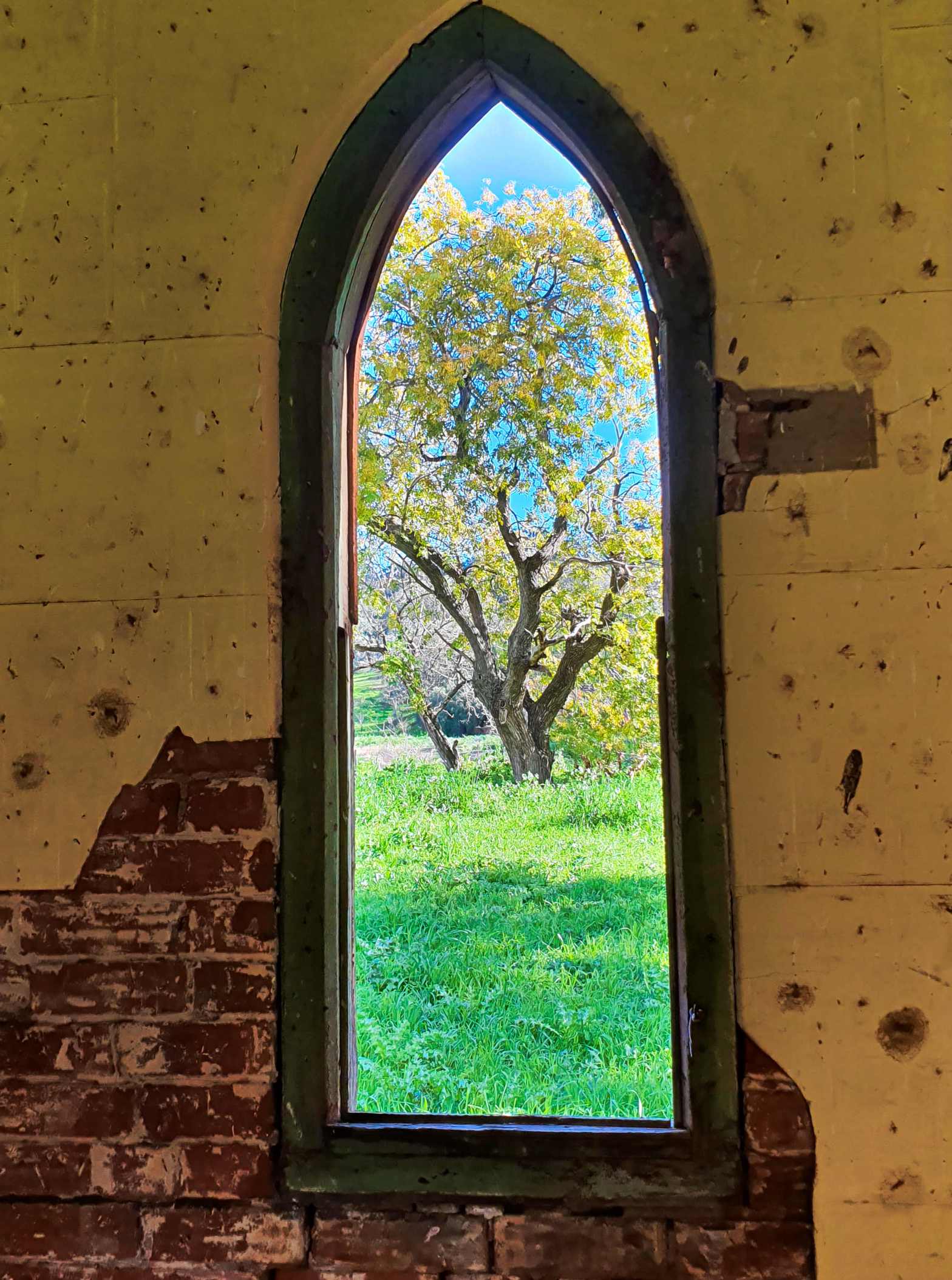
I was born and raised in Teralba, a suburb that still seems apart from the rest of Newcastle.  21 years passed, during which time I would frequently visit my grandmother on my father’s side. 

I still recall trips to Newcastle, a big occasion for a young lad, on the 363 bus from Speers Point.  Gran lived alone at Boolaroo, but I never made much of her being alone.  No, she was just the quiet lady, generous of spirit and it was such fun listening to Blue Hills on the radio with her.  But there was something never discussed; that’s the way society was at the time.  Her missing partner.  All I grew up knowing was that he had died of a shell explosion somewhere in a country called Belgium.

Much later in life I inherited some pussy willow leaves with poignant messages writ upon them.  “There were some nice places but none so nice as home”,  “To Bessie from W from far across the sea  1/8/1916” and “From A55 to “Kelmont” where would I sooner be” are some that I still hold. 

It really wasn’t until my brother found his inscription at the War Memorial in Canberra that I started to get interested in my missing grandfather.  I had been there a few times and never bothered; now, somehow, in my later years as the seventh decade rolled around, it seemed important.

I gathered more details and the thought came into my head that on my next trip to Europe I should make the effort to see his name on the Menin Gate at Ieper, formally Ypres, one of the most famous battlefields in history.  I wondered just how cathartic an experience it would be.

The following is how it panned out when I boarded the Quasimodo Tours bus, and I quote an email I sent home at the time:

“Today’s the day.  It was with some difficulty that I slept last night.  I’m wondering how I will react to all of this.
Odd, I thought, all I’m thinking about is myself and not what he might have gone through.  I note there’s a thick fog outside the window and wonder what would have happened on a day like this.  They wouldn’t have been able to see each other.
I remember too, yesterday, the Dutch couple I met up with were pointing out an earthy field as we rode along and were saying this is called “polders”.  It was from this natural, clay based material, that the special church at Lissewege was constructed. 

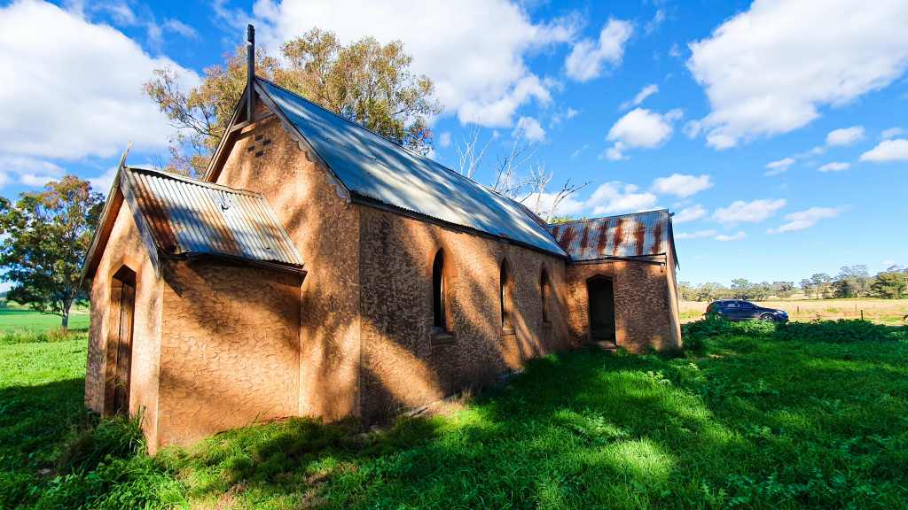
I had visited the church earlier; unbeknownst to me it is mentioned in the “Da Vinci Code”, something to do with the devil’s head carved in stone I believe.
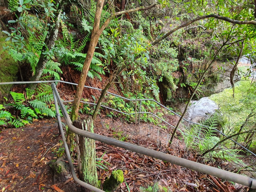
The field meanwhile was sodden, as they had been in the war.  I eyed off the slush and thought how horrible it must have been living in the goo, where every footstep was an exercise in itself, mud stuck to your kit and never left it, the thought that tomorrow would only bring more of the same.
Now it’s today and I’m on the tour bus.  Strangely, in some ways, our tour guide is an ex-pat Aussie and she’s an attractive middle aged female named Sharon and she’s been doing this since 1990.  She does it because she is passionate about the First World War.  Very passionate.
Other members of the tour are mostly English though there’s also a young Canadian couple.
Sharon begins by explaining the war’s origins, how Austria, Hungary and Germany were ready to “expand” and had taken steps already so that when the crown prince of Austria was assassinated in Sarajevo it was the excuse they were looking for.
The Germans had a plan to knock off Belgium in six days then run riot through France in around a month then this would allow them to send most of their troops to Russia whom they estimated would take 6 weeks to mobilize.
In the fields to where we are travelling, it all went horribly wrong, beyond anything that had happened before or since in human endeavour.  The tenacious Belgians held out for 32 days and flooded fields to delay the advance.  The Germans took Ypres (now Ieper), relinquished it, and never got it back.  The Allies held 10% of Belgium in a small triangular shape, the salient that stayed.
Our first stop is the Passchendale Ridge.  It’s far and away the highest piece of ground yet it’s only 56 metres high at its peak.  The 40 square kilometres were attacked by the British.  For every one metre gained, and I ask you here to imagine how wide the room you are currently in is, probably around 4 metres; they lost 35 men.  Imagine in your comfortable room there are 140 bodies in your house.  This will start to put you in the picture for what is about to come.
In this area of Belgium there is not a building, a tree, a blade of grass older than 85 years.
At Poelkapelle there are 7,500 buried, 84% of whom are “Known unto God” only.  This is not the first cemetery we pass.  At one stage there were literally hundreds of them.  These days they have been consolidated somewhat.
We learn how the fabled story of the Christmas football matches (three of them), when opposing troops shared provisions and had a game, only happened in 1914.  Things got nasty after that and the generals didn’t like the thought of you actually seeing the opposition.  Heck, you might even not want to shoot them.
The Germans took to putting a jagged edge on their bayonets.  This act infuriated the sensibilities of the British and they shot any prisoner on the spot if he had one.  The French took to urinating on their blades before combat in the hope of promoting infection.
Meanwhile, Belgian civilians were trying to escape, many to Holland who remained supposedly neutral; but they eventually put up something unheard of at the time – an electrified fence; and on this hundreds of Belgians perished.  The Dutch also bought concrete from the British and sold it to the Germans.  It was used to build trenches and bunkers.  It’s called profiteering.  Others may have other names for it.
Then came the gas.  The first recorded use was by the French in a grenade but the bulk stuff was first used here.  It was stored and ready to use for a month before they actually unleashed it.  Had they done their homework they would have known the prevailing winds are in the opposite direction.   It was chlorine gas, the first of 17 different types that would ultimately be used.
The Belgians and Zouaves (mainly from Africa), copped it first and worst.  The Germans gained over 2 kilometres then stopped.  During the month they were forced to wait, their reserves had been sent to France and they had no more momentum.
The Allies learnt quickly that a moist rag over your face helped a lot and if that moisture was urine it worked even better.  We are shown a picture of some soldiers with female sanitary pads strapped to their faces.
Though we tend to think it was an all German thing, the facts are that the British used ten times more gas than the Germans ever did and the mustard gas description was appalling beyond my capacity to comprehend.  Imagine your lungs slowly disintegrating to the point where you died an agonizing death.  The gasses that were slow killers were preferred because injured soldiers used up more manpower.
Those who were affected but didn’t die often passed it through to their children in later life, many of whom developed cancer as a result.
We next reach a Canadian cemetery, over 2,000 of whom are here.  It’s called Vancouver corner and has a large memorial with a figure in a “rest on your arms reversed” position or, as many like to call it, lying down.
We learn here that there were 1,500,000,000 shells fired.  Of these one and a half billion, one third failed to explode.  On average, over 250 tonnes have been dug up each year since the war.  If, like me, you have visions that it is diminishing, then dwell on this – in 2006 they unearthed 700 tonnes.  Imagine, two tonnes, per day, from something that happened nearly 90 years ago.
Each year in this area they average 3 deaths from unexploded munitions, 20-30% of which are chemicals.
The Belgians, without any assistance from any of the conflicting nations, spent 20 million euros on a special machine to dispose the chemical shells.  The known figures are that they have enough work for sixty years but have no doubt that it will go on for well over another hundred as they find more ordinance.
Until 1976 they simply dumped them at sea but a treaty put an end to that.
The disposal people are all volunteers, 5 have died since 1980 doing this work.
They have devised special suits for chemical disposal.  It’s a two layered affair and the body’s core temperature can quickly rise to 40 degrees inside them.  Thus an individual is only allowed two disposals per day.  After each individual disposal the suits are incinerated to avoid contamination and a new one put on.  It costs the government a fortune.  No other country contributes.
Every day during spring and summer, every year, at 11.45 and 4.30, munitions are blown up at a special site.
We have pulled in to one of Sharon’s friends places.  She explains they bought half a hectare with the intention of farming.  On the first line of ploughing, 120 metres in length, they unearthed 29 shells.
She alights and returns with some of the things they’ve uncovered.  Among them is a Lee Enfield .303 with a bullet in the chamber and a full magazine, meaning it was being used in conflict at the time.  Another item is a large shell with cordite in it.
Then there’s something else she doesn’t bring onto the bus as the large cannon projectile is too heavy to carry.
Every day throughout this entire area, on all these country lanes, 90 years after the event, people put discovered munitions on the roadside for the bomb squad to pick up.  They are in little piles beside telegraph poles, next to posts.  If a chemical one is found, the bomb squad is called in and, if it’s leaking, they put it in a plaster cast and mark where the leak was.
In 1917, on the 31st of July, a battle started.  The scenario is that most of the fighting was done in the summer, so it was timed to coincide with favourable weather.  Unfortunately, it rained heavily for the two weeks beforehand.  This did not stop General Haig, clearly not one of Sharon’s most favourite people to ever inhabit the earth, from insanely ordering the command to attack.
More than 300,000 troops were lost.  As a direct result of Haig’s decision more drowned in the quagmire than were actually shot.  Having closely looked at the mud the day before I can fully understand.
At the infamous Passchendale the Kiwis lost more per capita than any other nation and the Canadians won more V.C.s (9).
The Kiwis are the only nation not to accede to the Belgians’ request to consolidate the grave sites.  Thus you see their memorials at quite a few places, all with the “From the uttermost ends of the earth” tag.
We stop at Tyne (river) Cot (short for cottage) Cemetery, named after the Northumberland Regiments who fought here.
There are 11,908 graves and a massive wall listing a further 34,888 who are missing after August 16th, 1917.  There are 3 Australian V.C. winners buried here.
The shape of the wall echoes the shape of the salient (a military term for a line that penetrates) that was here.
The persistent fog swirls around the masses of white tombstones and the background of barely visible winter trees adds an eerie touch to the moment. 
I notice wreaths have been laid here and there by English school classes.  Apparently they get an actual name of a particular soldier, find out as much as they can about him, and then visit his grave and the war sites.  It’s something that has my wholehearted support.
The breeze springing up pushes the chill air against my eyes and I initially blame that for the moisture in my vision but soon realise it’s more than that.  The wreaths have affected me and when I tread the narrow path to the information centre my mood isn’t helped by this crystal clear voice that is suddenly apparent, its invisible host reading out the names of the deceased, a new one every five seconds.  Inside the centre photographs appear on a wall of the deceased as his name is read out.  In here nobody speaks.
Back on the bus we go past a house of someone Sharon knows.  She explains how undermined everything is with the trenches and such, then proceeds to relate how, in 1999, the lady of the house sank up to her neck in water when she got caught in an old trench and was lucky to be rescued from the mud in time.  Just four years later their bedroom sank 15 centimetres.
We pass Polygon Wood that changed hands 15 times and are reminded that 35 bodies were recovered last year, 70 the year before, 5 of them Australians.  They believe they have these narrowed down to 7 possibilities.
At Hellfire Corner we are reminded that, on average (dwell on this time frame) a shell fell here every 5 seconds.
We stop at the Messines Ridge.  The almost unbelievable effort that went on here was extraordinary.  This time, with the much smarter Canadian Plumer in charge, they had dug 24 tunnels, the longest 750 metres and set mines at the end.
They then bombarded the ridge for a fortnight and the Germans returned fire.  Then, at 3.00 a.m. on June 17th they stopped and, unbelievably, so did the Germans.  They thought the Germans might have wind of what they were about to do but went ahead anyway.
At 3.10 a.m. they detonated the mines.  With 45,000 lbs of Ammonal and 7,800 lbs of guncotton in each hole, 19 of them went off.  To this day, it remains the biggest man made earthquake ever.
”It was an appalling moment.  We all had the feeling, ‘It’s not going’ and then, the most remarkable thing happened.  The ground on which I was lying started to go up and down just like and earthquake.  It lasted for seconds and then, suddenly in front of us, the Hill 60 mine went up.”
85,000 troops attacked the ridge, 7,000 were lost but, for the most part, the Germans had been stunned by the massive 40 tonnes blast and it was the single most successful battle of the entire war.
Of the 5 that didn’t detonate, two had already been overrun, the Germans had discovered one and two misfired.  In 1955, a tree was hit by lighting and detonated one of them in a mighty explosion.  There’s still one out there somewhere.
Hitler served here, was a brave soldier, was awarded the Iron Cross 1st and 2nd class and lost a testicle when shot.  He worked for a field hospital for four years, was never promoted because he never had leadership potential.
In the next village was man named Winston Churchill.   As the Americans entered the war, a man named Patton also arrived.  Of course, just across the way was a man named Rommel.  Within less than an 8 kilometre radius these men fought against each other, 30 years before history repeated itself.
The Royal Army Medical Corps have a mixed reputation.  At times it was said that R.A.M.C. was an acronym for Rob All My Comrades, on the other hand they won more V.C.s than any other corps.
Our next stop is the Menin Gate.  It’s here that my grandfather is commemorated.  It’s from this gate that the sculpted lions were removed in the 1930’s by a grateful mayor of Ieper and now adorn the entrance to the Australian War Memorial in Canberra.
I locate my grandfather’s name.
They have to send one of the Canadians from the bus later to collect me as everyone is waiting.  Later on Sharon will remark that it seemed to have affected me and I freely admit that it did. In fact, I lost it and was shocked at how emotional I got. She asks me if she could place a poppy at the site the next day.  I thank her profusely but decline the offer.  She later asks my grandfather’s name, in such a way that I suspect she is going to put one there anyway.  Later still I say that if I returned the next day there would be a poppy there anyway would there not?  The way she looks at me indicates clearly that there will be.
We next visit a trench site at Ieper, excavated by volunteer diggers and filmed by the BBC which is why it was saved from industrial development.  Here you can really get the feel of how awful it must have been to actually live here.  There were two adjacent trenches.  On one side you went to the front, on the other the bodies were brought back.  It didn’t do for the fresh troops to see how they were going to end up.  At this site, no larger than the house where I now live, there’s a plaque indicating that they have unearthed 155 bodies.  Sharon said that it’s now out of date.  In fact it’s now 205.  She was here when they unearthed the 200th.  She is not only passionate about this tour, she is emotional.  You can see the welling in her eyes and she storms off to the bus banging the sides of her hands together.
I later query her about how amazed I am that someone who has been doing this for 17 years, with a break only for her daughter, can still have so much feeling.  She blames it on being a female, but it’s more than that.
Our last stop is where Valentine Joe Strudwick is buried.  He lied about his age, enlisted when he was 14, was wounded, went home, came back again and died when he was 15.  School children are often shown this grave, many older than he was when he died.  That’s why there are a lot of poppies here.
It’s also where John McRae spent much of the war, having enlisted when he was 40.  He was a doctor and he would work, sometimes up to 72 hours straight.  Eventually he ended up on the Somme where he died from the flu, bought on by overwork but, before he went he wrote a little piece.  That piece today is learnt by rote by his fellow Canadians in every school in their country.
Sharon later tells us that the poppy grows on fields that are disturbed and where there is no competition.  Hence they flourished in this area during the war.
Oh, and the poem?  It’s called “On Flanders Fields”. 

In Flanders fields the poppies blow

Between the crosses, row on row,

    That mark our place; and in the sky

    The larks, still bravely singing, fly

Scarce heard amid the guns below.

We are the Dead. Short days ago

We lived, felt dawn, saw sunset glow,

    Loved and were loved, and now we lie,

        In Flanders fields.

Take up our quarrel with the foe:

To you from failing hands we throw

    The torch; be yours to hold it high.

    If ye break faith with us who die

We shall not sleep, though poppies grow

        In Flanders fields.

PLEASURE WITH LYNN

To be honest, my brain was in a bit of a fog.  For over five weeks we’d seen a plethora of wonders, so much of which was breathtaking, that my mind had ground to a halt.

Aware that I had to do something, anything, I concluded that I had to go across the bridge, the one to the far side.  Over there in Vancouver north were mountains and forest, stuff I felt at home in.  I also wanted an easy day in somewhere less popular; that was how Lynn Canyon cropped up.

So it was I crossed the Second Narrows Bridge, aka the Ironworkers Memorial Bridge, and found myself in the “other” part of Vancouver, cruising along in what was to be my last day in the Toyota.

Then, I still find it hard to believe, I thought I took the correct turn towards Lynn after noticing a small sign and working out instantly that it was probably where I should go, though when I reached the area of possible carparks, I had to pull up and go and check out an information hut that fortunately had the right info.  I say fortunately because it was deserted initially and I was scrounging around when a helpful staff member returned, probably from a comfort stop I mused.

Turns out I had arrived at the Lower Seymour Conservation Reserve; turns out it was also a good starting point though the main access to Lynn is from the other side of the river.

Then I was on my way, having opted to do the Thirty Foot Pool and the Twin Falls.  The secondary growth Douglas Fir and Western Red Cedars have excluded much light from the forest floor, leaving moss laden remnants and a fungus or two.  It exuded an almost eerie calm as I barely managed a stroll, wallowing in the serene delights of an almost mature woodland.

Now stairways intervened, those of a downward direction.  Consulting my map it appeared I was on my way to the advertised pool.  The echo of water coursing rapidly through a chute reverberated off a rock wall somewhere and, as I neared said sound, the gorgeous swimming hole favoured by Vancouverites came into view.

The limpid waters disclosed a mass of rounded pebbles while behind, a maple turning yellow was reflected in the surface, surrounded on either side by evergreens.  Off to the right was where the noise was coming from, a tempting little canyon that, on another day, I would have chanced my arm to get closer to.

Shadow of the bridge

I returned to the trail, whose route now approximated the river’s and it seemed in no time at all I was at the semi-famous suspension bridge.  I say “semi” because Capilano Bridge is renowned world-wide and featured on many an internet site whereas the one at Lynn is known mainly amongst the locals but has an added feature – it’s free.  There once was a charge for J.P. Crawford’s suspension bridge when the park was opened in 1912.  It was also one of the few remnants when three days of torrential rain ripped through and the picnic grounds, the bandstand and the caretaker’s cottage all disappearing into the raging waters.

The water roars through the Canyon

I eavesdropped as someone compared it to Capilano that he’d done the day before.  He remarked that though Capilano was longer, this was more in your face as you were much closer to the falls and you got a sense of anxiety as they crashed beneath you.

On the other side was heaven in the form of a cafe; two stories of log cabin with who-knows-what on offer.  I salivated to the point where I noticed the problem – “Closed”.  A picture perfect day on the first week in October and it’s closed?

My thoughts of a mug of hot chocolate and a row of tantalizing desserts dissipated as I moved away down the opposite side of the river, ever downward, this time to the Twin Falls Bridge and here the creek was really aggressive with cascades everywhere.

In 1989, the District of North Vancouver decided to open up a new suburb, 1.900 land units, right in the area of the forest because the original park was only 10 hectares.  Luckily, 1,200 protesters turned up and the powers that be suddenly thought it might not be such a good idea after all and the park was expanded instead to 250 hectares.

Turning now, it was time for the “up” part of the journey, reflecting on nice moments as I traipsed through the mostly pencil straight vegetation that splayed shadows across the forest floor.  100 year old Douglas Firs lorded over western hemlock and western red cedar.  Though there are people doing the walk, they are scarce, as most come to experience the swinging bridge and falls.  Few venture to where I’m currently hiking.

“Flecked with autumn

Flecking through the gaps in the trees are flashes of autumn, tempting colourful morsels that await me on the drive home.  However, just down from my car there is another bridge, that of the local water body and aptly named the Pipeline Bridge as it was probably put there to service the adjacent pipeline.  Another big drop to the water is beneath and I dwell here for some minutes imagining this might be my last plunging stream for some time.  I imagine right, in two months since I’ve seen nothing of its ilk.

Beautiful colours of the river

I felt fortunate to have been tipped off about this special place by a local, seeing a Vancouver wonder that few tourists get to see.

ATTAINING NOB HILL

I’d gone at an earlier time to do the great tram ride.  Having learnt the day before that the queue can be blocks long I made an effort to avoid them in order to ride this archaic and uncomfortable method of public transport that was mooted for destruction in 1947 until an ultimately partially-successful “Save The Cable Cars” group was formed.  Today they are a listed National Landmark and protected by law and no tourist visit to San Francisco is complete without a journey to the heights.

Oldie but a goodie

Once aboard and ever curious I pondered the mechanism, querying the engineer in charge with questions he’d probably heard a thousand times before.  I was amazed to learn just how simple, yet complex, the drive mechanism is.  One simply pulls a lever that puts a clamp on a cable running beneath the surface and, presto, motion!

The complex bit I would see later.

It rumbled out, all ten tons of it, relying on a clamp.  How fast you go depends on how hard the gripman grasps, though 9.5 m.p.h. is the maximum.  Just how steep the streets are becomes quickly apparent as we ascend, a serious 24.8 percent in one spot.  I reflect on architecture as we mount and there is plenty of variety on show.  Somewhere in the distance the Transamerica Pyramid looms, its weird sharp pointed shape dominating the skyline.

TRANSAMERICA PYRAMID

Then we pull up beside a park and some expensive looking buildings.  I make an on-the-spot decision to alight.  It was a fortuitous choice.  I’d bailed out at Nob Hill, home of San Francisco’s elite.  The name is a contraction of “nabob”, someone who has made a large fortune, and it all happened in the 19th century when some people got lucky with either gold or silver mines while others ran the railroads.  No less a person than Robert Louis Stevenson wrote in 1882 that it was “the hill of palaces”.

PACIFIC UNION CLUB

Today’s magnates can be found at the Pacific Union Club, an exclusive building that  reeks of security and survived the 1906 quake and fire that turned nearby wooden buildings into charcoal.  The first building that captured my eye was the 606 room Fairmont, across Mason Street from the P-U and flying all manner of flags, occupying the block James G. Fair left to his children. The standout building featuring elegant porte-cochere and spacious lobby opened in 1907, the tower in 1961. The Penthouse Suite — rooftop manor, really — will set you back just under $20,000…..per day of course, though butler, maid and limousine service are included.  The corner it dominates at California and Taylor was first graced by wealthy 49-er Richard Tobin’s Victorian manse. The 12-story building housed apartment dwellers from 1924 to 1945 when it was converted into a hotel.

FAIRMONT HOTEL

The hotel overlooks Huntington Park, whose centrepiece copy of Rome’s Fontana delle Tartarughe (Fountain of the Turtles) by Taddeo Landini (1585) and donated by the Crocker family, is but one of the attractions.  Nearby there’s the Dancing Sprites fountain by French sculptor Henri Leon Greber, donated by the Flood family.

FOUNTAIN OF THE TURTLES

I couldn’t help but notice a church in the background.  The Crocker family donated this entire block to the Episcopal Diocese of California after the ‘06 fire destroyed their two residences there. The cornerstone was laid in 1910 but major construction did not begin until 1927.  The 100 metre long cathedral, complete with labyrinth inside, is a mixture of classical French, Spanish and English architecture and the largest church in the West.  

There was however, something that caught my attention.  I couldn’t quite get my head around what I was looking at for there, right before my eyes, was surely what Michelangelo thought would be appropriate as the “The Gates of Heaven”.  In fact, the doors are one of two copies of Ghiberti’s fabulous Renaissance work, the other is the one you see in Florence, because the original is buried in an underground vault, just like Michelangelo’s statue of David.  All the public sees are copies.  In the list of the top ten things to see at Nob Hill, Ghiberti’s bas relief doesn’t even rate!

GHIBERTI’S BAPTISTRY DOORS

In total contrast nearby is the SF Masonic Auditorium (1958).  On the main (north) façade, there is a large frieze by Emile Norman bearing the inscription “Dedicated to our Masonic Brethren who died in the cause of freedom“, depicting stylized servicemen from each of the four branches of the Armed Services, and a global tug of war representing global struggles.

MASONIC CLUB

There are other classic accommodation venues here as well, but my limited time didn’t allow me to soak them up.  Just two blocks away was the nerve centre of the tram system.  As you walk through the doors you can’t help but notice the large spoked wheels (called sheaves) with steel cables lubricated by pine tar wrapped around them, for here was the entire power system for the cable cars.  It’s not something that will detain you for a long time, but it’s fascinating nonetheless watching the endless loop go round and round knowing that it is driving something kilometres away.

POWER BEHIND THE TRAMS

I’d done the ride on the cable car, but it had turned out to be so much more.

DANCING SPRITES FOUNTAIN

DEGREES OF BEING LOST

Tracking through a regular newspaper I get on line I came across this fascinating, and tragic, article.  It started out with details of how a 66 year old experienced female hiker went for a comfort stop whilst walking the famed Appalachian Trail in the U.S.A.  She went about 80 paces off trail as she usually did.  Nearly two years later they found her body.  Her husband had been waiting for her at the next out point that very day.  She tried texting and phoning to no avail when she realised, to her shock, that she was irrevocably lost.  She lasted nearly three weeks before succumbing, despite a massive search for her.  In the end her remains were discovered inside her tent a bit over half a mile off the track.  She’d seen the searchers overhead and tried to contact them but she went unseen.  We know this from a diary she kept.

Then, only yesterday, a report of two Aussies being found after 19 days disoriented in thick foggy forest in N.Z.

It highlighted a few things, one of which is, doesn’t matter how experienced you are, without reference points you have no idea where you’re going and, what you saw in movies about going around in circles is, in reality, exactly what happens.  Psychiatrists know that, when you’re lost, you get dumber.  The only difference is in degrees, some get more stupid more quickly but everyone’s heading in the same direction.

Francis Chichester (yes, the sailor) was training pilots in night navigation during WWII.  A group took off and all landed safely except for one pair.  Three months later it was learned they’d been captured by Germans at a French airfield because they went exactly 180 degrees the wrong way, mistook the English Channel for the Bristol Channel and landed at an airfield that had switched on its lights and were thinking it was the right spot, until some German ground staff were pointing guns at their heads.

Scientific studies when the sun wasn’t visible in the Sahara Desert and the Bienwald Forest in Germany concluded that people will not walk more than 100 metres from their starting point because they have no reference point.  “Anyone who spends enough time in the woods will, sooner or later, become lost,” says Kenneth Hill.

People react in different ways.  Lost is a cognitive state. Your internal map has become detached from the external world, and nothing in your spatial memory matches what you see.  You suffer what neuroscientist Joseph LeDoux calls a “hostile takeover of consciousness by emotion.” 90 percent of people make things a lot worse for themselves when they realize they are lost—by running, for instance. 

It is common for lost people to lose their head, as well as their heading direction. Stories of people walking “trance-like” past search parties, or running off and having to be chased down and tackled, are part of search and rescue lore. 

WIMBACH GORGE, IT HAD FLOODED ONLY DAYS EARLIER

Personally speaking, I’ve experienced different phases.  The first was in Germany near Berchtesgaden.  My goal was to walk to a place called Hintersee but somewhere along the way I took a wrong turn.  At one stage I remember going through a fence to reach a forestry tower that I managed to scramble up, hoping to get some bearings, to no avail.  I stumbled across and went past places like Wimbachschloss and Wimbach Gorge that I’d never heard of.  It was only after more than 6 hours I came across a sign on a trail and eventually reached a hotel at Hintersee in the dark after 8 ½ hours.  It was a wakeup call.

THE TRAIL TO HINTERSEE HAD SUFFERED A LANDSLIDE I HAD TO WALK OVER

The next was in Tasmania, searching for the lower entrance to Lake Judd.  There is a trail, though it hardly deserves the name, and it meanders along a damp floor with an island or two of trees.  The weather was less than desirable, misty driven rain in the offing with an already overcast sky.  Barely discernible boardwalks enshrouded by melaleucas before plunging over small watercourses and stumbling through mud was the nature of the way. 

There is also a problem with your digestive processes because your stomach releases the hormone ghrelin when you’re hungry and quite a few studies suggest it negatively impacts decision making and increases impulsive behaviours. 

THE LURE OF LAKE JUDD, FROM THE FIRST TIME I SAW IT ON THE MOUNT ELIZA TRAIL

But Lake Judd lured me as a fish to the bait.  Its vista from a previous trek on high to Mount Eliza tormented my brain.  I splashed on as the drizzle arrived.  Then, at one point, I emerged from a forested section and determined that since the trail ahead was so bad and was only going to get worse I should quit; thus I turned around and went back into the woods, but struggled to find the path.  Eventually I emerged and continued on.  Lord the track was terrible but I suffered in silence.

LET’S BE HONEST, CONDITIONS COULD HAVE BEEN BETTER

In time I came to a place I knew I hadn’t been before.  A creek that was too deep for me to cross.  I wondered just where I was, but had no real idea.  The term “lost” entered my brain and drilled in until it was fixed.  My map, such as it was, was drenched and useless, much like my compass.  However, I realised I had to reverse my direction from where I now was.  That was after screaming meaningless obscenities to the sky above.  Where was I?

TRY FINDING YOUR WAY ALONG HERE!

I kept going until, at one particular point just before a copse of trees, I realised exactly what had happened.  When I was scrambling through them originally, I’d actually turned 180 degrees and continued on instead of going back.  At least, after a horrible hour, I knew what I had to do.  I also knew what it was like to feel helpless and alone in the wilderness.  When you’re on your own, it magnifies.  People then ask me why I walk alone most of the time.  The simple answer is that none of my friends are either adventurous or bushwalkers.

PARTS OF THIS WALK WERE AMAZING, BEFORE I GOT LOST

The next occurrence was relatively recently.  Aiming down a steep slope from a carpark in the Watagans, the creek I sought was reached.  I crossed it once and then twice, winding up in the backyard of some property.  However, it had rained most of the time and I was drenched.  My camera and phone were rendered useless by the moisture.

WORSE THAN A BRICK WALL!

So, instead of exploring I turned around, crossed the creek twice and scrambled up the slope.  Except, when I reached very near the top, it was a jungle with almost impenetrable vines and a vertical rock shelf.  After an hour of exhaustive hiking I was going nowhere and descended again to the creek before walking out to a road, making contact at a house I was walking past and getting them to ring a cab for me.

When I got home I did some research and realised that the second time I crossed the creek on the way back I had actually turned about 120 degrees and gone up the wrong hill entirely. 

I HAD TO SCRAMBLE THROUGH THIS TO GET OUT – IT WAS WORSE THAN IT LOOKS!

The scary thing, as far as I was concerned, was how easy it had happened when I thought it would be hard to get lost.  That’s why the article about the lady held such resonance.  The person you are can be changed by circumstance in such a short time and you have no idea how you will change until it happens.

Excerpts adapted from From Here to There: The Art and Science of Finding and Losing Our Way, by Michael Bond, published by Harvard University Press.

NEAR WIMBACHSCHLOSS
ZAUBERWALD – THE MAGIC FOREST NEAR HINTERSEE
ONE OF THE RIVER CROSSINGS IN THE WATAGANS

A MAN AT IRONBARK

It seems to me a little sad.  In the cities it’s all about the latest American rapper or no-talent people on “reality” shows.  Australian names from the past are largely lost, forgotten and generally neglected.  The work of once literary giants like “Banjo” Paterson have escaped notice.  His accurate descriptions and portrayals of times past appear no longer meaningful.  Unwanted, unused.

All is not lost out in the “sticks” however.  On a country road in western N.S.W. there’s an intersection.  Where two roads meet there’s log that’s been professionally carved with the name “Ironbark” etched deeply in its grains.  There’s also a mobile coffee van.  I’m not sure which interested me most.

At least I recognized the name; but I had arrived at Stuart Town, to the best of my knowledge.  However, it once was called “Ironbark”, only getting its name changed because there was confusion for the postal service due to another having the same name.  Obviously this town had history, so I took the turnoff and headed up the street without any knowledge of where it might lead.

Indeed, I’d only come this way because there was a hotel advertised at Mumbil, now there’s a moniker.  I figured any place with a name like that had to be viewed but I’d quickly gone through and figured that, since Stuart Town was just up the road, I might as well have a look.

I was loving it.  Cast back in time I eased the car up the slight incline.  The village was riddled with classic architecture from a 100 years ago or more.  No fancy modern residential area here.  Tin, wood, fibro, accompanied by classic stone chimneys.  A bullnose verandah with some wrought iron work stood out.  Obviously once a commercial establishment, as was another wall with much faded paint denoting what had been a bakery.  It was at once both sad and exciting.

AUSTRALIA HOTEL

At the next intersection was the one flourishing building and a crowd was obviously inside if the vehicles parked around were any indication.  It’s natural in the bush that the hotel is the great survivor.  A standout two storey edifice with freshly painted balcony with ornamental brackets, the Australia Hotel is the building of significance here.  Put into context however, there were once 100 of the genre, which is often used as a mark as to how prosperous a place was.  There were a purported 30,000 people living in the area, for this is an old gold rush town and, even today, you can still pan in a nearby creek, though it’s unlikely you’ll be part of a crowd.

“…And whether he’s believed or no, there’s one thing to remark,
That flowing beards are all the go way up in Ironbark.”  Thus wrote Mr. Paterson, but there was not a hint of anyone walking around with hairy protuberances today to add to the historical feel of Stuart Town.  In fact, apart from the lady at the coffee cart, I didn’t see anyone.

Other houses featured indescribable bric-a-brac in the gardens with no semblance of order.  Such plots are rare in the city but you’d almost be disappointed if you didn’t find at least one in a village like this and, indeed, there were several.

The modernity of the few paved streets belied the extraordinary circumstances that some people found themselves in.  One place with a well mown lawn was nothing more than a glorified tin shed affixed to upright poles.  Immediately I thought of summer and winter extremes and how harsh it must be.  The place next door was no better.  It’s a different world out here and I longed to know more, but it wouldn’t be today that I’d find out.

I stopped and chatted to the coffee lady.  She said it was a busy road and she’d done well during the crisis.  I was amazed.  It certainly wasn’t a highway and there were no towns of significance.  Burrendong Dam and its surrounds were the only things noteworthy it seemed to me, which was probably showing my ignorance.

So I sipped on my hot chocolate and another customer arrived, then a car went past; it was indeed busy.

Drifting back to Mumbil I saw more of the same; discarded vehicles in backyards, homes in various stages of decay, a corrugated iron hall and wooden church.  Closer to Wellington was a place called Dripstone. 

A long ago abandoned stone church was structurally intact but devoid of anything religious inside, the altar vanished, the windows bare of stained glass.  Further up the side road, what once were houses hadn’t seen a laden paint brush in living memory and a solid bluestone cottage had been boarded up who-knows-when and seemed to be merely a storage shed these days.

I pondered the lives of those who dwelt within; how they got their daily bread, so to speak, and felt quite downcast considering the history, knowing that in a couple of decades most would be in a state of ruin.

Next stop was a café at the northern end of Wellington.  A hot chocolate was required and some reflection.  Amazingly, there was a well-thumbed copy of collected A.B. Banjo Paterson’s works on the table I chose to sit at.  I read through “The Drover’s Wife” and saw again how Paterson had captured the essence of the bush, the reality of the harsh life and those who led it.  May his works not be forgotten.